Category:Nederlands Hervormde Kerk, Overlangbroek
Jump to navigation
Jump to search
| Object location | | View all coordinates using: OpenStreetMap |
|---|
church building in Wijk bij Duurstede, Netherlands  | |||||
| Upload media | |||||
| Instance of | |||||
|---|---|---|---|---|---|
| Location | Langbroek, Utrecht, Netherlands | ||||
| Street address |
| ||||
| Heritage designation |
| ||||
 | |||||
|
This is a category about rijksmonument number 23920
|
| Address |
|
Media in category "Nederlands Hervormde Kerk, Overlangbroek"
The following 25 files are in this category, out of 25 total.
-
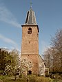 2007-04-09 15.18 Overlangbroek, kerk.JPG 1,674 × 2,232; 3.13 MB
-
 Achterkant NH kerk Overlangbroek.jpg 2,740 × 1,830; 2.89 MB
-
 Consistorie - Overlangbroek - 20181186 - RCE.jpg 1,192 × 1,200; 385 KB
-
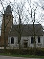
 Exterieur OVERZICHT ZUIDGEVEL - Overlangbroek - 20314145 - RCE.jpg 1,183 × 1,200; 504 KB
-
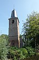
 Exterieur TOREN, OVERZICHT WESTGEVEL - Overlangbroek - 20314146 - RCE.jpg 1,177 × 1,200; 351 KB
-
 Ingangspartij toren - Overlangbroek - 20181181 - RCE.jpg 943 × 1,200; 404 KB
-
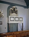 Interieur, aanzicht orgel, orgelnummer 1202 - Overlangbroek - 20356691 - RCE.jpg 949 × 1,200; 119 KB
-

-

-
 Kerk - Overlangbroek - 20181177 - RCE.jpg 912 × 1,200; 355 KB
-
 N-H Kerk Overlangbroek.jpg 2,448 × 3,264; 1.43 MB
-
 Naar waterverftekening Archief de Leeuw - Overlangbroek - 20181178 - RCE.jpg 844 × 1,200; 242 KB
-
 NH kerk Overlangbroek frontaal.jpg 2,740 × 1,827; 2.94 MB
-
 Noordgevel - Overlangbroek - 20181188 - RCE.jpg 1,200 × 960; 320 KB
-
 Noordgevel met consistorie - Overlangbroek - 20181183 - RCE.jpg 1,195 × 1,200; 373 KB
-
 Overzicht - Overlangbroek - 20181179 - RCE.jpg 958 × 1,200; 321 KB
-
 RM23920 NH Kerk.JPG 2,754 × 4,200; 3.34 MB
-
 Toren - Overlangbroek - 20181180 - RCE.jpg 958 × 1,200; 283 KB
-
 Toren - Overlangbroek - 20181182 - RCE.jpg 1,192 × 1,200; 222 KB
-
 Vooraanzicht NH kerk Overlangbroek.jpg 1,782 × 2,740; 2.43 MB
-
 Westgevel - Overlangbroek - 20181187 - RCE.jpg 965 × 1,200; 274 KB
-

-
 Zuidgevel - Overlangbroek - 20181184 - RCE.jpg 1,197 × 1,200; 460 KB
-
 Zuidgevel - Overlangbroek - 20181189 - RCE.jpg 1,200 × 951; 363 KB
-
 Zuidgevel met consistorie - Overlangbroek - 20181185 - RCE.jpg 1,188 × 1,200; 511 KB


