Category:Nederlands Hervormde Kerk, Wisch
Jump to navigation
Jump to search
| Object location | | View all coordinates using: OpenStreetMap |
|---|
church building in Oude IJsselstreek, Netherlands  | |||||
| Upload media | |||||
| Instance of | |||||
|---|---|---|---|---|---|
| Location | Sinderen, Oude IJsselstreek, Gelderland, Netherlands | ||||
| Street address |
| ||||
| Located on street |
| ||||
| Heritage designation |
| ||||
| Inception |
| ||||
| Significant event |
| ||||
 | |||||
Nederlands: Antoniuskapel - anno 1662
|
This is a category about rijksmonument number 39088
|
| Address |
|
Media in category "Nederlands Hervormde Kerk, Wisch"
The following 8 files are in this category, out of 8 total.
-
 Antoniuskapel Sinderen grafsteen Bertha Ruebel.jpg 3,864 × 2,586; 7.68 MB
-
 Antoniuskapel Sinderen klokkenstoel.jpg 1,956 × 3,185; 5.49 MB
-
 Antoniuskapel Sinderen poortje.jpg 3,773 × 2,526; 5.39 MB
-
 Antoniuskapel Sinderen.JPG 3,264 × 2,448; 2.02 MB
-
 Exterieur naar het noord-westen - Wisch - 20215576 - RCE.jpg 1,200 × 943; 373 KB
-
 Exterieur naar het zuid-oosten - Wisch - 20215575 - RCE.jpg 939 × 1,200; 334 KB
-
 Interieur naar het oosten - Wisch - 20215578 - RCE.jpg 1,200 × 960; 167 KB
-
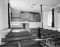 Interieur naar het westen - Wisch - 20215577 - RCE.jpg 1,200 × 952; 164 KB


