Category:Neighbourhood maps of Saskatoon
Jump to navigation
Jump to search
Media in category "Neighbourhood maps of Saskatoon"
The following 38 files are in this category, out of 38 total.
-
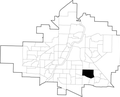
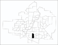 Adelaide-Churchill-map.png 847 × 663; 208 KB
-
 Arbor-Creek-map.png 548 × 441; 76 KB
-
 Avalon-map.png 330 × 250; 22 KB
-
 Brevoort-Park-map.png 330 × 250; 22 KB
-
 Briarwood-map.png 548 × 441; 75 KB
-
 Buena-Vista-map.png 548 × 441; 75 KB
-
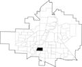
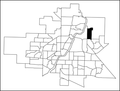
 City-Park-map.png 848 × 664; 208 KB
-
 College-Park-East-map.png 320 × 250; 22 KB
-
 College-Park-map.png 548 × 441; 82 KB
-
 Eastview-map.png 848 × 664; 208 KB
-
 Erindale-map.png 548 × 441; 75 KB
-
 Forest-Grove-map.png 548 × 441; 75 KB
-
 Greystone-Heights-map.png 320 × 250; 22 KB
-
 Grosvenor-Park-map.png 548 × 441; 75 KB
-
 Haultain-map.png 330 × 250; 21 KB
-
 Holliston-map.png 330 × 250; 22 KB
-
 King-George-map.png 548 × 441; 75 KB
-
 Lakeridge-map.png 548 × 441; 75 KB
-
 Lakeview-map.png 548 × 441; 75 KB
-
 Lakewood-Suburban-Centre.png 548 × 441; 75 KB
-
 Nutana-map.png 846 × 662; 211 KB
-
 Nutana-park-map.png 330 × 250; 22 KB
-
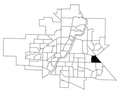
 Nutana-SC-map.png 330 × 258; 37 KB
-
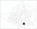
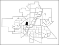
 Queen-Elizabeth-map.png 847 × 663; 208 KB
-
 Riversdale-map.png 548 × 441; 75 KB
-
 Rosewood-map.png 548 × 441; 75 KB
-
 Saskatoon Neighbourhoods.png 2,200 × 1,700; 1.02 MB
-
 Saskatoon-SDA-map.png 1,239 × 994; 211 KB
-
 Silverspring map.png 330 × 250; 22 KB
-
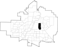
 Silverwood-Heights-map.png 848 × 664; 208 KB
-
 Stonebridge-map.png 849 × 665; 208 KB
-
 Sutherland-Industrial-map.png 548 × 441; 75 KB
-
 Sutherland-map.png 548 × 441; 76 KB
-
 U-of-S-Lands-South-MA-map.png 548 × 441; 75 KB
-
 University-Heights-SC.png 848 × 664; 212 KB
-
 Westmount-map.png 330 × 250; 22 KB
-
 Wildwood-map.png 548 × 441; 75 KB
-
 Willowgrove-map.png 548 × 441; 45 KB


