Category:New York (state) flora distribution maps
Jump to navigation
Jump to search
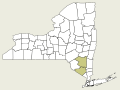
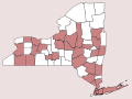
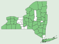
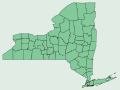
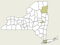
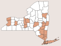
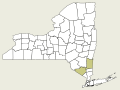
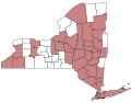
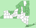
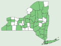
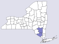
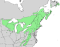
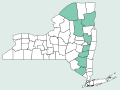
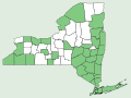
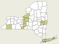
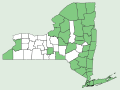
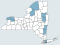
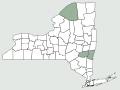
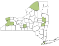
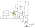
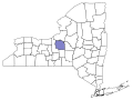
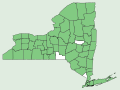
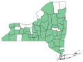
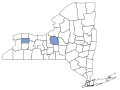
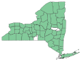
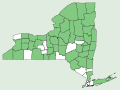
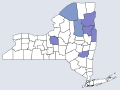
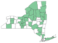
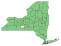
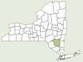
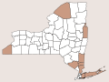
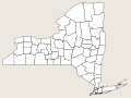
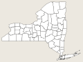
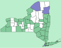
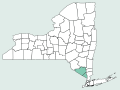
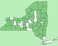
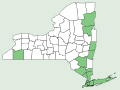
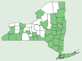
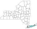
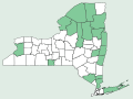
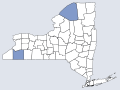
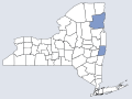
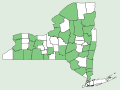
Files in this category are used by Flora of New York in Wikibooks to show the distribution of plant taxa in New York State. Counties indicated in the vector-graphic (SVG) files in the top-level category are based primarily on data from Weldy, Troy, David Werier, and Andrew Nelson. 2013. New York Flora Atlas. New York Flora Association, Albany, New York.. Color-coding of these maps is based on the purported nativity, rarity, and invasivity of the taxon in New York:
|
|


Subcategories
This category has the following 2 subcategories, out of 2 total.
N
- NRCS New York (state) distribution maps (13 P, 1648 F)
Media in category "New York (state) flora distribution maps"
The following 200 files are in this category, out of 712 total.
(previous page) (next page)-
 Abies concolor nymap.svg 668 × 501; 317 KB
-
 Abies magnifica nymap.svg 668 × 501; 317 KB
-
 Acer campestre nymap.svg 668 × 501; 317 KB
-
 Acer ginnala nymap.svg 668 × 501; 317 KB
-
 Acer negundo var negundo nymap.svg 668 × 501; 317 KB
-
 Acer negundo var violaceum nymap.svg 668 × 501; 317 KB
-
 Acer palmatum nymap.svg 668 × 501; 317 KB
-
 Acer platanoides nymap.svg 668 × 501; 317 KB
-
 Acer pseudoplatanus nymap.svg 668 × 501; 317 KB
-
 Achillea millefolium nymap.svg 668 × 501; 317 KB
-
 Achillea millefolium var millefolium nymap.svg 668 × 501; 317 KB
-
 Achillea millefolium var nigrescens nymap.svg 668 × 501; 317 KB
-
 Achillea millefolium var occidentalis nymap.svg 668 × 501; 317 KB
-
 Achillea ptarmica nymap.svg 668 × 501; 317 KB
-
 Achyranthes japonica nymap.svg 668 × 501; 317 KB
-
 Acorus americanus nymap.svg 640 × 500; 224 KB
-
 Acorus calamus nymap.svg 640 × 500; 224 KB
-
 Actaea pachypoda nymap.svg 668 × 501; 317 KB
-
 Actaea racemosa nymap.svg 668 × 501; 317 KB
-
 Actaea rubra nymap.svg 668 × 501; 317 KB
-
 Actaea × ludovici nymap.svg 668 × 501; 317 KB
-
 Adiantum pedatum nymap.svg 668 × 501; 317 KB
-
 Adoxa moschatellina nymap.svg 668 × 501; 317 KB
-
 Agastache foeniculum nymap.svg 668 × 501; 317 KB
-
 Ailanthus altissima nymap.svg 668 × 501; 317 KB
-
 Aira caryophyllea var capillaris nymap.svg 668 × 501; 317 KB
-
 Aira caryophyllea var caryophyllea nymap.svg 668 × 501; 317 KB
-
 Ajuga genevensis nymap.svg 668 × 501; 317 KB
-
 Ajuga reptans nymap.svg 668 × 501; 317 KB
-
 Akebia quinata nymap.svg 668 × 501; 317 KB
-
 Alliaria petiolata nymap.svg 640 × 500; 223 KB
-
 Allium sativum var sativum nymap.svg 668 × 501; 317 KB
-
 Allium tricoccum var burdickii nymap.svg 668 × 501; 317 KB
-
 Allium tricoccum var tricoccum nymap.svg 668 × 501; 317 KB
-
 Alnus glutinosa nymap.svg 668 × 501; 317 KB
-
 Alnus glutinosa × serrulata nymap.svg 668 × 501; 317 KB
-
 Alnus incana ssp rugosa nymap.svg 640 × 500; 224 KB
-
 Alnus serrulata nymap.svg 668 × 501; 317 KB
-
 Alnus viridis ssp crispa nymap.svg 668 × 501; 317 KB
-
 Alnus × fallacina nymap.svg 668 × 501; 317 KB
-
 Alyssum alyssoides nymap.svg 666 × 500; 314 KB
-
 Ambrosia bidentata nymap.svg 668 × 501; 317 KB
-
 Ambrosia psilostachya nymap.svg 668 × 501; 317 KB
-
 Ambrosia × helenae nymap.svg 668 × 501; 317 KB
-
 Ambrosia × intergradiens nymap.svg 668 × 501; 317 KB
-
 Ampelopsis brevipedunculata nymap.svg 668 × 501; 317 KB
-
 Amsonia illustris nymap.svg 668 × 501; 317 KB
-
 Amsonia tabernaemontana var salicifolia nymap.svg 668 × 501; 317 KB
-
 Amsonia tabernaemontana var tabernaemontana nymap.svg 668 × 501; 317 KB
-
 Anemone multifida var multifida nymap.svg 640 × 500; 224 KB
-
 Anemone virginiana nymap.svg 640 × 500; 223 KB
-
 Anisocampium niponicum nymap.svg 668 × 501; 317 KB
-
 Anoda cristata nymap.svg 668 × 501; 317 KB
-
 Anthoxanthum hirtum nymap.svg 640 × 500; 224 KB
-
 Anthoxanthum monticola ssp monticola nymap.svg 640 × 500; 224 KB
-
 Anthoxanthum nitens ssp nitens nymap.svg 640 × 500; 224 KB
-
 Anthriscus sylvestris nymap.svg 668 × 501; 317 KB
-
 Apocynum cannabinum nymap.svg 668 × 501; 317 KB
-
 Arabis caucasica nymap.svg 668 × 501; 317 KB
-
 Arabis pycnocarpa var adpressipilis nymap.svg 668 × 501; 317 KB
-
 Arabis pycnocarpa var pycnocarpa nymap.svg 668 × 501; 317 KB
-
 Aralia elata nymap.svg 668 × 501; 317 KB
-
 Aralia hispida nymap.svg 668 × 501; 317 KB
-
 Aralia nudicaulis nymap.svg 668 × 501; 317 KB
-
 Aralia racemosa ssp racemosa nymap.svg 668 × 501; 317 KB
-
 Aralia spinosa nymap.svg 668 × 501; 317 KB
-
 Aristolochia clematitis nymap.svg 640 × 500; 224 KB
-
 Artemisia vulgaris nymap.svg 640 × 500; 224 KB
-
 Arthraxon hispidus var hispidus nymap.svg 668 × 501; 317 KB
-
 Aruncus dioicus var acuminatus nymap.svg 320 × 240; 17 KB
-
 Aruncus dioicus var dioicus nymap.svg 320 × 240; 17 KB
-
 Aruncus dioicus var vulgaris nymap.svg 320 × 240; 17 KB
-
 Arundinaria gigantea nymap.svg 668 × 501; 317 KB
-
 Arundinaria tecta nymap.svg 668 × 501; 317 KB
-
 Asclepias incarnata ssp pulchra nymap.svg 668 × 501; 317 KB
-
 Asclepias purpurascens nymap.svg 668 × 501; 317 KB
-
 Asclepias rubra nymap.svg 668 × 501; 317 KB
-
 Asclepias speciosa nymap.svg 668 × 501; 317 KB
-
 Asclepias tuberosa ssp interior nymap.svg 668 × 501; 317 KB
-
 Asclepias variegata nymap.svg 668 × 501; 317 KB
-
 Asclepias verticillata nymap.svg 668 × 501; 317 KB
-
 Asclepias viridiflora nymap.svg 668 × 501; 317 KB
-
 Asimina triloba nymap.svg 640 × 500; 224 KB
-
 Asplenium bradleyi nymap.svg 668 × 501; 317 KB
-
 Asplenium montanum nymap.svg 668 × 501; 317 KB
-
 Asplenium ruta-muraria nymap.svg 668 × 501; 317 KB
-
 Asplenium scolopendrium var americanum nymap.svg 668 × 501; 317 KB
-
 Asplenium scolopendrium var scolopendrium nymap.svg 668 × 501; 317 KB
-
 Asplenium viride nymap.svg 668 × 501; 317 KB
-
 Asplenium × ebenoides nymap.svg 668 × 501; 317 KB
-
 Asplenium × clermontae nymap.svg 668 × 501; 317 KB
-
 Athyrium filix-femina ssp angustum nymap.svg 666 × 500; 316 KB
-
 Athyrium filix-femina ssp angustum × ssp asplenioides nymap.svg 668 × 501; 317 KB
-
 Athyrium filix-femina ssp asplenioides nymap.svg 668 × 501; 317 KB
-
 Atriplex cristata nymap.svg 668 × 501; 317 KB
-
 Atriplex dioica nymap.svg 668 × 501; 317 KB
-
 Atriplex glabriuscula nymap.svg 668 × 501; 317 KB
-
 Aurinia petraea nymap.svg 666 × 500; 314 KB
-
 Azolla cristata nymap.png 1,214 × 960; 126 KB
-
 Azolla cristata nymap.svg 668 × 501; 317 KB
-
 Berberis canadensis nymap.png 486 × 380; 30 KB
-
 Berberis julianae nymap.svg 640 × 500; 223 KB
-
 Berberis koreana nymap.png 433 × 338; 27 KB
-
 Berberis thunbergii nymap.svg 668 × 501; 317 KB
-
 Berberis vulgaris nymap.svg 668 × 501; 317 KB
-
 Berberis × ottawensis nymap.svg 640 × 500; 223 KB
-
 Berteroa incana nymap.svg 666 × 500; 314 KB
-
 Betula alleghaniensis nymap.svg 668 × 501; 317 KB
-
 Betula alleghaniensis range map 2.png 4,184 × 3,294; 210 KB
-
 Betula cordifolia nymap.svg 668 × 501; 317 KB
-
 Betula glandulosa nymap.svg 668 × 501; 317 KB
-
 Betula lenta nymap.svg 668 × 501; 317 KB
-
 Betula minor nymap.svg 668 × 501; 317 KB
-
 Betula nigra nymap.svg 668 × 501; 317 KB
-
 Betula papyrifera nymap.svg 668 × 501; 317 KB
-
 Betula pendula nymap.svg 668 × 501; 317 KB
-
 Betula platyphylla nymap.svg 668 × 501; 317 KB
-
 Betula populifolia nymap.svg 668 × 501; 317 KB
-
 Betula pubescens ssp pubescens nymap.svg 668 × 501; 317 KB
-
 Betula pumila nymap.svg 668 × 501; 317 KB
-
 Betula × caerulea nymap.svg 668 × 501; 317 KB
-
 Betula × purpusii nymap.svg 668 × 501; 317 KB
-
 Betula × sandbergii nymap.svg 668 × 501; 317 KB
-
 Bidens aristosa nymap.svg 640 × 500; 223 KB
-
 Bidens laevis nymap.svg 640 × 500; 223 KB
-
 Bidens polylepis nymap.svg 640 × 500; 223 KB
-
 Bidens vulgata nymap.svg 640 × 500; 223 KB
-
 Botrychium campestre nymap.svg 668 × 501; 313 KB
-
 Botrychium dissectum nymap.svg 668 × 501; 317 KB
-
 Botrychium lanceolatum ssp angustisegmentum nymap.svg 668 × 501; 313 KB
-
 Botrychium lunaria nymap.svg 668 × 501; 313 KB
-
 Botrychium matricariifolium nymap.svg 668 × 501; 313 KB
-
 Botrychium minganense nymap.svg 668 × 501; 313 KB
-
 Botrychium multifidum nymap.svg 668 × 501; 317 KB
-
 Botrychium oneidense nymap.svg 668 × 501; 317 KB
-
 Botrychium rugulosum nymap.svg 668 × 501; 317 KB
-
 Botrychium simplex nymap.svg 668 × 501; 313 KB
-
 Botrychium virginianum nymap.svg 668 × 501; 313 KB
-
 Brachypodium pinnatum nymap.svg 668 × 501; 317 KB
-
 Brachypodium sylvaticum ssp sylvaticum nymap.svg 640 × 500; 224 KB
-
 Brassica juncea nymap.svg 666 × 500; 315 KB
-
 Brassica napus nymap.svg 666 × 500; 315 KB
-
 Brassica nigra nymap.svg 666 × 500; 315 KB
-
 Bunias orientalis nymap.svg 640 × 500; 223 KB
-
 Butomus umbellatus nymap.svg 668 × 501; 317 KB
-
 Buxus sempervirens nymap.svg 668 × 501; 317 KB
-
 Cabomba caroliniana nymap.svg 640 × 500; 224 KB
-
 Calycanthus floridus var floridus nymap.svg 640 × 500; 224 KB
-
 Calycanthus floridus var glaucus nymap.svg 668 × 501; 317 KB
-
 Cardamine impatiens nymap.svg 668 × 501; 317 KB
-
 Cardamine maxima nymap.svg 668 × 501; 317 KB
-
 Cardiospermum halicacabum nymap.svg 666 × 500; 315 KB
-
 Carex kobomugi nymap.svg 668 × 501; 317 KB
-
 Carex leptalea nymap.svg 640 × 500; 224 KB
-
 Carex macrocephala nymap.svg 668 × 501; 317 KB
-
 Carex nigromarginata nymap.svg 668 × 501; 317 KB
-
 Carex reznicekii nymap.svg 668 × 501; 317 KB
-
 Carex × aestivaliformis nymap.svg 668 × 501; 317 KB
-
 Castanea dentata nymap.svg 640 × 500; 224 KB
-
 Castanea mollissima nymap.svg 668 × 501; 317 KB
-
 Castanea pumila nymap.svg 640 × 500; 224 KB
-
 Castanea sativa nymap.svg 668 × 501; 317 KB
-
 Caulophyllum giganteum nymap.svg 668 × 501; 317 KB
-
 Cercidiphyllum japonicum nymap.svg 668 × 501; 317 KB
-
 Cercis canadensis var canadensis nymap.svg 668 × 501; 317 KB
-
 Chaenomeles japonica nymap.svg 668 × 501; 317 KB
-
 Chaenomeles speciosa nymap.svg 668 × 501; 317 KB
-
 Chaerophyllum procumbens nymap.svg 668 × 501; 317 KB
-
 Chamaecyparis obtusa nymap.svg 668 × 501; 317 KB
-
 Chamaecyparis thyoides nymap.svg 668 × 501; 317 KB
-
 Cheilanthes lanosa.svg 320 × 240; 17 KB
-
 Circaea alpina nymap.svg 640 × 500; 224 KB
-
 Circaea canadensis nymap.svg 640 × 500; 224 KB
-
 Circaea × sterilis nymap.svg 640 × 500; 224 KB
-
 Cladrastis kentukea nymap.svg 668 × 501; 317 KB
-
 Clethra alnifolia nymap.svg 668 × 501; 317 KB
-
 Comptonia peregrina nymap.svg 668 × 501; 317 KB
-
 Conringia orientalis nymap.svg 666 × 500; 314 KB
-
 Corema conradii nymap.svg 668 × 501; 317 KB
-
 Coreopsis rosea nymap.svg 640 × 500; 223 KB
-
 Cotinus coggygria nymap.svg 668 × 501; 317 KB
-
 Cotoneaster adpressus nymap.svg 668 × 501; 317 KB
-
 Cotoneaster silvestrii nymap.svg 668 × 501; 317 KB
-
 Crassula aquatica nymap.svg 668 × 501; 317 KB
-
 Crataegus chrysocarpa nymap.svg 668 × 501; 317 KB
-
 Crataegus compta nymap.svg 668 × 501; 317 KB
-
 Crataegus flabellata nymap.svg 668 × 501; 317 KB
-
 Crataegus iracunda nymap.svg 668 × 501; 317 KB
-
 Crataegus irrasa nymap.svg 668 × 501; 317 KB
-
 Crataegus jesupii nymap.svg 668 × 501; 317 KB
-
 Crataegus jonesiae nymap.svg 668 × 501; 317 KB
-
 Crataegus macrosperma nymap.svg 668 × 501; 317 KB
-
 Crataegus mollis nymap.svg 668 × 501; 317 KB
-
 Crataegus prona nymap.svg 668 × 501; 317 KB
-
 Crataegus pruinosa nymap.svg 668 × 501; 317 KB
-
 Crataegus punctata nymap.svg 668 × 501; 317 KB
-
 Crataegus schuettei nymap.svg 668 × 501; 317 KB
-
 Crataegus submollis nymap.svg 668 × 501; 317 KB
-
 Crataegus suborbiculata nymap.svg 668 × 501; 317 KB
-
 Crepidomanes intricatum nymap.svg 668 × 501; 317 KB


_flora_distribution_maps&filefrom=Cydonia+oblonga+nymap.svg#mw-category-media)