Category:Newbiggin, North Yorkshire (village)
Jump to navigation
Jump to search
village and civil parish in North Yorkshire, UK  | |||||
| Upload media | |||||
| Instance of | |||||
|---|---|---|---|---|---|
| Location | Richmondshire, North Yorkshire, Yorkshire and the Humber, England | ||||
 | |||||
English: Newbiggin is a village and civil parish in the Richmondshire district of North Yorkshire, England. In the Yorkshire Dales very near Thoralby and tourist attraction Aysgarth.
Subcategories
This category has only the following subcategory.
S
- Street Head Inn, Bishopdale (4 F)
Media in category "Newbiggin, North Yorkshire (village)"
The following 96 files are in this category, out of 96 total.
-
 A Faint Footpath near West Burton - geograph.org.uk - 2004234.jpg 2,816 × 2,112; 2.03 MB
-
 Along Street Head Bank - geograph.org.uk - 6173884.jpg 1,024 × 683; 433 KB
-
 B6160 at East Lane House - geograph.org.uk - 3082133.jpg 640 × 405; 54 KB
-
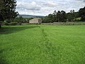
 Barn at the Western End of Newbiggin. - geograph.org.uk - 279150.jpg 640 × 480; 223 KB
-
 Barn beside Street Head Bank - geograph.org.uk - 6173347.jpg 1,024 × 683; 500 KB
-
 Barn in field - geograph.org.uk - 4928927.jpg 1,600 × 1,200; 417 KB
-
 Barn near Whitbeck Bridge - geograph.org.uk - 3082034.jpg 640 × 430; 51 KB
-

-
 Baxton Edge - geograph.org.uk - 1999159.jpg 2,816 × 2,112; 1.04 MB
-
 Baxton Edge - geograph.org.uk - 4264989.jpg 640 × 480; 44 KB
-
 Below Naughtberry Hill - geograph.org.uk - 1999204.jpg 2,816 × 2,112; 1.98 MB
-
 Bench Mark, East Lane House - geograph.org.uk - 2151299.jpg 480 × 640; 89 KB
-
 Benchmark on Mill Bridge - geograph.org.uk - 3059615.jpg 1,024 × 683; 267 KB
-

-
 Bishopdale - geograph.org.uk - 124296.jpg 587 × 392; 32 KB
-
 Bishopdale - geograph.org.uk - 1810079.jpg 3,456 × 1,839; 984 KB
-
 Bishopdale - geograph.org.uk - 2151249.jpg 640 × 480; 73 KB
-
 Bishopdale Beck - geograph.org.uk - 159118.jpg 640 × 480; 150 KB
-
 Bishopdale in mist - geograph.org.uk - 4700044.jpg 6,000 × 4,000; 6.44 MB
-
 Bishopdale view - geograph.org.uk - 4594717.jpg 4,320 × 3,240; 4.19 MB
-
 Bishopsdale - a green valley - geograph.org.uk - 4928924.jpg 1,600 × 1,271; 321 KB
-
 Bridleway on Wasset Fell - geograph.org.uk - 1997451.jpg 2,816 × 2,112; 1.92 MB
-
 Cottages in Newbiggin - geograph.org.uk - 1997409.jpg 2,816 × 2,112; 1.81 MB
-
 Cows above the entrance drive to Dale Foot Farm - geograph.org.uk - 4700092.jpg 6,000 × 4,000; 3.62 MB
-
 Cows by Howesyke Farm - geograph.org.uk - 4700088.jpg 6,000 × 4,000; 6.31 MB
-
 Disused Barn in Bishopdale - geograph.org.uk - 3439420.jpg 4,000 × 3,000; 3.53 MB
-
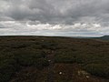
 Disused Lead Workings on Wassett Fell. - geograph.org.uk - 279131.jpg 640 × 480; 306 KB
-
 East farm at Newbiggin - geograph.org.uk - 3581641.jpg 640 × 480; 88 KB
-
 East Lane House - geograph.org.uk - 2151284.jpg 640 × 480; 58 KB
-
 East Lane House - geograph.org.uk - 3581631.jpg 4,000 × 3,000; 2.85 MB
-
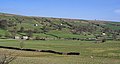
 Farmland in Bishopdale - geograph.org.uk - 4623565.jpg 1,024 × 753; 576 KB
-
 Fence on Askrigg Common - geograph.org.uk - 1732395.jpg 640 × 480; 98 KB
-
 Field below Newbiggin - geograph.org.uk - 4700017.jpg 6,000 × 4,000; 3.4 MB
-
 Field near Street Head Inn - geograph.org.uk - 6173656.jpg 1,024 × 683; 525 KB
-
 Field on the side of Bishopdale - geograph.org.uk - 4700055.jpg 6,000 × 4,000; 3.32 MB
-
 Fields below Dalefoot Plantation - geograph.org.uk - 4831489.jpg 640 × 427; 93 KB
-
 Fields near East Lane House - geograph.org.uk - 4831491.jpg 640 × 427; 81 KB
-
 Fields near to Newbiggin in Bishopdale - geograph.org.uk - 2407245.jpg 1,500 × 843; 1.14 MB
-
 Flooded Fields in Bishopdale. - geograph.org.uk - 295444.jpg 640 × 480; 289 KB
-
 Floutgate Scar - geograph.org.uk - 4264993.jpg 640 × 480; 71 KB
-
 Ford at Thoralby - geograph.org.uk - 4459985.jpg 3,872 × 2,592; 4.78 MB
-
 Ford at Thoralby - geograph.org.uk - 4460008.jpg 3,872 × 2,592; 4.84 MB
-
 Furnishings on Wasset Fell - geograph.org.uk - 1997463.jpg 2,816 × 2,112; 1.61 MB
-
 Hargarth Farm - geograph.org.uk - 4264996.jpg 640 × 480; 75 KB
-
 Herding cows near Thoralby - geograph.org.uk - 65328.jpg 640 × 480; 137 KB
-
 House at Crosslanes road junction - geograph.org.uk - 3081953.jpg 640 × 450; 60 KB
-
 Howesyke Farm entrance from B6160 - geograph.org.uk - 3082135.jpg 640 × 393; 69 KB
-
 Laithe in Bishopdale - geograph.org.uk - 2005830.jpg 2,816 × 2,112; 1.91 MB
-
 Lane to Newbiggin - geograph.org.uk - 4700008.jpg 6,000 × 4,000; 7.75 MB
-
 Looking into Bishopdale - geograph.org.uk - 4594711.jpg 4,320 × 3,240; 3.37 MB
-
 Mill Bridge from Holme Lane - geograph.org.uk - 3059642.jpg 1,024 × 683; 194 KB
-
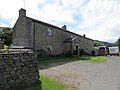
 Modern housing at Hargarth Farm, Newbiggin - geograph.org.uk - 3581638.jpg 4,000 × 3,000; 3.37 MB
-

-
 Narrow field off Street Head Bank - geograph.org.uk - 6173893.jpg 1,024 × 683; 503 KB
-
 Near Thoralby - geograph.org.uk - 6161183.jpg 2,048 × 1,536; 950 KB
-
 Victorian Letterbox in Newbiggin. - geograph.org.uk - 277662.jpg 640 × 480; 303 KB
-
 Newbiggin - geograph.org.uk - 1997398.jpg 2,705 × 2,108; 1.72 MB
-
 Newbiggin Occupations of Those Economically Active.PNG 467 × 275; 15 KB
-
 Newbiggin Population Change from 1881-2011.PNG 467 × 275; 10 KB
-
 A Footpath To West Burton - geograph.org.uk - 284534.jpg 640 × 480; 106 KB
-
 On Forelands Rigg - geograph.org.uk - 4594708.jpg 4,320 × 3,240; 3.66 MB
-
 On Wasset Fell Road - geograph.org.uk - 1997433.jpg 2,816 × 2,112; 1.77 MB
-
 Path into the dale - geograph.org.uk - 4594715.jpg 3,240 × 4,320; 3.44 MB
-
 Pinfold next to Mill Beck - geograph.org.uk - 4512927.jpg 4,000 × 3,000; 5.01 MB
-
 Remnants of the Forelands Plantation - geograph.org.uk - 4594697.jpg 4,320 × 3,240; 4.33 MB
-
 Roughly grassed enclosure below Wasset Fell Road - geograph.org.uk - 2407260.jpg 1,500 × 1,125; 1.78 MB
-
 Ruin on Wasset Fell - geograph.org.uk - 2307282.jpg 3,664 × 2,748; 1.82 MB
-
 Ruined building on Wasset Fell - geograph.org.uk - 5659132.jpg 1,500 × 870; 1.18 MB
-
 Ruined wall north-east of Naughtberry Hill - geograph.org.uk - 2452597.jpg 1,500 × 1,125; 1.45 MB
-
 Ruins of Shooting Hut - geograph.org.uk - 4264991.jpg 640 × 480; 53 KB
-
 Sheep At Newbiggin - geograph.org.uk - 287873.jpg 640 × 480; 87 KB
-
 Sheep in Bishopdale - geograph.org.uk - 4700032.jpg 6,000 × 4,000; 6.84 MB
-
 Sheep in Bishopdale - geograph.org.uk - 4831495.jpg 640 × 427; 84 KB
-
 Shooting Hut on Wassett Fell. - geograph.org.uk - 278155.jpg 640 × 480; 294 KB
-
 Small Laithe near Newbiggin - geograph.org.uk - 1997417.jpg 2,816 × 2,112; 2.1 MB
-
 Small wooded ravine containing Little Beck - geograph.org.uk - 3581644.jpg 4,000 × 3,000; 3.8 MB
-
 Street Head Caravan Site - geograph.org.uk - 4264998.jpg 640 × 480; 53 KB
-
 The B6160 by East Lane House - geograph.org.uk - 4700068.jpg 6,000 × 4,000; 3.36 MB
-
 The Fleak - geograph.org.uk - 1752742.jpg 2,592 × 1,944; 1.11 MB
-
 The Old School Bunkhouse - geograph.org.uk - 2407231.jpg 1,500 × 1,125; 1.46 MB
-

-
 The remains of Forelands Rigg Plantation - geograph.org.uk - 2650120.jpg 800 × 600; 120 KB
-
 The Street Head Inn - geograph.org.uk - 6173890.jpg 1,024 × 683; 382 KB
-
 Track beside Street Head Inn - geograph.org.uk - 6173889.jpg 1,024 × 683; 506 KB
-
 Track by East Farm - geograph.org.uk - 2005833.jpg 2,816 × 2,112; 2.43 MB
-
 Track to Mile Stone Hill - geograph.org.uk - 4264988.jpg 640 × 480; 53 KB
-
 Tree beside Wasset Fell Road - geograph.org.uk - 4264994.jpg 480 × 640; 103 KB
-
 Tree lined track near Ox Pasture - geograph.org.uk - 3439424.jpg 4,000 × 3,000; 4.8 MB
-
 Walking To Thoralby - geograph.org.uk - 287876.jpg 640 × 480; 98 KB
-
 Wall corner in Bishopdale - geograph.org.uk - 4700076.jpg 6,000 × 4,000; 3.79 MB
-
 Wasset Fell Road - geograph.org.uk - 4264992.jpg 640 × 480; 59 KB
-
 Wensleydale Cheese at West Lane House - geograph.org.uk - 4700108.jpg 6,000 × 4,000; 7.25 MB
-
 Where two paths meet - geograph.org.uk - 4594722.jpg 4,320 × 3,240; 3.2 MB
-
 Whit Beck - geograph.org.uk - 1810024.jpg 2,045 × 2,045; 786 KB
-
 Winter feed near Newbiggin - geograph.org.uk - 2151242.jpg 640 × 480; 73 KB
-
 Disused Shaft on Wassett Fell. - geograph.org.uk - 278135.jpg 640 × 480; 255 KB


