Category:Nieuwe Molstraat 11, The Hague
Jump to navigation
Jump to search
| Object location | | View all coordinates using: OpenStreetMap |
|---|
building in The Hague, Netherlands  | |||||
| Upload media | |||||
| Instance of | |||||
|---|---|---|---|---|---|
| Location | The Hague, South Holland, Netherlands | ||||
| Street address |
| ||||
| Located on street | |||||
| Heritage designation |
| ||||
 | |||||
|
This is a category about rijksmonument number 17799
|
| Address |
|
Media in category "Nieuwe Molstraat 11, The Hague"
The following 14 files are in this category, out of 14 total.
-
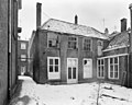 Exterieur - 's-Gravenhage - 20089211 - RCE.jpg 1,200 × 958; 239 KB
-
 Exterieur - 's-Gravenhage - 20089212 - RCE.jpg 1,200 × 960; 261 KB
-
 Exterieur - 's-Gravenhage - 20089213 - RCE.jpg 1,200 × 951; 328 KB
-
 Ingang - 's-Gravenhage - 20089209 - RCE.jpg 863 × 1,200; 221 KB
-
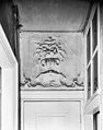
 Interieur - 's-Gravenhage - 20089214 - RCE.jpg 939 × 1,200; 268 KB
-
 Interieur - 's-Gravenhage - 20089215 - RCE.jpg 1,200 × 950; 202 KB
-
 Interieur - 's-Gravenhage - 20089216 - RCE.jpg 945 × 1,200; 152 KB
-
 Interieur - 's-Gravenhage - 20089217 - RCE.jpg 942 × 1,200; 151 KB
-
 Interieur - 's-Gravenhage - 20089218 - RCE.jpg 1,200 × 953; 170 KB
-
 Interieur - 's-Gravenhage - 20089219 - RCE.jpg 1,200 × 950; 190 KB
-
 RM17799 Den Haag - Nieuwe Molstraat 11.jpg 2,448 × 3,264; 2.06 MB
-
 Voorgevel - 's-Gravenhage - 20089210 - RCE.jpg 801 × 1,200; 215 KB
-
 Voorgevel - 's-Gravenhage - 20089221 - RCE.jpg 946 × 1,200; 217 KB
-
 Voorgevels in straat, geparkeerde auto's - 's-Gravenhage - 20398804 - RCE.jpg 949 × 1,200; 210 KB


