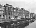
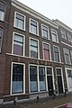
Category:Nieuwe Rijn 66, Leiden
Jump to navigation
Jump to search
| Object location | | View all coordinates using: OpenStreetMap |
|---|
building in Leiden, Netherlands  | |||||
| Upload media | |||||
| Instance of | |||||
|---|---|---|---|---|---|
| Location | Leiden, South Holland, Netherlands | ||||
| Street address |
| ||||
| Heritage designation |
| ||||
 | |||||
|
This is a category about rijksmonument number 25169
|
| Address |
|
Media in category "Nieuwe Rijn 66, Leiden"
The following 7 files are in this category, out of 7 total.
-
 Eind, overzicht voorgevels - Leiden - 20136578 - RCE.jpg 1,200 × 951; 219 KB
-
 Eind, voorgevels overzicht - Leiden - 20136582 - RCE.jpg 1,200 × 958; 242 KB
-
 Gevels - Leiden - 20136585 - RCE.jpg 808 × 1,200; 197 KB
-
 Leiden - Nieuwe rijn 66.JPG 3,056 × 4,592; 4.31 MB
-

-
 Voorgevels - Leiden - 20136580 - RCE.jpg 1,200 × 958; 243 KB
-
 Voorgevels - Leiden - 20136581 - RCE.jpg 1,200 × 941; 215 KB


