Category:Noorderkerk, Hoorn
Jump to navigation
Jump to search
| Object location | | View all coordinates using: OpenStreetMap |
|---|
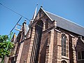
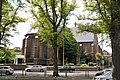
church building in Hoorn, Netherlands  | |||||
| Upload media | |||||
| Instance of | |||||
|---|---|---|---|---|---|
| Location | Hoorn, North Holland, Netherlands | ||||
| Street address |
| ||||
| Heritage designation |
| ||||
 | |||||
|
This is a category about rijksmonument number 22452
|
| Address |
|
Subcategories
This category has only the following subcategory.
I
Media in category "Noorderkerk, Hoorn"
The following 52 files are in this category, out of 52 total.
-
 20180719 249 hoorn.jpg 4,000 × 6,000; 12.9 MB
-
 20180719 250 hoorn.jpg 6,000 × 4,000; 13.59 MB
-
 20180719 251 hoorn.jpg 6,000 × 4,000; 14.24 MB
-
 20180719 252 hoorn.jpg 6,000 × 4,000; 12.85 MB
-
 Avondmaalszilver - Hoorn - 20115741 - RCE.jpg 1,200 × 945; 182 KB
-
 Binnenstad Hoorn, 1621 Hoorn, Netherlands - panoramio (137).jpg 4,896 × 3,264; 2.98 MB
-
 Exterieur - Hoorn - 20115725 - RCE.jpg 874 × 1,200; 245 KB
-
 Exterieur naar het noord noord-westen - Hoorn - 20115722 - RCE.jpg 876 × 1,200; 227 KB
-
 Exterieur naar het noord-westen - Hoorn - 20115723 - RCE.jpg 1,200 × 882; 211 KB
-
 Exterieur naar het zuid-oosten - Hoorn - 20115718 - RCE.jpg 887 × 1,200; 321 KB
-
 Exterieur naar het zuid-westen - Hoorn - 20115721 - RCE.jpg 1,200 × 885; 241 KB
-
 Exterieur vanuit het zuid-oosten - Hoorn - 20115719 - RCE.jpg 875 × 1,200; 268 KB
-
 Exterieur vanuit het zuid-oosten - Hoorn - 20115720 - RCE.jpg 878 × 1,200; 283 KB
-
 Gebrandschilderd raam - Hoorn - 20400828 - RCE.jpg 880 × 1,200; 240 KB
-
 Gedeelte van de westgevel - Hoorn - 20115750 - RCE.jpg 964 × 1,200; 276 KB
-
 Gedeelte van de westgevel - Hoorn - 20115751 - RCE.jpg 949 × 1,200; 281 KB
-
 Geveldetail noord hal - Hoorn - 20115727 - RCE.jpg 889 × 1,200; 247 KB
-
 Hoorn 077.JPG 3,264 × 2,448; 2.09 MB
-
 Hoorn Noorderkerk exterieur DSC 1199.jpg 3,554 × 2,823; 1.65 MB
-
 Hoorn Noorderkerk portaal DSC 1163.jpg 4,288 × 2,848; 6.33 MB
-
 Hoorn, hek bij Noorderkerk.jpg 990 × 1,320; 426 KB
-
 Hoorn, Noorderkerk.jpg 966 × 1,374; 310 KB
-
 Kleine Noord 32A, Hoorn.jpg 2,048 × 1,536; 657 KB
-
 Kleine Noord 32a, Hoorn.jpg 2,592 × 1,456; 1.3 MB
-
 Koor - Hoorn - 20115716 - RCE.jpg 886 × 1,200; 243 KB
-
 Koor - Hoorn - 20115747 - RCE.jpg 1,200 × 873; 232 KB
-
 Koor - Hoorn - 20115755 - RCE.jpg 1,200 × 951; 262 KB
-
 Koor - Hoorn - 20115756 - RCE.jpg 1,200 × 941; 329 KB
-
 Lengtedoorsnede naar het noorden - Hoorn - 20115714 - RCE.jpg 1,200 × 891; 184 KB
-
 Noorderkerk Hoorn 22452 oostzijde.jpg 4,288 × 2,848; 10.03 MB
-
 Noordgevel - Hoorn - 20115752 - RCE.jpg 1,200 × 961; 321 KB
-
 Noordgevel - Hoorn - 20115753 - RCE.jpg 954 × 1,200; 272 KB
-
 Nordholland Hoorn 2004 005b.jpg 1,533 × 2,060; 719 KB
-
 Oostgevel - Hoorn - 20115754 - RCE.jpg 1,200 × 955; 280 KB
-

-
 Overzicht van ingangspartij in westgevel - Hoorn - 20381670 - RCE.jpg 1,200 × 1,192; 365 KB
-
 Overzicht westgevels - Hoorn - 20371643 - RCE.jpg 810 × 1,200; 226 KB
-
 Pomp tegen de gevel van de kerk - Hoorn - 20406805 - RCE.jpg 1,200 × 1,168; 272 KB
-
 Portalen - Hoorn - 20115744 - RCE.jpg 876 × 1,200; 244 KB
-
 Portalen - Hoorn - 20115745 - RCE.jpg 892 × 1,200; 278 KB
-
 Sculpture above the entrance of the Noorderkerk, Hoorn.JPG 1,280 × 960; 238 KB
-
 Toegangsportaal Middenhal naar het oosten - Hoorn - 20115728 - RCE.jpg 894 × 1,200; 222 KB
-
 Towerr and outreaching clock at the protestant church Hoorn - panoramio.jpg 3,264 × 4,928; 6.55 MB
-
 West-gevel - Hoorn - 20115715 - RCE.jpg 896 × 1,200; 200 KB
-
 West-gevel - Hoorn - 20115724 - RCE.jpg 951 × 1,200; 200 KB
-
 Westgevel - Hoorn - 20115748 - RCE.jpg 952 × 1,200; 271 KB
-
 Westgevel - Hoorn - 20115749 - RCE.jpg 960 × 1,200; 266 KB
-
 Zuid portaal zuid hal naar het noorden - Hoorn - 20115729 - RCE.jpg 975 × 1,200; 256 KB
-
 Zuid-oostgevel - Hoorn - 20115757 - RCE.jpg 1,200 × 965; 258 KB
-
 Zuid-west hoek - Hoorn - 20115717 - RCE.jpg 879 × 1,200; 304 KB
-
 Zuidgevel - Hoorn - 20115758 - RCE.jpg 945 × 1,200; 280 KB
-
 Zuidgevel met aanbouw - Hoorn - 20115759 - RCE.jpg 1,200 × 961; 291 KB


.jpg)


