Category:Northam, Devon
Vai alla navigazione
Vai alla ricerca
town and civil parish in Devon, England  | |||||
| Carica un file multimediale | |||||
| Istanza di | |||||
|---|---|---|---|---|---|
| Luogo | Torridge, Devon, Sud Ovest dell'Inghilterra, Inghilterra | ||||
| Popolazione |
| ||||
| Altezza sul mare |
| ||||
| Distinto da | |||||
| sito web ufficiale | |||||
 | |||||
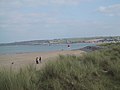
English: Northam is a small town in Devon, England, lying north of Bideford and south of Westward Ho!. It is thought to have been the site of an Anglo-Saxon castle, and is said to have been where Hubba the Dane attacked Devon and was repelled (perhaps by Alfred the Great or by the Earl of Devon). A little over a mile away along the coast is a town called Appledore. Between the towns of Appledore and Northam, is 'Bloody Corner'. There is a rock called 'Hubba's Rock' which is supposed to be the site where Hubba the Dane was killed by the Anglo-Saxon (or Devonshire) fyrd. Northam is also the place of birth of 'House of Horrors' serial killer Rosemary West.
Nederlands: Northam is een plaats in het bestuurlijke gebied Torridge, in het Engelse graafschap Devon. De plaats telt 11.632 inwoners.
Português: Northam é uma pequena cidade localizada no condado de Devon, Inglaterra. Localiza-se ao norte de Bideford e ao sul de Westward Ho!. Em 2001, a cidade possuia aproximadamente 11.632 habitantes.
Română: Northam este un oraş în comitatul Devon, regiunea South West, Anglia. Oraşul se află în districtul Torridge.
Sottocategorie
Questa categoria contiene le 8 sottocategorie indicate di seguito, su un totale di 8.
A
B
N
- Northam War Memorial (18 F)
O
- Orchard Hill, Devon (1 F)
R
- Royal North Devon Golf Club (4 F)
S
T
- Torridge Bridge (18 F)
W
File nella categoria "Northam, Devon"
Questa categoria contiene 200 file, indicati di seguito, su un totale di 698.
(pagina precedente) (pagina successiva)-

-

-

-
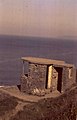
 A derelict building in a copse on Kipling Tors - geograph.org.uk - 5323299.jpg 6 000 × 4 000; 5,53 MB
-
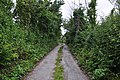
 A footpath leading from Windmill Lane - geograph.org.uk - 1837396.jpg 1 024 × 768; 340 KB
-

-
-
 A housing development on Buckleigh Road, Westward Ho^ - geograph.org.uk - 5324351.jpg 6 000 × 4 000; 4,35 MB
-
 A housing development on Buckleigh Road, Westward Ho^ - geograph.org.uk - 5324356.jpg 6 000 × 4 000; 4,96 MB
-

-
 A sign, "Here be dragons" - geograph.org.uk - 4044713.jpg 1 536 × 1 152; 1,04 MB
-

-
 A warning for walkers - geograph.org.uk - 4044707.jpg 1 536 × 1 152; 1,34 MB
-

-
 A386 in Diddywell - geograph.org.uk - 4044819.jpg 1 536 × 1 153; 944 KB
-
 A39 - A386 junction - geograph.org.uk - 3289399.jpg 640 × 480; 54 KB
-
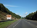 A39 approaching Bideford - geograph.org.uk - 3641740.jpg 1 024 × 768; 114 KB
-
 A39 approaching roundabout - geograph.org.uk - 5477839.jpg 2 078 × 1 381; 1,49 MB
-
 A39 near Kenwith Castle - geograph.org.uk - 4128734.jpg 1 024 × 602; 145 KB
-
 A39 near Silford - geograph.org.uk - 2746897.jpg 4 320 × 3 240; 3,65 MB
-
 A39 near Silford - geograph.org.uk - 2746898.jpg 4 320 × 3 240; 4,23 MB
-
 A39, Torridge Bridge - geograph.org.uk - 3289408.jpg 640 × 480; 41 KB
-
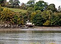
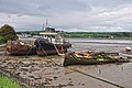
 Abandoned boats near Appledore - geograph.org.uk - 1354833.jpg 640 × 480; 71 KB
-
 Across The Skern to Appledore - geograph.org.uk - 31626.jpg 640 × 424; 66 KB
-
 Along Pebble Ridge just after high tide - geograph.org.uk - 5247008.jpg 1 469 × 1 102; 482 KB
-
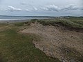 An eroded sand dune on Northam Burrows - geograph.org.uk - 4044270.jpg 1 536 × 1 152; 1,07 MB
-
 An interesting section of cycle lane on Heywood Road - geograph.org.uk - 2709664.jpg 4 288 × 2 848; 2,82 MB
-
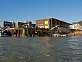
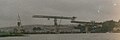
 Another view of Appledore shipyard - geograph.org.uk - 3002677.jpg 3 681 × 2 070; 3,87 MB
-
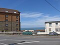
 Apartment block, Westward Ho^ - geograph.org.uk - 1821079.jpg 2 000 × 1 500; 651 KB
-
 Appledore , Bidna Lane - geograph.org.uk - 4018636.jpg 4 288 × 2 848; 6,16 MB
-
 Appledore , Footpath - geograph.org.uk - 4018633.jpg 2 848 × 4 288; 6,2 MB
-
 Appledore , Footpath - geograph.org.uk - 4018658.jpg 4 288 × 2 848; 6,04 MB
-
 Appledore , Footpath - geograph.org.uk - 4018662.jpg 2 848 × 4 288; 6,18 MB
-
 Appledore , Grassy Field ^ Shipyard - geograph.org.uk - 4018656.jpg 4 288 × 2 848; 6,72 MB
-
 Appledore , River Torridge - geograph.org.uk - 4018612.jpg 4 037 × 2 681; 5,69 MB
-
 Appledore , River Torridge - geograph.org.uk - 4018615.jpg 4 288 × 2 848; 5,37 MB
-
 Appledore , River Torridge ^ Boats - geograph.org.uk - 4018624.jpg 4 237 × 2 814; 5,43 MB
-
 Appledore , Wooda Road - geograph.org.uk - 4018664.jpg 4 288 × 2 848; 6,53 MB
-
 Appledore , Wooda Road - geograph.org.uk - 4018666.jpg 4 288 × 2 848; 5,63 MB
-
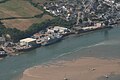
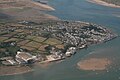 Appledore and Shipyard, aerial 2018 - geograph.org.uk - 5960424.jpg 640 × 427; 76 KB
-
 Appledore Bridge over the River Pill at Northam Burrows - geograph.org.uk - 5534524.jpg 1 600 × 1 200; 737 KB
-
 Appledore Fish Dock on the River Torridge - geograph.org.uk - 4862808.jpg 4 000 × 3 000; 4,64 MB
-
 Appledore Shipyard, aerial 2018 - geograph.org.uk - 5960423.jpg 640 × 427; 69 KB
-
 Approaching Westward Ho on Long Lane - geograph.org.uk - 5534723.jpg 1 600 × 1 200; 740 KB
-
-
 Armada Way, off Cornborough Road, Westward Ho^ - geograph.org.uk - 1821029.jpg 2 000 × 1 500; 539 KB
-
 Artwork on Torridge Bridge - geograph.org.uk - 4435690.jpg 800 × 531; 110 KB
-
 Assells, near Appledore - geograph.org.uk - 2854498.jpg 640 × 425; 71 KB
-

-
 Baptist Church, Westward Ho^ - geograph.org.uk - 3033004.jpg 2 000 × 1 496; 234 KB
-
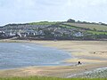
 Beach and dunes - geograph.org.uk - 4986985.jpg 3 207 × 2 138; 1,77 MB
-
 Beach at Westward Ho^ - geograph.org.uk - 3289375.jpg 640 × 480; 47 KB
-
 Beach huts - geograph.org.uk - 5912207.jpg 1 024 × 683; 213 KB
-
 Beach Scene, Westward Ho - geograph.org.uk - 5532536.jpg 1 200 × 901; 185 KB
-
 Beach Scene, Westward Ho - geograph.org.uk - 5532552.jpg 1 200 × 903; 327 KB
-

-
 Beachcomber at Northam Burrows - geograph.org.uk - 5533824.jpg 1 154 × 865; 337 KB
-
 Bench on Kipling Tors - geograph.org.uk - 1302656.jpg 640 × 480; 118 KB
-
 Bideford , Grassy Field - geograph.org.uk - 3594584.jpg 4 288 × 2 848; 5,34 MB
-
 Bideford Hospital on Abbottsham Road - geograph.org.uk - 5326867.jpg 6 000 × 4 000; 6,07 MB
-
-
 Bideford Quay - geograph.org.uk - 1832096.jpg 1 024 × 768; 206 KB
-
 Bideford RFC and part of Victoria Park - geograph.org.uk - 5681884.jpg 5 460 × 3 012; 4,55 MB
-
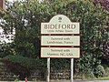 Bideford town sign - geograph.org.uk - 2773972.jpg 4 320 × 3 240; 4,86 MB
-
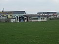
 Bideford, Littleham ^ Westward Ho^ Cricket Club - Ground - geograph.org.uk - 3201948.jpg 1 600 × 1 200; 263 KB
-
-

-
 Bloody Corner - geograph.org.uk - 1380964.jpg 480 × 640; 202 KB
-
 Bloody Corner with rubbish - geograph.org.uk - 1380968.jpg 640 × 480; 154 KB
-
 Boat in the Taw estuary - geograph.org.uk - 1354709.jpg 640 × 480; 59 KB
-
 Boats beached at low tide - geograph.org.uk - 1354848.jpg 480 × 640; 57 KB
-
 Boats on the Skern - geograph.org.uk - 4670942.jpg 800 × 451; 183 KB
-
-
 Bungalow, Cornborough Road, Westward Ho^ - geograph.org.uk - 1821013.jpg 2 000 × 1 236; 601 KB
-
 Bus stop and shelter on Churchill Way, Northam - geograph.org.uk - 4045468.jpg 1 536 × 1 148; 1,01 MB
-
 Car park and lifeguard look-out on Northam Burrows - geograph.org.uk - 4044746.jpg 1 536 × 1 152; 926 KB
-
 Car park, Northam Burrows - geograph.org.uk - 1367785.jpg 640 × 480; 77 KB
-
 Chanters Road, Bideford - geograph.org.uk - 2773963.jpg 4 320 × 3 240; 4,22 MB
-
 Chapel, North Street, Northam - geograph.org.uk - 1821118.jpg 2 000 × 1 481; 612 KB
-
 Church and Rest Centre, Fore Street, Northam (geograph 1821134).jpg 2 000 × 1 346; 660 KB
-

-
 Coast above Mermaid's Pool - geograph.org.uk - 5912218.jpg 1 024 × 683; 147 KB
-
 Coastal defence works on Golf links Road - geograph.org.uk - 5535613.jpg 1 600 × 1 203; 679 KB
-
 Coastguard, Westward Ho^ - geograph.org.uk - 2773958.jpg 4 320 × 3 240; 3,93 MB
-
 Coastline at Northam Burrows - geograph.org.uk - 932020.jpg 640 × 480; 63 KB
-
-
 Collection of signs at Silford Cross - geograph.org.uk - 1302623.jpg 640 × 480; 134 KB
-
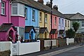 Colourful houses, Westward Ho^ - geograph.org.uk - 5912189.jpg 1 024 × 683; 153 KB
-
 Corner of Fore Street and Tower Street, Northam - geograph.org.uk - 1821126.jpg 2 000 × 1 369; 597 KB
-
 Cricket ground recovering from the summer - geograph.org.uk - 5250952.jpg 1 632 × 1 224; 468 KB
-
 Cricket ground, Westward Ho^ - geograph.org.uk - 4488814.jpg 640 × 427; 76 KB
-
 Crossing the Torridge Bridge from the west - geograph.org.uk - 3641751.jpg 1 024 × 768; 147 KB
-
 Culvert on Long Lane - geograph.org.uk - 5534715.jpg 1 600 × 1 200; 1,08 MB
-
 Daddon Hill - geograph.org.uk - 4760946.jpg 800 × 600; 84 KB
-
 Daddon Hill Farm - geograph.org.uk - 4003459.jpg 2 316 × 1 737; 3,54 MB
-
 Derelict house, near Westward Ho^ - geograph.org.uk - 3061215.jpg 1 024 × 768; 167 KB
-
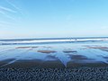
 Deserted (nearly) Beach - geograph.org.uk - 723750.jpg 640 × 480; 32 KB
-
 Detached house on Diddywell Road - geograph.org.uk - 4258365.jpg 1 024 × 822; 124 KB
-

-
 Disused railway bridge, Westward Ho^ - geograph.org.uk - 3037891.jpg 2 000 × 1 505; 490 KB
-
 Down to the beach at Westward Ho^ - geograph.org.uk - 3952812.jpg 1 280 × 851; 271 KB
-
 Downstream at the shoreline - geograph.org.uk - 5250956.jpg 2 390 × 1 792; 1 MB
-
 Driftwood at Northam Burrows - geograph.org.uk - 5533408.jpg 1 200 × 902; 420 KB
-
 Dune erosion at Northam Burrows - geograph.org.uk - 5533386.jpg 1 200 × 900; 389 KB
-
 Dune Vegetation on Northam Burrows - geograph.org.uk - 30599.jpg 640 × 621; 192 KB
-
 Dunes at Northam Burrows - geograph.org.uk - 5533372.jpg 1 600 × 1 200; 509 KB
-
 Dunes at Northam Burrows - geograph.org.uk - 5533377.jpg 2 816 × 2 112; 2,79 MB
-
 Dunes by the Torridge Estuary - geograph.org.uk - 932021.jpg 640 × 480; 53 KB
-
 Dunes of Grey Sand Hill - geograph.org.uk - 1302818.jpg 640 × 480; 85 KB
-
 Dunes on the west of Northam Burrows - geograph.org.uk - 4044743.jpg 1 536 × 1 152; 1,14 MB
-
 Dunes, shingle and driftwood on the shoreline - geograph.org.uk - 5250947.jpg 1 469 × 1 102; 473 KB
-
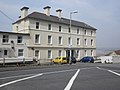
 Durrant House Hotel, Northam - geograph.org.uk - 4862816.jpg 4 000 × 3 000; 4,01 MB
-
 Enclosed football field, Northam - geograph.org.uk - 4043989.jpg 1 536 × 1 152; 973 KB
-
 Entrance to shipbuilding yard, Appledore - geograph.org.uk - 4044816.jpg 1 536 × 1 154; 870 KB
-
 Erosion of Northam Burrows - geograph.org.uk - 1824381.jpg 1 632 × 1 224; 486 KB
-
 Expanse of sand - geograph.org.uk - 1302844.jpg 640 × 480; 46 KB
-
-
 Fairlea, Northam - geograph.org.uk - 4826711.jpg 4 890 × 4 000; 5,75 MB
-
 Falling tide on Westward Ho^ beach - geograph.org.uk - 5247013.jpg 1 469 × 1 102; 430 KB
-
 Flooded track on Northam Burrows - geograph.org.uk - 4258354.jpg 1 024 × 768; 132 KB
-
 Flower pot, Northam 01.jpg 4 032 × 3 024; 6,74 MB
-
 Flower pot, Northam 02.jpg 4 032 × 3 024; 6,85 MB
-
 Footpath junction in woods above Westward Ho^ - geograph.org.uk - 5912227.jpg 1 024 × 683; 334 KB
-
 Footpath sign on Grey Sand Hill - geograph.org.uk - 4044682.jpg 1 152 × 1 536; 1,08 MB
-
 Footpath to Pusehill - geograph.org.uk - 1302620.jpg 640 × 480; 102 KB
-
 Fore Street , Northam - geograph.org.uk - 1821110.jpg 2 000 × 1 500; 578 KB
-
 Fore Street, Northam - geograph.org.uk - 3061928.jpg 1 024 × 768; 148 KB
-

-
 Garage and derelict building, Watertown - geograph.org.uk - 4044773.jpg 1 536 × 1 101; 967 KB
-
 Ghost writing, Westward Ho^ - geograph.org.uk - 5250955.jpg 1 469 × 1 102; 745 KB
-
 Glebefields, Northam - geograph.org.uk - 4488704.jpg 640 × 480; 86 KB
-
 Golf Links Road, Westward Ho^ - geograph.org.uk - 2773951.jpg 4 320 × 3 240; 4,12 MB
-
 Golf Links Road, Westward Ho^ - geograph.org.uk - 2773953.jpg 4 320 × 3 240; 4,24 MB
-
 Golf Links Road, Westward Ho^ - geograph.org.uk - 3952437.jpg 1 280 × 851; 288 KB
-
 Golf Links Road, Westward Ho^ - geograph.org.uk - 5912194.jpg 1 024 × 683; 122 KB
-
 Golfers at Northam Burrows - geograph.org.uk - 5533419.jpg 1 200 × 900; 365 KB
-
 Grassy space and bench - geograph.org.uk - 4983712.jpg 3 318 × 2 212; 1,99 MB
-
 Grey Sand Hill, Northam Burrows - geograph.org.uk - 5533474.jpg 1 200 × 900; 311 KB
-
 Grey Sand Hill, Northam Burrows - geograph.org.uk - 5533497.jpg 1 200 × 900; 336 KB
-
 Grey Sand Hill, Northam Burrows - geograph.org.uk - 5533515.jpg 1 024 × 768; 211 KB
-
 Grey Sand Hill, Northam Burrows - geograph.org.uk - 76152.jpg 640 × 480; 29 KB
-
 Hanson Aggregates on Hubbastone Road, Appledore - geograph.org.uk - 3361596.jpg 1 600 × 1 067; 376 KB
-
 Heathwood Motor Company - geograph.org.uk - 5535580.jpg 1 600 × 1 200; 485 KB
-

-
 High Water zone - geograph.org.uk - 4258322.jpg 1 024 × 768; 145 KB
-
 Hindostan, floating restaurant at Bideford - geograph.org.uk - 4621423.jpg 5 184 × 3 456; 3,49 MB
-
 Hocking's Ice Cream Van, Westward Ho - geograph.org.uk - 5532494.jpg 1 200 × 903; 223 KB
-

-
 Holiday accommodation, Westward Ho^ - geograph.org.uk - 4045564.jpg 1 536 × 1 024; 617 KB
-
 Holiday apartments, Westward Ho^ - geograph.org.uk - 3060790.jpg 1 024 × 768; 132 KB
-
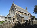 Holy Trinity Church - geograph.org.uk - 4482688.jpg 640 × 480; 78 KB
-
 Holy Trinity Church at Westward Ho^ - geograph.org.uk - 3702291.jpg 4 000 × 3 000; 2,37 MB
-

-

-

-
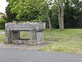 Horse trough in Northam - geograph.org.uk - 4043220.jpg 1 536 × 1 152; 1,23 MB
-
 House and attractive garden, Northam - geograph.org.uk - 1359503.jpg 640 × 480; 166 KB
-

-
 House, at corner of Long Lane and Broad Lane - geograph.org.uk - 4257728.jpg 1 024 × 768; 110 KB
-
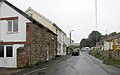
 Houses at Lower Cleave, Northam - geograph.org.uk - 4055824.jpg 640 × 480; 68 KB
-

-
 Houses on Riverside Court and Riverside Close - geograph.org.uk - 4841915.jpg 4 845 × 3 230; 4,34 MB
-

-
 Housing development North of Golf links Road, Northam - geograph.org.uk - 5534790.jpg 1 600 × 1 200; 529 KB
-
 Hubbastone Road, Appledore - geograph.org.uk - 5298348.jpg 1 916 × 1 192; 381 KB
-
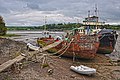
 Hulks in the Torridge.jpg 2 992 × 2 328; 2,65 MB
-
 Ice cream van - Westward Ho^ - geograph.org.uk - 3952441.jpg 1 280 × 851; 125 KB
-

-
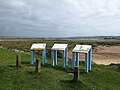 Information boards at Northam Burrows - geograph.org.uk - 5533818.jpg 1 600 × 1 200; 682 KB
-

-
 Information signs, Westward Ho^ beach - geograph.org.uk - 2773955.jpg 4 320 × 3 240; 4 MB
-
 Instow on the Torridge Estuary - geograph.org.uk - 1832100.jpg 1 024 × 768; 115 KB
-
 Junction of B3236 with A39 - geograph.org.uk - 5473561.jpg 2 121 × 1 379; 1,47 MB
-
 Junction of Burrows Lane and Long Lane, Assells - geograph.org.uk - 5534697.jpg 1 600 × 1 203; 602 KB
-

-
 Kenwithcastlecutting.jpg 496 × 480; 41 KB
-
 Kingsley Hall, Westward Ho^ - geograph.org.uk - 3060787.jpg 1 024 × 768; 146 KB
-
 Kipling Tors - geograph.org.uk - 1401058.jpg 480 × 640; 108 KB
-
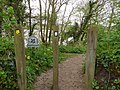
 Kissing gate at Bloody Corner - geograph.org.uk - 661445.jpg 640 × 480; 91 KB
-
 Kite Karting - geograph.org.uk - 1358237.jpg 640 × 480; 47 KB
-
 Laptop And Coffee Cup (22804923).jpeg 584 × 360; 67 KB
-
 Large stone house on Durrant Lane - geograph.org.uk - 4258377.jpg 1 024 × 768; 159 KB
-
 Lay-by on road across Northam Burrows - geograph.org.uk - 4044013.jpg 1 536 × 767; 606 KB
-
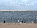 Leisure fishing in the Taw and Torridge Estuary - geograph.org.uk - 5533483.jpg 1 200 × 902; 316 KB
-
 Lifeguard Station - geograph.org.uk - 4983390.jpg 3 292 × 2 194; 1,34 MB
-

-
 Look out tower Westward Ho^ - geograph.org.uk - 130802.jpg 411 × 640; 37 KB
-

-

-

-
 Looking down Highbury Hill, Northam - geograph.org.uk - 4044765.jpg 1 536 × 921; 731 KB
-

-
 Looking south to Bloody Corner - geograph.org.uk - 4045463.jpg 1 536 × 1 149; 863 KB
-
-
 Looking upstream on the River Torridge near Riverside Court - geograph.org.uk - 5683301.jpg 6 000 × 4 000; 5,03 MB
-
 Low tide on Zulu Bank - geograph.org.uk - 1358226.jpg 640 × 480; 103 KB
-
 Marsh Farm, Northam Road, Bideford - geograph.org.uk - 3945040.jpg 6 000 × 4 000; 4,69 MB
-
 Marsh Farm, Northam Road, Bideford - geograph.org.uk - 3945044.jpg 6 000 × 4 000; 5,13 MB
-
 Marsh Farm, Northam Road, Bideford - geograph.org.uk - 3945049.jpg 5 729 × 3 820; 5,51 MB
-
 Marsh Farm, Northam Road, Bideford - geograph.org.uk - 3945051.jpg 6 000 × 4 000; 5,97 MB


.jpg)


_Beach_-_geograph.org.uk_-_723750.jpg)


.jpeg)


