Category:Norton Lindsey
Jump to navigation
Jump to search
village in United Kingdom | |||||
| Upload media | |||||
| Instance of | |||||
|---|---|---|---|---|---|
| Location | Warwick, Warwickshire, West Midlands, England | ||||
 | |||||
English: Norton Lindsey is a village and civil parish in Warwickshire, UK. It is located 3.5 miles south-east of the tourist and county town of Warwick and a mile south-east of the M40 motorway. According to the 2001 UK Census the village had between 300 and 350 people living in it. The uncertainty arises because part of the village is in a separate parish. Indeed whilst most of the village is in the Warwick District, some of it is in the Stratford District.
Subcategories
This category has the following 2 subcategories, out of 2 total.
H
N
- New Inn, Norton Lindsey (3 F)
Media in category "Norton Lindsey"
The following 153 files are in this category, out of 153 total.
-
 "No to broiler houses" - geograph.org.uk - 1841016.jpg 640 × 480; 439 KB
-
 A building site by Canada Lane - geograph.org.uk - 2242271.jpg 640 × 360; 57 KB
-
 A deep ditch by Norton Curlieu Lane - geograph.org.uk - 1844445.jpg 640 × 480; 590 KB
-
 A farm track and footbridge over the M40 - geograph.org.uk - 4469056.jpg 1,500 × 999; 109 KB
-
 A4189 Bridge, M40 - geograph.org.uk - 2682675.jpg 640 × 464; 65 KB
-
 Access Lane to the Sewage Works - geograph.org.uk - 2866551.jpg 640 × 480; 112 KB
-
 Ardenhill Spinney, moonrise - geograph.org.uk - 2243410.jpg 640 × 427; 232 KB
-
 Bottom of a slope, Lowerhouse Farm - geograph.org.uk - 2242260.jpg 1,024 × 682; 170 KB
-
 Bridge over Horse Brook - geograph.org.uk - 1840985.jpg 640 × 480; 646 KB
-
 Bridge over the M40 - geograph.org.uk - 4469068.jpg 1,500 × 999; 97 KB
-
 Bridleway towards Ardenhill Spinney - geograph.org.uk - 2218634.jpg 2,000 × 1,502; 204 KB
-
 Briery Land - geograph.org.uk - 15288.jpg 640 × 480; 95 KB
-
 Brittons Lane - geograph.org.uk - 1843286.jpg 640 × 480; 497 KB
-
 Brittons Lane, Norton Lindsey - geograph.org.uk - 2150531.jpg 640 × 480; 51 KB
-
 Cake stop at Norton Lindsey - geograph.org.uk - 1228744.jpg 640 × 480; 78 KB
-
 Canada Lane - geograph.org.uk - 2242274.jpg 800 × 533; 144 KB
-
 Canada Lane - geograph.org.uk - 2242302.jpg 1,024 × 768; 245 KB
-
 Caution Land Mines^ - geograph.org.uk - 2219106.jpg 2,000 × 1,492; 229 KB
-
 Coppice with standards, Curlieu Lane - geograph.org.uk - 1844449.jpg 640 × 480; 678 KB
-
 Countryside near Norton Lindsey - geograph.org.uk - 2227928.jpg 640 × 481; 57 KB
-
 Cropland near Horsley House Farm - geograph.org.uk - 1845541.jpg 640 × 480; 392 KB
-
 Curlieu Farm, Norton Curlieu Lane - geograph.org.uk - 1844440.jpg 640 × 480; 521 KB
-
 Derelict broiler house - geograph.org.uk - 1841007.jpg 640 × 480; 336 KB
-
 Entrance to Norton Lindsey - geograph.org.uk - 4082078.jpg 640 × 456; 71 KB
-
 Entrance to Wits End - geograph.org.uk - 1844443.jpg 640 × 480; 406 KB
-
 Field by Curlieu Lane - geograph.org.uk - 1844452.jpg 640 × 480; 419 KB
-
 Field gates by Curlieu Lane - geograph.org.uk - 1844456.jpg 640 × 480; 464 KB
-
 Field north of Canada Lane - geograph.org.uk - 2242276.jpg 800 × 533; 131 KB
-
 Fields east of Hatton Road - geograph.org.uk - 3359309.jpg 2,000 × 1,500; 509 KB
-
 Finger post at end of Brittons Lane - geograph.org.uk - 2354616.jpg 1,500 × 2,100; 289 KB
-
 Footbridge over the M40 - geograph.org.uk - 2682668.jpg 640 × 430; 53 KB
-
 Footbridge over the Northbound M40 - geograph.org.uk - 3300927.jpg 640 × 480; 414 KB
-
 Footpath at Horsley House Farm - geograph.org.uk - 2781228.jpg 640 × 480; 66 KB
-
 Footpath to Grove Park - geograph.org.uk - 1845396.jpg 640 × 480; 400 KB
-
 Footpath to Heath End - geograph.org.uk - 2218658.jpg 2,000 × 1,498; 206 KB
-
 Girls on two wheels, New Road - geograph.org.uk - 1843281.jpg 640 × 480; 516 KB
-
 Hardstanding, Horsley House Farm - geograph.org.uk - 1845413.jpg 640 × 480; 362 KB
-
 Hatton Road - geograph.org.uk - 3357092.jpg 2,000 × 1,500; 611 KB
-
 Hawks Hill Close - geograph.org.uk - 2227930.jpg 640 × 427; 63 KB
-
 Hazel coppice, Norton Curlieu Lane - geograph.org.uk - 1844431.jpg 640 × 480; 707 KB
-
 Hedgerow and field off Canada Lane - geograph.org.uk - 2219120.jpg 2,000 × 1,504; 262 KB
-
 Henley Road crosses M40 - geograph.org.uk - 1845574.jpg 640 × 480; 401 KB
-
 Henley Road north of Norton Lindsey - geograph.org.uk - 1842928.jpg 640 × 454; 448 KB
-
 Henley Road, A4189 - geograph.org.uk - 1845514.jpg 640 × 480; 365 KB
-
 Holy Trinity, Norton Lindsey, hall - geograph.org.uk - 6064443.jpg 640 × 480; 46 KB
-

-
 Horses on Canada Lane, Norton Lindsey - geograph.org.uk - 2218599.jpg 2,000 × 1,494; 231 KB
-
 Horsley House Farm - geograph.org.uk - 1845388.jpg 640 × 480; 432 KB
-
 Horsley House Farm - geograph.org.uk - 2781232.jpg 640 × 486; 87 KB
-
 Horsley House Farm - geograph.org.uk - 6075077.jpg 1,024 × 614; 1.11 MB
-

-
 Junction on Warwick Road, Norton Lindsey - geograph.org.uk - 2354627.jpg 2,000 × 1,502; 214 KB
-

-
 Littleworth Barn - geograph.org.uk - 1840996.jpg 640 × 480; 396 KB
-
 Looking north from Canada Lane - geograph.org.uk - 2242304.jpg 640 × 384; 63 KB
-
 Lowerhouse Farm downslope - geograph.org.uk - 2242264.jpg 800 × 533; 114 KB
-
 M40 - A4189 Bridge - geograph.org.uk - 3246519.jpg 640 × 430; 34 KB
-
 M40 - Horsley House Farm Bridge - geograph.org.uk - 3246524.jpg 640 × 430; 41 KB
-
 M40 - overbridge - geograph.org.uk - 3246516.jpg 640 × 430; 34 KB
-
 M40 - southbound - geograph.org.uk - 3246530.jpg 640 × 339; 31 KB
-
 M40 approaches A4189 overbridge - geograph.org.uk - 3702651.jpg 3,384 × 2,567; 945 KB
-
 M40 approaches Dark Lane overbridge - geograph.org.uk - 3702653.jpg 3,648 × 2,736; 1.09 MB
-

-
-
-
 M40 motorway near Norton Lindsey - geograph.org.uk - 4727492.jpg 800 × 499; 99 KB
-
-

-

-
 M40 near Horsley House Farm - geograph.org.uk - 1845531.jpg 640 × 480; 451 KB
-
 M40 northbound - geograph.org.uk - 3224508.jpg 640 × 454; 47 KB
-
 M40 northbound - geograph.org.uk - 3224510.jpg 640 × 480; 50 KB
-
 M40 overbridge serving Horsley House Farm - geograph.org.uk - 3702652.jpg 3,548 × 2,664; 992 KB
-
 M40 southeast-bound - geograph.org.uk - 1847807.jpg 640 × 480; 420 KB
-
 M40, footbridge near Grove Park - geograph.org.uk - 2468400.jpg 640 × 385; 29 KB
-
 Main Street, Norton Lindsey, 1 - geograph.org.uk - 1842897.jpg 640 × 480; 368 KB
-
 Main Street, Norton Lindsey, 2 - geograph.org.uk - 1842904.jpg 640 × 480; 356 KB
-
 Meadow by the Horse Brook - geograph.org.uk - 1847910.jpg 640 × 480; 333 KB
-
 Mill Close, dusk - geograph.org.uk - 2239907.jpg 640 × 427; 48 KB
-
 Mixed broadleaved plantation - geograph.org.uk - 2243398.jpg 640 × 480; 455 KB
-
 New Plantation and a cottage - geograph.org.uk - 1840975.jpg 640 × 480; 442 KB
-
 Northbound M40, Dark Lane Bridge - geograph.org.uk - 3300929.jpg 640 × 480; 404 KB
-
 Norton Curlieu Lane - geograph.org.uk - 1844427.jpg 640 × 480; 480 KB
-
 Norton Curlieu Lane Joining A4189 - geograph.org.uk - 3451665.jpg 640 × 444; 58 KB
-
 Norton Lindsey and Telephone Kiosk - geograph.org.uk - 5685610.jpg 640 × 480; 64 KB
-
 Norton Lindsey playground - geograph.org.uk - 1842959.jpg 640 × 480; 431 KB
-
 Norton Lindsey Sewage Works - geograph.org.uk - 2866424.jpg 640 × 480; 123 KB
-
 Norton Lindsey sports field - geograph.org.uk - 1842893.jpg 640 × 480; 329 KB
-
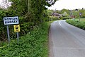
 Norton Lindsey village entrance - geograph.org.uk - 2150519.jpg 640 × 480; 93 KB
-
 Norton Lindsey village hall - geograph.org.uk - 1842961.jpg 640 × 480; 343 KB
-
 Norton Lindsey Windmill-geograph.org-1842958.jpg 640 × 480; 402 KB
-
 Norton Lindsey windmill.jpg 1,944 × 2,592; 1.13 MB
-
 Norton Lindsey, Cannings Farm - geograph.org.uk - 3335510.jpg 1,024 × 768; 117 KB
-
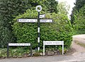
 Norton Lindsey, fingerpost - geograph.org.uk - 3335467.jpg 760 × 1,024; 108 KB
-
 Norton Lindsey, Main Street - geograph.org.uk - 3335560.jpg 1,024 × 768; 137 KB
-
 Norton Lindsey, The White Horse - geograph.org.uk - 3335493.jpg 1,024 × 768; 105 KB
-
 Norton Lindsey, war memorial - geograph.org.uk - 3335545.jpg 1,024 × 768; 170 KB
-

-
 Obstructed stile near Horsley House Farm - geograph.org.uk - 1845430.jpg 640 × 483; 510 KB
-

-

-
-
 Ornate finger post, Norton Lindsey - geograph.org.uk - 4082090.jpg 640 × 456; 91 KB
-
 Ornate fingerpost, Norton Lindsey - geograph.org.uk - 4082085.jpg 640 × 446; 46 KB
-
 Ornate signpost, Norton Lindsey - geograph.org.uk - 3109845.jpg 640 × 480; 105 KB
-
 Paddock and stables, Norton Curlieu Lane - geograph.org.uk - 1844435.jpg 640 × 480; 423 KB
-

-
 Paddock by the Horse Brook - geograph.org.uk - 1847927.jpg 640 × 480; 414 KB
-
 Poplar and pine plantations - geograph.org.uk - 2243386.jpg 640 × 480; 410 KB
-
 Primrose cottage, Norton Lindsay - geograph.org.uk - 6066.jpg 640 × 480; 77 KB
-
 Red Horse Corner - geograph.org.uk - 2239892.jpg 800 × 533; 99 KB
-
 Road junction, Norton Lindsey - geograph.org.uk - 1842911.jpg 640 × 470; 561 KB
-
 Road passing Littleworth Farm - geograph.org.uk - 5751566.jpg 1,024 × 680; 252 KB
-
 Round things, Lowerhouse Farm - geograph.org.uk - 2242268.jpg 1,024 × 768; 273 KB
-
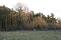 Scots Pine plantation by a brook - geograph.org.uk - 2243394.jpg 640 × 427; 307 KB
-
 Sewage pumping station, Norton Lindsey - geograph.org.uk - 1842933.jpg 640 × 480; 325 KB
-
 Sheep in Norton Lindsey - geograph.org.uk - 2227935.jpg 640 × 425; 119 KB
-
 Signpost, Norton Lindsey (detail).jpg 1,440 × 2,560; 1.87 MB
-
 Signpost, Norton Lindsey.jpg 1,440 × 2,560; 1.59 MB
-
 Snitterfield Lane in Norton Lindsey - geograph.org.uk - 4727465.jpg 800 × 541; 151 KB
-
 Space between woods near Grove Park - geograph.org.uk - 1845559.jpg 640 × 480; 483 KB
-

-
 The M40 approaching Dark Lane bridge - geograph.org.uk - 5864101.jpg 2,700 × 2,025; 315 KB
-
 The M40 runs under a farm track - geograph.org.uk - 5864097.jpg 2,700 × 2,008; 292 KB
-
 The M40 runs under Henley Road - geograph.org.uk - 5864093.jpg 2,700 × 2,025; 333 KB
-
 The Main Street in Norton Lindsey - geograph.org.uk - 4727485.jpg 800 × 591; 162 KB
-
 Tractor tracks in young crop - geograph.org.uk - 2242269.jpg 1,280 × 853; 1.45 MB
-
 Trees, Norton Curlieu - geograph.org.uk - 1843284.jpg 640 × 480; 381 KB
-
 Turning for Main Street, Norton Lindsey - geograph.org.uk - 1842952.jpg 640 × 480; 423 KB
-
 View NE from Warwick Road, Norton Lindsey - geograph.org.uk - 2354673.jpg 2,000 × 1,500; 217 KB
-
-

-
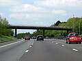
 Warwick Road Bridge, M40 - geograph.org.uk - 2682681.jpg 640 × 304; 42 KB
-
 Warwick Road in Norton Lindsey - geograph.org.uk - 4727489.jpg 800 × 556; 143 KB
-
 Warwick Road Littleworth - geograph.org.uk - 5685620.jpg 640 × 480; 103 KB
-
 Warwick Road Near Littleworth Farm - geograph.org.uk - 5685616.jpg 640 × 480; 65 KB
-
 Water point, Lower Norton - geograph.org.uk - 1840966.jpg 640 × 480; 300 KB
-
 Wolverton Road, Norton Lindsey - geograph.org.uk - 1842954.jpg 640 × 480; 410 KB
-
 Blacon Farm - geograph.org.uk - 15282.jpg 640 × 480; 116 KB
-
 Canada Lane - geograph.org.uk - 15279.jpg 640 × 480; 99 KB
-
 Entrance to Stratford Manor Hotel - geograph.org.uk - 120338.jpg 640 × 480; 56 KB
-
 Fishing Lakes at High Close Farm - geograph.org.uk - 120088.jpg 640 × 480; 51 KB
-
 Gannaway Gate - geograph.org.uk - 11290.jpg 640 × 480; 84 KB
-
 Garden Centre at Black Hill - geograph.org.uk - 121371.jpg 640 × 480; 57 KB
-
 Hampton Hill Farm - geograph.org.uk - 2687.jpg 640 × 480; 34 KB
-
 High Close Farm - geograph.org.uk - 121372.jpg 640 × 480; 52 KB
-
 Littleworth, near Norton Lindsey - geograph.org.uk - 6065.jpg 640 × 480; 85 KB
-
 Luscombe Farm - geograph.org.uk - 15286.jpg 640 × 480; 143 KB
-
 Near Longbridge - geograph.org.uk - 13598.jpg 640 × 480; 73 KB
-
 Norton Lindsey - geograph.org.uk - 2684.jpg 480 × 640; 43 KB
-
 Sherbourne Hill - geograph.org.uk - 13592.jpg 640 × 480; 113 KB
-
 Sherbourne Hill - geograph.org.uk - 13594.jpg 640 × 480; 61 KB
-
 View from Park Lane - geograph.org.uk - 121375.jpg 640 × 480; 68 KB


_-_geograph.org.uk_-_2902817.jpg)


.jpg)


