Category:Norton juxta Kempsey
Jump to navigation
Jump to search
civil parish in Worcestershire, England | |||||
| Upload media | |||||
| Instance of | |||||
|---|---|---|---|---|---|
| Location | Wychavon, Worcestershire, West Midlands, England | ||||
| Population |
| ||||
| Area |
| ||||
 | |||||
Subcategories
This category has the following 4 subcategories, out of 4 total.
Media in category "Norton juxta Kempsey"
The following 200 files are in this category, out of 227 total.
(previous page) (next page)-
 1 mile to junction 7 - geograph.org.uk - 4742114.jpg 640 × 373; 87 KB
-

-
 A spooky churchyard at Norton - geograph.org.uk - 4886621.jpg 640 × 480; 70 KB
-
 A straight section of the B4084 - geograph.org.uk - 2279163.jpg 640 × 480; 40 KB
-
 A4440 sharing old bridge - geograph.org.uk - 5681211.jpg 4,896 × 3,672; 5.26 MB
-
 Accommodation bridge under the railway - geograph.org.uk - 2892856.jpg 2,951 × 1,771; 1.47 MB
-
 Across the fields to Hatfield - geograph.org.uk - 6011447.jpg 1,600 × 1,200; 322 KB
-
 Across the fields to Littleworth - geograph.org.uk - 6011434.jpg 1,600 × 1,200; 328 KB
-
 An autumnal view of the bund beside St Peter's drive - geograph.org.uk - 4195641.jpg 2,048 × 1,341; 629 KB
-

-
 Approaching M5 Junction 7 from the East - geograph.org.uk - 5054911.jpg 1,600 × 1,200; 409 KB
-

-

-

-
 B4084 bridge over railway near Norton - geograph.org.uk - 3510356.jpg 1,024 × 512; 90 KB
-
 B4084 passes under railway bridge - geograph.org.uk - 3132968.jpg 640 × 481; 55 KB
-
 B4084 South East of M5 Junction 7 - geograph.org.uk - 5582412.jpg 640 × 480; 97 KB
-

-
 B4084 Whittington Village Sign - geograph.org.uk - 5583947.jpg 640 × 480; 38 KB
-
 Barn on Hatfield Lane, Hatfield - geograph.org.uk - 4003091.jpg 1,600 × 1,064; 668 KB
-
 Bridge over an agricultural track - geograph.org.uk - 2279379.jpg 1,500 × 1,011; 232 KB
-
 Bridge over the A4440 - geograph.org.uk - 2279385.jpg 1,500 × 1,000; 284 KB
-
 Bridge over the railway near Brockhill Farm - geograph.org.uk - 2279338.jpg 1,500 × 957; 225 KB
-
 Bridle path - geograph.org.uk - 2458078.jpg 640 × 480; 86 KB
-
 Bridleway bridge over the Worcester to London line - geograph.org.uk - 3002293.jpg 4,000 × 2,437; 2.79 MB
-
 Bridleway over the Worcester to London line - geograph.org.uk - 3002286.jpg 4,000 × 2,585; 2.99 MB
-
 Brockhill Lane, Norton - geograph.org.uk - 4363725.jpg 800 × 531; 176 KB
-
 Broomhall , St Peter's Garden Centre - Christmas Display - geograph.org.uk - 2170157.jpg 4,288 × 2,848; 6.11 MB
-
 Broomhall , St Peter's Garden Centre - Father Christmas - geograph.org.uk - 2170152.jpg 2,848 × 4,288; 4.95 MB
-
 Broomhall , St Peter's Garden Centre - Flower Pots - geograph.org.uk - 2170154.jpg 2,848 × 4,288; 5.76 MB
-
 Broomhall , St Peter's Garden Centre - geograph.org.uk - 2170145.jpg 4,288 × 2,848; 4.05 MB
-
 Broomhall , St Peter's Garden Centre - geograph.org.uk - 2170149.jpg 4,288 × 2,848; 4.16 MB
-
 Broomhall , St Peter's Garden Centre - Potted Plants - geograph.org.uk - 2170155.jpg 4,288 × 2,848; 6.02 MB
-
 Broomhall Cottages - geograph.org.uk - 857789.jpg 640 × 480; 74 KB
-
 Broomhall Grange - geograph.org.uk - 650349.jpg 640 × 315; 58 KB
-
 Building plot in Norton - geograph.org.uk - 4588795.jpg 800 × 531; 121 KB
-
 Buildings at Crucible Business Park - geograph.org.uk - 3998894.jpg 640 × 480; 48 KB
-
 Buildings at Crucible Business Park - geograph.org.uk - 4005914.jpg 640 × 480; 104 KB
-
 Bus stop on B4084 between Norton and Whittington - geograph.org.uk - 5881128.jpg 1,600 × 1,201; 688 KB
-
 Bus stop on edge of Whittington - geograph.org.uk - 3510353.jpg 1,024 × 519; 59 KB
-

-
-
 Clearing the cutting - geograph.org.uk - 4364370.jpg 3,072 × 2,304; 1.8 MB
-

-
 Construction of the new railway bridge - geograph.org.uk - 5681208.jpg 4,896 × 3,672; 4.73 MB
-
 Construction of Worcester Parkway Station - geograph.org.uk - 5866878.jpg 1,024 × 768; 261 KB
-
 Construction of Worcester Parkway Station - geograph.org.uk - 5866881.jpg 1,024 × 768; 250 KB
-
 Construction of Worcester Parkway Station - geograph.org.uk - 6009427.jpg 1,024 × 768; 304 KB
-
 Construction of Worcester Parkway Station - geograph.org.uk - 6190847.jpg 1,024 × 680; 192 KB
-
 Construction of Worcester Parkway Station - geograph.org.uk - 6190850.jpg 1,024 × 680; 176 KB
-
 Cooksholme Crossing - geograph.org.uk - 1930176.jpg 1,500 × 976; 223 KB
-
 Country road to Green Street - geograph.org.uk - 4901709.jpg 800 × 600; 170 KB
-
 Court Farm, Norton - geograph.org.uk - 883879.jpg 640 × 480; 89 KB
-

-
-

-
 Crops next to the main line - geograph.org.uk - 884023.jpg 640 × 480; 103 KB
-
 Dualling the A4440 - geograph.org.uk - 4451112.jpg 3,072 × 2,304; 1.77 MB
-
 Eastfield Fisheries - geograph.org.uk - 6011435.jpg 1,600 × 1,200; 488 KB
-
 Entrance to Cooksholme Farm - geograph.org.uk - 4005937.jpg 640 × 480; 144 KB
-
 Entrance to the new Worcester Parkway Station - geograph.org.uk - 6009433.jpg 1,024 × 768; 255 KB
-

-

-
 Farmland near Old House Farm - geograph.org.uk - 4378056.jpg 640 × 453; 68 KB
-
 Farmland near Woodbury Holding - geograph.org.uk - 4376561.jpg 640 × 446; 73 KB
-
 Field beside the A4440 - geograph.org.uk - 2762024.jpg 4,000 × 2,412; 2.91 MB
-
 Field Off B4084 North of Stoulton - geograph.org.uk - 5583937.jpg 640 × 480; 56 KB
-
 Fields near Junction 7 of the M5 - geograph.org.uk - 2458090.jpg 640 × 480; 75 KB
-
 Fire in a field in Worcestershire - geograph.org.uk - 5129129.jpg 1,600 × 1,200; 232 KB
-
 Footpath and farmland track - geograph.org.uk - 4976913.jpg 800 × 600; 128 KB
-
 Footpath and track, Norton - geograph.org.uk - 4365533.jpg 1,024 × 680; 326 KB
-
 Footpath behind the firing range - geograph.org.uk - 2762012.jpg 4,000 × 2,470; 3.53 MB
-
 Footpath to Hatfield - geograph.org.uk - 4901686.jpg 800 × 600; 153 KB
-
 Footpath to Hatfield - geograph.org.uk - 5014427.jpg 768 × 1,024; 272 KB
-
 Former filling station, Norton - geograph.org.uk - 883897.jpg 640 × 480; 73 KB
-
 Former garage in Norton - geograph.org.uk - 4588844.jpg 800 × 531; 94 KB
-
 Former garage on Church Lane, Norton - geograph.org.uk - 4003054.jpg 1,600 × 1,064; 483 KB
-
 Fox Farm, Hatfield - geograph.org.uk - 4278683.jpg 640 × 480; 59 KB
-
 Fox Farm, Hatfield, Worcestershire - geograph.org.uk - 4278463.jpg 640 × 480; 67 KB
-
 Grange Organic Farm on Hatfield Lane - geograph.org.uk - 4003072.jpg 1,600 × 931; 449 KB
-
 Hatfield Lane at Hatfield Bank, Hatfield - geograph.org.uk - 4003098.jpg 1,600 × 1,064; 878 KB
-
 Hatfield Lane, Hatfield - geograph.org.uk - 4003075.jpg 1,600 × 1,064; 577 KB
-
 Hatfield, Worcestershire - geograph.org.uk - 4278457.jpg 640 × 480; 70 KB
-
 Heavy cranes and new bridge - geograph.org.uk - 6230679.jpg 768 × 1,024; 168 KB
-
 House for sale on the edge of Hatfield - geograph.org.uk - 4005921.jpg 640 × 480; 187 KB
-
 House opposite church, Norton, Worcestershire - geograph.org.uk - 5197896.jpg 1,600 × 1,200; 701 KB
-

-
 Industrial building by B4084 near Norton - geograph.org.uk - 3510355.jpg 1,024 × 768; 118 KB
-
 Land subject to development threat - geograph.org.uk - 2763216.jpg 4,000 × 2,343; 3.07 MB
-
 Lane from Hatfield to Stonehall - geograph.org.uk - 4005931.jpg 640 × 480; 120 KB
-
 Lane junction - geograph.org.uk - 4005939.jpg 640 × 480; 161 KB
-
 Large warehouse (shed) alongside the B4084 - geograph.org.uk - 2313277.jpg 1,024 × 768; 99 KB
-
 Lay-by on the B4084 - geograph.org.uk - 2313278.jpg 1,024 × 640; 98 KB
-
 Layby at Whittington - geograph.org.uk - 1083463.jpg 640 × 426; 110 KB
-

-
 M5 approaching junction 7 - geograph.org.uk - 4742116.jpg 640 × 382; 91 KB
-
 M5 bridge near Hatfield - geograph.org.uk - 5052009.jpg 1,024 × 652; 102 KB
-
 M5 heading south - geograph.org.uk - 4625005.jpg 2,096 × 1,392; 905 KB
-
 M5 heading south - geograph.org.uk - 4625012.jpg 2,256 × 1,496; 879 KB
-
 M5 Motorway - Junction 7 Northbound - geograph.org.uk - 2629852.jpg 640 × 480; 73 KB
-
 M5 near Hatfield, Worcestershire - geograph.org.uk - 4522722.jpg 1,920 × 1,166; 258 KB
-
 M5 near Norton Juxta Kempsey - geograph.org.uk - 5052010.jpg 1,024 × 735; 115 KB
-
 M5 northbound at junction 7 - geograph.org.uk - 4345276.jpg 1,600 × 1,200; 1.03 MB
-
 M5 Northbound at Junction 7 - geograph.org.uk - 6115464.jpg 800 × 533; 535 KB
-
 M5 northbound towards junction 7 - geograph.org.uk - 4345286.jpg 1,600 × 1,200; 904 KB
-
 M5 northbound towards junction 7 - geograph.org.uk - 4345298.jpg 1,600 × 1,200; 1.09 MB
-
 M5 southbound at 14 miles to Tewkesbury - geograph.org.uk - 4624266.jpg 2,128 × 1,360; 749 KB
-
 M5 southbound near Brook Hill Farm - geograph.org.uk - 3557414.jpg 640 × 480; 57 KB
-
 M5 west of Norton Juxta Kempsey - geograph.org.uk - 2611489.jpg 640 × 481; 41 KB
-
 Main Line north - geograph.org.uk - 884018.jpg 640 × 480; 103 KB
-
 New bridge - geograph.org.uk - 5713448.jpg 4,896 × 3,672; 6.6 MB
-
 New bridge and heavy crane - geograph.org.uk - 6230685.jpg 1,024 × 768; 202 KB
-
 New bridleway-footbridge assembly beside A4440 - geograph.org.uk - 6219646.jpg 4,896 × 3,672; 6.98 MB
-
 New houses close in on St Peter's Garden Centre - geograph.org.uk - 3054869.jpg 4,000 × 3,000; 4.7 MB
-
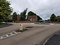
 New roundabout at Norton - geograph.org.uk - 3903703.jpg 1,024 × 680; 196 KB
-
 New roundabout on the B4084 - geograph.org.uk - 6009443.jpg 1,024 × 768; 213 KB
-
 Next stop the Cotswolds - geograph.org.uk - 989120.jpg 640 × 348; 49 KB
-
 No through road, near Norton - geograph.org.uk - 1083473.jpg 640 × 426; 87 KB
-
 Northbound M5 near Hatfield - geograph.org.uk - 6115447.jpg 800 × 600; 659 KB
-
 Northbound M5 towards Junction 7 - geograph.org.uk - 6115461.jpg 800 × 533; 550 KB
-

-
 Norton Barracks - geograph.org.uk - 4363726.jpg 531 × 800; 119 KB
-
 Norton Barracks and Crookbarrow Road (geograph 4364401 by Philip Halling).jpg 1,024 × 680; 222 KB
-
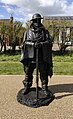 Norton Barracks Statue.jpg 462 × 756; 491 KB
-
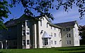
 Norton Barracks, now converted to apartments.jpg 1,600 × 1,200; 554 KB
-
 Norton Barracks, Worcester - geograph.org.uk - 43236.jpg 640 × 426; 121 KB
-
 Norton Church Lane - geograph.org.uk - 5583575.jpg 640 × 474; 78 KB
-

-
 Norton Church Lane Sharp Bend - geograph.org.uk - 5583579.jpg 640 × 478; 56 KB
-
 Norton Grange, Norton, Worcestershire - geograph.org.uk - 1726483.jpg 640 × 480; 218 KB
-
 Norton Hatfield Lane and War Memorial - geograph.org.uk - 5583570.jpg 640 × 480; 131 KB
-
 Norton Junction - geograph.org.uk - 4278526.jpg 640 × 480; 113 KB
-
 Norton Junction - geograph.org.uk - 862712.jpg 640 × 428; 93 KB
-
 Norton Junction - geograph.org.uk - 862756.jpg 640 × 480; 120 KB
-

-
 Norton Junction Signal Box - geograph.org.uk - 1930187.jpg 1,500 × 1,000; 268 KB
-
 Norton Parish Hall - geograph.org.uk - 4634455.jpg 800 × 600; 109 KB
-
 Norton Parish Hall - geograph.org.uk - 4634457.jpg 800 × 600; 113 KB
-
 Norton Parish Hall - geograph.org.uk - 4634458.jpg 800 × 600; 89 KB
-
 Norton Parish Hall with playground - geograph.org.uk - 6011431.jpg 1,600 × 1,200; 319 KB
-
 Norton Road - geograph.org.uk - 4976908.jpg 800 × 600; 101 KB
-
 Norton Road Approaching A4440 Island - geograph.org.uk - 5583590.jpg 640 × 480; 51 KB
-
 Norton Village - geograph.org.uk - 2842410.jpg 1,600 × 1,200; 603 KB
-
 Norton Village and War Memorial - geograph.org.uk - 2842411.jpg 1,600 × 1,200; 702 KB
-

-

-
 Old House Farm - geograph.org.uk - 1015101.jpg 640 × 480; 105 KB
-
 Old House Farm, Whittington - geograph.org.uk - 1083340.jpg 640 × 426; 109 KB
-
 Old milk churn stand - geograph.org.uk - 1083472.jpg 640 × 426; 96 KB
-
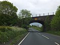
 Overbridge at Hatfield - geograph.org.uk - 4898271.jpg 2,188 × 1,680; 488 KB
-
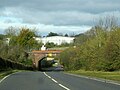
 Overbridge near Hatfield - geograph.org.uk - 4742115.jpg 640 × 430; 130 KB
-
 Paddock at Whittington - geograph.org.uk - 1083464.jpg 640 × 426; 91 KB
-
 Plank bridge on footpath behind the firing range - geograph.org.uk - 2762017.jpg 4,000 × 2,563; 3.14 MB
-
 Public footpath - Norton - geograph.org.uk - 4277851.jpg 640 × 480; 89 KB
-
 Rail bridge on the B4084 towards Pershore - geograph.org.uk - 4002934.jpg 1,600 × 1,064; 655 KB
-
 Railway accommodation bridge - geograph.org.uk - 4363721.jpg 800 × 531; 131 KB
-
 Railway at Norton - geograph.org.uk - 4278502.jpg 640 × 480; 100 KB
-
 Railway Bridge Over B4084 - geograph.org.uk - 4498484.jpg 640 × 485; 73 KB
-

-

-
-
 Railway overbridge over B4084 near Norton - geograph.org.uk - 3510357.jpg 1,024 × 768; 146 KB
-
 Rainbow at Norton - geograph.org.uk - 4886619.jpg 640 × 480; 47 KB
-
 Road from Mucknell Farm - geograph.org.uk - 1083477.jpg 426 × 640; 77 KB
-
 Road junction near Norton church - geograph.org.uk - 883883.jpg 640 × 480; 103 KB
-
 Road passing through Littleworth - geograph.org.uk - 4634460.jpg 800 × 600; 149 KB
-
 Road to Mucknell Farm - geograph.org.uk - 1083469.jpg 426 × 640; 79 KB
-

-
 Roundabout of battle roads, Brockhill Village (geograph 6531427).jpg 1,600 × 1,200; 479 KB
-
 Signpost near Norton - geograph.org.uk - 4003036.jpg 1,514 × 1,600; 1.04 MB
-
 Soon to be a road - geograph.org.uk - 4456364.jpg 3,072 × 1,807; 951 KB
-
 Southbound M5, Saxon Meadows - geograph.org.uk - 6115453.jpg 800 × 533; 468 KB
-
 St Peter's Garden Centre - geograph.org.uk - 5137748.jpg 1,024 × 768; 152 KB
-
 St Peter's garden centre - geograph.org.uk - 857797.jpg 640 × 480; 120 KB
-
 St Peters Garden Centre - geograph.org.uk - 766600.jpg 640 × 480; 73 KB
-
 Stubble field beside the A4440 - geograph.org.uk - 3179452.jpg 4,000 × 3,000; 4.62 MB
-
 Stuffed and Mounted at Norton^ - geograph.org.uk - 4278533.jpg 640 × 480; 112 KB
-
 Talavera Road - geograph.org.uk - 542291.jpg 640 × 246; 145 KB
-
 Telephone Box in Norton - geograph.org.uk - 4003058.jpg 1,064 × 1,600; 805 KB
-
 The B4084 near Littleworth - geograph.org.uk - 5866853.jpg 1,024 × 768; 200 KB
-
 The Bristol to Birmingham railway - geograph.org.uk - 5866885.jpg 1,024 × 768; 276 KB
-
 The Firs - geograph.org.uk - 449633.jpg 640 × 404; 84 KB
-
 The former Norton Barracks - geograph.org.uk - 4278511.jpg 640 × 480; 70 KB
-
 The Grange, Norton - geograph.org.uk - 883891.jpg 640 × 480; 119 KB
-
 The M5 crossing the railway - geograph.org.uk - 1930200.jpg 1,500 × 981; 199 KB
-
 The mid morning train to Worcester from Paddington - geograph.org.uk - 3002288.jpg 3,644 × 2,288; 3.09 MB
-
 The railway approaching Worcester - geograph.org.uk - 4363723.jpg 531 × 800; 151 KB
-
 The railway lines to Worcester - geograph.org.uk - 1930198.jpg 1,500 × 1,000; 217 KB
-
 The Retreat - public house - geograph.org.uk - 4277848.jpg 640 × 480; 54 KB
-
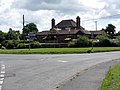 The Retreat pub, Norton - geograph.org.uk - 883904.jpg 640 × 480; 75 KB
-
 The Retreat public house near Norton - geograph.org.uk - 4003029.jpg 1,600 × 1,064; 530 KB
-
 The Tump revealed - geograph.org.uk - 4363768.jpg 4,896 × 3,219; 3.64 MB
-
 The Worcester to Oxford railway - geograph.org.uk - 4363722.jpg 800 × 531; 146 KB
-
 The works continue - geograph.org.uk - 5108729.jpg 4,896 × 3,672; 6.22 MB
-
 These trees are about to get the chop - geograph.org.uk - 4365551.jpg 800 × 531; 148 KB
-
 Track and footpath - geograph.org.uk - 4588785.jpg 1,024 × 680; 302 KB
-
 Train at Norton Junction - geograph.org.uk - 883927.jpg 640 × 480; 115 KB
-
 Tree at the gate for Wood Hall, Norton - geograph.org.uk - 3510354.jpg 1,024 × 1,024; 162 KB
-
 Tree on the edge of the churchyard, Norton, Worcester - geograph.org.uk - 5197902.jpg 1,600 × 1,188; 544 KB
-
 Turning to Norton - geograph.org.uk - 2279154.jpg 640 × 480; 114 KB


_alongside_the_B4084_-_geograph.org.uk_-_2313277.jpg)


.jpg)


_-_geograph.org.uk_-_5583941.jpg)


.jpg)


