Category:Obertor (Nabburg)
Jump to navigation
Jump to search
| Object location | | View all coordinates using: OpenStreetMap |
|---|
 | |||||
| Upload media | |||||
| Instance of | |||||
|---|---|---|---|---|---|
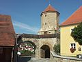
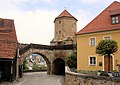
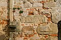
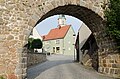
| Location | Nabburg, Schwandorf, Upper Palatinate, Bavaria, Germany | ||||
| Street address |
| ||||
| Heritage designation | |||||
 | |||||
This is the category of the Bavarian Baudenkmal (cultural heritage monument) with the ID D-3-76-144-56 (Wikidata)
|
Media in category "Obertor (Nabburg)"
The following 12 files are in this category, out of 12 total.
-
 Nabburg Obertor 190823005RM.jpg 3,388 × 4,517; 6.66 MB
-
 Nabburg Obertor Laurentiuskirche 190823004RM.jpg 5,184 × 3,888; 9.08 MB
-
 Nabburg Obertor.jpg 2,560 × 1,920; 1.53 MB
-
 Nabburg, das Obertor.jpg 4,030 × 2,844; 3.1 MB
-
 Nabburg, Obertor-001.jpg 3,264 × 4,928; 7.27 MB
-
 Nabburg, Obertor-002.jpg 3,264 × 4,928; 7.99 MB
-
 Nabburg, Obertor-003.jpg 3,264 × 4,928; 8.41 MB
-
 Nabburg, Obertor-004.jpg 4,928 × 3,264; 11.99 MB
-
 Nabburg, Obertor-005.jpg 3,264 × 4,928; 11.25 MB
-
 Nabburg, Obertor-006.jpg 3,264 × 4,928; 8.8 MB
-
 Nabburg, Obertor-007.jpg 4,928 × 3,264; 9.16 MB
-
 Zeichnung - Nabburg - Obertor - Max Schultze - 1911.jpg 1,200 × 887; 391 KB


