Category:October 2008 in Northern Ireland
Jump to navigation
Jump to search
English: Images taken in Northern Ireland in this month of 2008 (not the date of the upload).
| Jan | Feb | Mar | Apr | May | Jun | Jul | Aug | Sep | Oct | Nov | Dec | ||
| ← | 7 | 176 | 194 | 214 | 271 | 9 | 117 | 214 | 114 | 304 | 253 | 114 | → |
|---|
Subcategories
This category has the following 8 subcategories, out of 8 total.
A
- October 2008 in County Antrim (11 F)
B
D
- October 2008 in County Down (24 F)
L
O
T
- October 2008 in County Tyrone (81 F)
Media in category "October 2008 in Northern Ireland"
The following 200 files are in this category, out of 296 total.
(previous page) (next page)-
 Autumn at Minnowburn 2008 (1) - geograph.org.uk - 1023321.jpg 565 × 373; 100 KB
-
 Autumn at St Malachi's, Hillsborough - geograph.org.uk - 1011079.jpg 640 × 390; 108 KB
-
 Autumn in Donard forest - geograph.org.uk - 1016588.jpg 640 × 388; 99 KB
-
 Autumn leaves, Glenarm forest - geograph.org.uk - 1010256.jpg 640 × 393; 124 KB
-
 Autumn leaves, Ward Park - geograph.org.uk - 1024022.jpg 480 × 640; 309 KB
-
 Autumn scene along the Strule, Omagh - geograph.org.uk - 1020653.jpg 640 × 273; 44 KB
-
 Autumn trees, Belfast - geograph.org.uk - 1002781.jpg 640 × 413; 105 KB
-
 Autumn Trees, Omagh - geograph.org.uk - 1019150.jpg 640 × 510; 111 KB
-
 B and M Bargains, Omagh - geograph.org.uk - 1011015.jpg 640 × 480; 55 KB
-
 B4 (Drumnakilly Road) - geograph.org.uk - 1015151.jpg 640 × 479; 50 KB
-
 B4 (Hospital Road), Omagh - geograph.org.uk - 1011045.jpg 640 × 480; 90 KB
-
 Ballygawley National School plaque - geograph.org.uk - 1024771.jpg 640 × 448; 91 KB
-
 Ballygawley Town - geograph.org.uk - 1024941.jpg 640 × 479; 54 KB
-
 Ballygawley, County Tyrone - geograph.org.uk - 1024937.jpg 640 × 479; 52 KB
-
 Ballygawley, County Tyrone - geograph.org.uk - 1024948.jpg 640 × 479; 56 KB
-
 Balmoral Cemetery - geograph.org.uk - 1019830.jpg 640 × 422; 318 KB
-
 Balmoral Cemetery - geograph.org.uk - 1019836.jpg 640 × 480; 367 KB
-
 Bangor Academy and Sixth Form College - geograph.org.uk - 1024682.jpg 640 × 391; 215 KB
-
 Bangor Marina at night - geograph.org.uk - 1007691.jpg 640 × 640; 248 KB
-
 Bangor Town Hall - south face - geograph.org.uk - 1024723.jpg 640 × 622; 360 KB
-
 Bargain Books, Omagh - geograph.org.uk - 1019152.jpg 640 × 480; 64 KB
-
 Barn, Campsie, Omagh - geograph.org.uk - 1023391.jpg 640 × 480; 68 KB
-
 Beragh, CountyTyrone - geograph.org.uk - 1015014.jpg 640 × 295; 31 KB
-
 Betting Office, Newtownstewart - geograph.org.uk - 988982.jpg 640 × 480; 44 KB
-
 BourkeHairdessingBoutique.JPG 3,072 × 2,304; 1.21 MB
-
 Brian Gerard - Austins - geograph.org.uk - 1024794.jpg 640 × 479; 54 KB
-
 Bridge Street, Strabane - geograph.org.uk - 994440.jpg 640 × 480; 48 KB
-
 Bureau Express, Lifford Road, Strabane - geograph.org.uk - 1026397.jpg 458 × 640; 125 KB
-
 Bus stop, Omagh - geograph.org.uk - 1023382.jpg 640 × 480; 59 KB
-
 Canal Basin, Strabane - geograph.org.uk - 994457.jpg 640 × 480; 48 KB
-
 Car parking, Stranmillis, Belfast - geograph.org.uk - 991738.jpg 640 × 405; 74 KB
-
 Castle Brae, Newtownstewart - geograph.org.uk - 989701.jpg 640 × 253; 26 KB
-
 Castle Brae, Newtownstewart - geograph.org.uk - 989867.jpg 640 × 480; 64 KB
-
 Castle Hotel. Newtownstewart - geograph.org.uk - 989703.jpg 640 × 287; 28 KB
-
 Centra, Ballygawley - geograph.org.uk - 1024853.jpg 640 × 479; 49 KB
-
 Church - Toilets, Newtownstewart - geograph.org.uk - 988892.jpg 640 × 480; 45 KB
-
 Church bell and church, Beragh - geograph.org.uk - 1013960.jpg 640 × 479; 48 KB
-
 Church Bell, Beragh - geograph.org.uk - 1013942.jpg 490 × 640; 68 KB
-
 Church Street, Ballygawley - geograph.org.uk - 1024693.jpg 640 × 479; 46 KB
-

-

-
 Clogher Valley Cycles - geograph.org.uk - 1009971.jpg 640 × 479; 58 KB
-
 Community Network, Newtownstewart - geograph.org.uk - 988815.jpg 640 × 249; 28 KB
-
 Computers 'R' us, Omagh - geograph.org.uk - 1020598.jpg 640 × 480; 70 KB
-
 Concrete table and benches, Cranny - geograph.org.uk - 1002885.jpg 640 × 479; 70 KB
-
 Cootes, Ballygawley - geograph.org.uk - 1024805.jpg 640 × 479; 60 KB
-
-
 Credit Union - Centra, Newtownstewart - geograph.org.uk - 988883.jpg 640 × 480; 56 KB
-
 Credit Union, Ballygawley - geograph.org.uk - 1024841.jpg 640 × 479; 64 KB
-
 CrimeacannonLisburn.JPG 3,072 × 2,304; 1.19 MB
-
 Crossroads near Armoy - geograph.org.uk - 1022226.jpg 640 × 373; 64 KB
-
 Crow's Foot, Ballygawley - geograph.org.uk - 1024784.jpg 640 × 479; 94 KB
-
 Davis Crescent, Newtownstewart - geograph.org.uk - 989837.jpg 640 × 480; 51 KB
-
 DC 1780, Ballygawley - geograph.org.uk - 1024754.jpg 640 × 479; 41 KB
-
 Doggy dispute coming up^ - geograph.org.uk - 1002783.jpg 640 × 479; 86 KB
-
 Drumglass Park, Belfast - geograph.org.uk - 997210.jpg 640 × 480; 583 KB
-
 Dublin Road corner, Omagh - geograph.org.uk - 1013759.jpg 640 × 480; 60 KB
-
 Dublin Road, Omagh - geograph.org.uk - 1020677.jpg 640 × 249; 44 KB
-
 Dublin Street, Newtownstewart - geograph.org.uk - 988962.jpg 640 × 480; 56 KB
-
 Dublin Street, Newtownstewart - geograph.org.uk - 988969.jpg 640 × 290; 34 KB
-
 DUP Advice Centre, Newtownstewart - geograph.org.uk - 989698.jpg 640 × 480; 56 KB
-
 East window, Sacred Heart Church Church - geograph.org.uk - 1019361.jpg 466 × 640; 124 KB
-

-
 Evening peak traffic, Belfast (2) - geograph.org.uk - 997623.jpg 640 × 392; 81 KB
-
 Figure-head, Newtownstewart - geograph.org.uk - 989858.jpg 480 × 640; 105 KB
-
 Fir Trees Hotel, Strabane - geograph.org.uk - 994426.jpg 640 × 256; 23 KB
-

-
 First Trust Bank plaque, Omagh - geograph.org.uk - 996355.jpg 640 × 480; 49 KB
-
 Flagpole, Bangor - geograph.org.uk - 1024730.jpg 640 × 480; 306 KB
-
 Footbridge, Glenarm forest - geograph.org.uk - 1010425.jpg 640 × 400; 131 KB
-
 Former Bank, Beragh - geograph.org.uk - 1013872.jpg 640 × 479; 53 KB
-
 Fountain Lane, Beragh - geograph.org.uk - 1013869.jpg 640 × 294; 29 KB
-
 FountainLisburn.JPG 2,304 × 3,072; 1.9 MB
-
 Froth forming^ - geograph.org.uk - 1002877.jpg 640 × 479; 94 KB
-
 Frozen Ice, Omagh - geograph.org.uk - 1027186.jpg 512 × 384; 64 KB
-
-
 G.W. Gibson and Son, Beragh - geograph.org.uk - 1013887.jpg 640 × 479; 79 KB
-
 Gallagher's, Newtownstewart - geograph.org.uk - 989750.jpg 640 × 480; 59 KB
-
 Garvaghy Bridge Road - geograph.org.uk - 1009801.jpg 640 × 479; 78 KB
-
 Garvaghy Townland - geograph.org.uk - 1009765.jpg 640 × 479; 73 KB
-
 Garvaghy Townland - geograph.org.uk - 1009768.jpg 640 × 479; 67 KB
-
 Georgian Villas, Omagh - geograph.org.uk - 1002741.jpg 640 × 479; 82 KB
-
 Giant lizard in Palm House, Botanic Gardens, Belfast.jpg 640 × 420; 107 KB
-
 Golden Gate, Beragh - geograph.org.uk - 1013858.jpg 640 × 479; 46 KB
-
 Gone^ - geograph.org.uk - 994431.jpg 640 × 480; 41 KB
-
 Gorey Cinema, Newtownstewart - geograph.org.uk - 989807.jpg 640 × 480; 52 KB
-
 Gorse plant with sliver web, Omagh - geograph.org.uk - 1002803.jpg 640 × 479; 91 KB
-
 Grave, Balmoral Cemetery - geograph.org.uk - 1019928.jpg 640 × 473; 331 KB
-

-
 Gravestones, Balmoral Cemetery - geograph.org.uk - 1019825.jpg 640 × 447; 290 KB
-
 Grotto Wall, Sacred Heart Church - geograph.org.uk - 1000357.jpg 640 × 479; 86 KB
-
 Hall, Beragh - geograph.org.uk - 1013764.jpg 640 × 479; 41 KB
-
 Harry Avery's Lounge Bar - geograph.org.uk - 988971.jpg 640 × 480; 40 KB
-
 House with shutters, Newtownstewart - geograph.org.uk - 989012.jpg 640 × 480; 64 KB
-

-

-

-
 In Trim - Cootes, Ballygawley - geograph.org.uk - 1024798.jpg 640 × 479; 54 KB
-

-
 Inside, Strabane - geograph.org.uk - 994456.jpg 640 × 480; 52 KB
-

-
 Irishtown Road, Omagh - geograph.org.uk - 1020700.jpg 640 × 480; 68 KB
-

-
 J Gormley and Sons, Ballygawley - geograph.org.uk - 1024750.jpg 640 × 479; 56 KB
-
 J.M. Tyres, Newtownstewart - geograph.org.uk - 989829.jpg 640 × 480; 42 KB
-
 James Gervais, Beragh - geograph.org.uk - 1013909.jpg 640 × 479; 51 KB
-
 James Street, Omagh - geograph.org.uk - 1013744.jpg 640 × 480; 79 KB
-
 Jimmy Johnston and his book - geograph.org.uk - 1009915.jpg 479 × 640; 94 KB
-
 Jimmy Johnston's Bar, Augher - geograph.org.uk - 1009907.jpg 640 × 479; 57 KB
-
 Joe's Takeaway, Sion Mills - geograph.org.uk - 994425.jpg 640 × 480; 52 KB
-
 Jogging at Cranny - geograph.org.uk - 1002880.jpg 640 × 479; 78 KB
-

-
 KD's Takeaway, Beragh - geograph.org.uk - 1013868.jpg 640 × 479; 50 KB
-
 Killyclogher Burn, Cranny - geograph.org.uk - 1002899.jpg 640 × 479; 91 KB
-
-
 Knock Crescent, Ballygawley - geograph.org.uk - 1024696.jpg 640 × 293; 29 KB
-
 Kyle Insurance, Ballygawley - geograph.org.uk - 1024837.jpg 640 × 479; 53 KB
-
 Lane and bridge, Glenarm - geograph.org.uk - 1010333.jpg 640 × 378; 98 KB
-
 Lane off Irish Street, Augher - geograph.org.uk - 1010016.jpg 640 × 479; 55 KB
-

-

-
 Lavender, Ballygawley - geograph.org.uk - 1024831.jpg 640 × 479; 49 KB
-
 Le Mar Fashions, Ballygawley - geograph.org.uk - 1024856.jpg 640 × 479; 57 KB
-
 Leafy conditions, Omagh - geograph.org.uk - 1020685.jpg 640 × 480; 88 KB
-

-

-
 Lichen on seat, Cranny - geograph.org.uk - 1002780.jpg 640 × 479; 104 KB
-
 Linton and Robinson, Strabane - geograph.org.uk - 994458.jpg 640 × 480; 48 KB
-
 LionLisburn.jpg 3,072 × 2,304; 488 KB
-
 Little May Street, Belfast - geograph.org.uk - 993516.jpg 640 × 417; 69 KB
-
 Local postcards for sale, Omagh - geograph.org.uk - 996225.jpg 430 × 640; 114 KB
-
 Lookin sharpe, Beragh - geograph.org.uk - 1013932.jpg 640 × 479; 51 KB
-

-

-
 Main Street, Augher - geograph.org.uk - 1009943.jpg 640 × 479; 56 KB
-
 Main Street, Beragh - geograph.org.uk - 1013912.jpg 640 × 479; 55 KB
-
 Main Street, Newcastle - geograph.org.uk - 1000432.jpg 640 × 399; 85 KB
-
 Main Street, Newtownstewart - geograph.org.uk - 988832.jpg 640 × 480; 59 KB
-
 Market Yard, Omagh - geograph.org.uk - 1013753.jpg 640 × 480; 59 KB
-
 Masonic Hall, Newtownstewart - geograph.org.uk - 988999.jpg 640 × 480; 49 KB
-
 May memorial, Balmoral Cemetery - geograph.org.uk - 1019943.jpg 492 × 640; 296 KB
-

-
 McGarveys, Ballygawley - geograph.org.uk - 1024887.jpg 640 × 479; 44 KB
-
 McGinn's Butchers, Beragh - geograph.org.uk - 1013927.jpg 640 × 479; 60 KB
-
 McKenna Gallery, Omagh - geograph.org.uk - 1001587.jpg 640 × 480; 52 KB
-
 McKenna's Bar, Augher - geograph.org.uk - 1009938.jpg 640 × 479; 48 KB
-
 Me and my shadow^ - geograph.org.uk - 1027058.jpg 479 × 640; 69 KB
-
 Melmount Road, Strabane - geograph.org.uk - 994429.jpg 640 × 480; 66 KB
-
 Melmount Road, Strabane - geograph.org.uk - 994434.jpg 640 × 480; 36 KB
-
 Melmount Road, Strabane - geograph.org.uk - 994436.jpg 640 × 480; 36 KB
-

-
 Middlepath Street, Belfast (2) - geograph.org.uk - 1760909.jpg 640 × 429; 82 KB
-
 Mill Street, Newtownstewart - geograph.org.uk - 989831.jpg 640 × 480; 50 KB
-
 Modern Tyres, Strabane - geograph.org.uk - 994446.jpg 640 × 480; 44 KB
-
 Monday Market, Omagh - geograph.org.uk - 1013755.jpg 640 × 268; 39 KB
-
 Moyle Road, Newtownstewart - geograph.org.uk - 989003.jpg 640 × 480; 65 KB
-
 Moyle Road, Newtownstewart - geograph.org.uk - 989015.jpg 640 × 480; 48 KB
-
 Name plate, Tyrone County Club - geograph.org.uk - 1027070.jpg 640 × 405; 54 KB
-

-

-
 Nationwide, Omagh - geograph.org.uk - 1001267.jpg 640 × 480; 63 KB
-
 Newtownstewart Library - geograph.org.uk - 989042.jpg 640 × 311; 35 KB
-
 Newtownstewart Orange Hall.jpg 640 × 480; 51 KB
-
 Newtownstewart Pharmacy - geograph.org.uk - 988799.jpg 640 × 480; 52 KB
-

-
 Newtownstewart Town - geograph.org.uk - 988841.jpg 640 × 286; 38 KB
-
 Newtownstewart Town Hall - geograph.org.uk - 989731.jpg 640 × 480; 46 KB
-
 Newtownstewart, County Tyrone - geograph.org.uk - 988794.jpg 640 × 276; 34 KB
-
 Newtownstewart, County Tyrone - geograph.org.uk - 989840.jpg 640 × 265; 32 KB
-
 Newtownstewart, County Tyrone - geograph.org.uk - 993822.jpg 640 × 254; 27 KB
-
 Northern Bank, Ballygawley - geograph.org.uk - 1024870.jpg 640 × 479; 50 KB
-
 Nos 34 and 36 Victoria Street, Belfast - geograph.org.uk - 1002986.jpg 640 × 438; 103 KB
-
 Obelisk lit up, Omagh - geograph.org.uk - 1027061.jpg 640 × 479; 60 KB
-
 Old farm buildings at Garvaghy - geograph.org.uk - 1009774.jpg 640 × 479; 95 KB
-
 Old Manhole Cover, Newtownstewart - geograph.org.uk - 989049.jpg 640 × 573; 114 KB
-
 Old Omagh Road, Ballygawley - geograph.org.uk - 1024689.jpg 640 × 479; 60 KB
-
 Old wall and gate, Glenarm forest - geograph.org.uk - 1010381.jpg 624 × 366; 108 KB
-
 Omagh Bus Station - geograph.org.uk - 1019148.jpg 640 × 267; 39 KB
-
 Omagh in the rain - geograph.org.uk - 1010989.jpg 640 × 480; 59 KB
-
 Omagh Road, Garvaghy - geograph.org.uk - 1009777.jpg 640 × 479; 56 KB
-
 Omagh Road, Garvaghy - geograph.org.uk - 1009798.jpg 640 × 479; 57 KB
-
 Oratory Cross, Newtownstewart - geograph.org.uk - 988860.jpg 480 × 640; 140 KB
-
 Oratory internal, Newtownstewart - geograph.org.uk - 988867.jpg 640 × 480; 44 KB
-
 P Traynor, Ballygawley - geograph.org.uk - 1024894.jpg 640 × 479; 55 KB
-
-
 Parked Heliostats, Omagh - geograph.org.uk - 1020623.jpg 640 × 480; 43 KB
-
 Path and leaves, Castle Park - geograph.org.uk - 1024712.jpg 640 × 480; 397 KB
-
 Path at Cranny - geograph.org.uk - 1002891.jpg 640 × 479; 101 KB
-
 Path, Donard forest - geograph.org.uk - 1016617.jpg 640 × 388; 88 KB
-
 Path, Glenarm forest - geograph.org.uk - 1010403.jpg 640 × 383; 105 KB
-

-
 Pete's, Ballygawley - geograph.org.uk - 1024737.jpg 640 × 479; 55 KB
-
 Pharmacy, Ballygawley - geograph.org.uk - 1024874.jpg 640 × 479; 58 KB
-
 Picnic table, Glenarm forest - geograph.org.uk - 1010448.jpg 594 × 380; 131 KB
-

-
 Pizza Plus, Newtownstewart - geograph.org.uk - 1551019.jpg 640 × 480; 48 KB
-
 Plaque, Boots Pharmacy, Omagh - geograph.org.uk - 996123.jpg 489 × 640; 57 KB
-
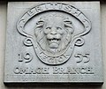 Plaque, British Legion, Omagh - geograph.org.uk - 1011034.jpg 640 × 541; 65 KB
-
 Plaque, G.W. Gibson, Beragh - geograph.org.uk - 1013895.jpg 640 × 513; 61 KB
-
 Plaque, Newtownstewart - geograph.org.uk - 988967.jpg 640 × 554; 113 KB
_-_geograph.org.uk_-_1023321.jpg)


_-_geograph.org.uk_-_1015151.jpg)
,_Omagh_-_geograph.org.uk_-_1011045.jpg)


_-_geograph.org.uk_-_996330.jpg)


_-_geograph.org.uk_-_997623.jpg)


,_Omagh_-_geograph.org.uk_-_1019153.jpg)
,_Omagh_-_geograph.org.uk_-_1019154.jpg)


_bus_2332_(SEZ_2332)_2008_Volvo_B9TL_Wright_Eclipse_Gemini,_8_October_2008_uncropped.jpg)
_-_geograph.org.uk_-_1760909.jpg)


