Category:Odiham
Jump to navigation
Jump to search
village and civil parish in Hampshire, United Kingdom  | |||||
| Upload media | |||||
| Instance of | |||||
|---|---|---|---|---|---|
| Location | Hart, Hampshire, South East England, England | ||||
| Said to be the same as | Odiham (Wikimedia duplicated page, civil parish) | ||||
| official website | |||||
 | |||||
Deutsch: Odiham ist eine englische Kleinstadt mit 4.406 Einwohnern im Hart District in Hampshire in der Region South East England.
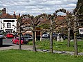
English: Odiham is a village in the Hart district of Hampshire, England. The current population is 4,406. It is twinned with Sourdeval in the Calvados Department of France.
Nederlands: Odiham is een Engels stadje in het Hart district in Hampshire. Het telt 4.406 inwoners. Ten zuiden van de plaats is er een vliegveld van de Royal Air Force gevestigd, "RAF Odiham". Koning Jan zonder Land liet in Odiham een kasteel bouwen in de periode van 1207 tot 1214. In 1238 werd het de verblijfplaats van Simon V van Montfort, een zwager van Jan zonder Land. In de 14e eeuw speelde het kasteel een rol in een aantal belangrijke gebeurtenissen. Er vond onder meer een zitting plaats van het parlement en werd David II van Schotland er gedurende 11 jaar opgesloten. Nadien raakte het kasteel in verval.
Svenska: Odiham är en stad i Hampshire i Storbritannien. Odiham har ca 4 400 invånare. Odiham omnämns i Domesday Book (1086), med den nuvarande stavningen, även om stavningarna Odiam och Wudiham har använts sedan dess.
Subcategories
This category has the following 20 subcategories, out of 20 total.
A
- Almshouses, Odiham (3 F)
B
- The Bell, Odiham (4 F)
G
- The George Hotel, Odiham (2 F)
K
- King's Barn, Odiham (2 F)
L
- Odiham Library (3 F)
- Little Court, Odiham (7 F)
M
- Marycourt, Odiham (3 F)
N
O
- Oasts in Odiham (14 F)
- Odiham Castle (91 F)
- Odiham War Memorial (2 F)
- The Old House, Odiham (7 F)
P
- Parish Room, Odiham (2 F)
- The Pest House, Odiham (28 F)
- The Priory, Odiham (2 F)
Q
- Queen Anne House, Odiham (6 F)
R
Media in category "Odiham"
The following 200 files are in this category, out of 773 total.
(previous page) (next page)-

-
 "Snowflakes" in Odiham - geograph.org.uk - 2743806.jpg 640 × 480; 79 KB
-
 57 High Street, Odiham - geograph.org.uk - 4219136.jpg 640 × 510; 142 KB
-
 6 to 11 Farnham Road, Odiham - geograph.org.uk - 1369048.jpg 640 × 427; 112 KB
-
 78 High Street, Odiham - geograph.org.uk - 4219173.jpg 467 × 640; 171 KB
-
 82 High Street, Odiham - geograph.org.uk - 4219158.jpg 504 × 640; 160 KB
-
 83-85 High Street, Odiham - geograph.org.uk - 4219123.jpg 534 × 640; 185 KB
-
 A fairly new plantation - geograph.org.uk - 4181303.jpg 640 × 480; 170 KB
-
 A fine exotic tree - geograph.org.uk - 2425000.jpg 480 × 640; 119 KB
-
 A frosty garden - Poland Mill - geograph.org.uk - 2772383.jpg 640 × 480; 124 KB
-
 A lone survivor - geograph.org.uk - 2772399.jpg 640 × 480; 48 KB
-
 A long lane from Long Lane - geograph.org.uk - 2312215.jpg 600 × 800; 93 KB
-
 A muddy path - Odiham Common - geograph.org.uk - 2772371.jpg 640 × 480; 130 KB
-
 A reflective mood - geograph.org.uk - 2772359.jpg 480 × 640; 127 KB
-
 A Transparent Castle - geograph.org.uk - 6209331.jpg 5,005 × 3,500; 2.16 MB
-
 A tree with character - geograph.org.uk - 2772471.jpg 640 × 480; 115 KB
-

-
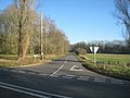
 A287 - geograph.org.uk - 5212716.jpg 640 × 426; 53 KB
-
 A287 - Odiham bypass - geograph.org.uk - 2831467.jpg 640 × 415; 62 KB
-
 A287 bridge, Basingstoke Canal - geograph.org.uk - 6230409.jpg 1,024 × 768; 512 KB
-
 A287 crosses the River Whitewater - geograph.org.uk - 4049140.jpg 3,523 × 2,575; 2.06 MB
-
 A287 junction with B3016 - geograph.org.uk - 4049141.jpg 3,502 × 2,563; 1.57 MB
-
 A287 junction with Chalky Lane - geograph.org.uk - 4049144.jpg 3,648 × 2,736; 2.76 MB
-
 A287 nears Odiham roundabout - geograph.org.uk - 3126304.jpg 640 × 481; 46 KB
-
 A287 north of Odiham - geograph.org.uk - 4534231.jpg 640 × 427; 74 KB
-
 A287 roundabout east of Odiham - geograph.org.uk - 3787868.jpg 800 × 600; 103 KB
-
 A287 roundabout south of Broad Oak Farm - geograph.org.uk - 4049142.jpg 3,648 × 2,736; 1.8 MB
-
 A287 south of Farnham Lodge Copse - geograph.org.uk - 4049143.jpg 3,422 × 2,531; 1.48 MB
-
 A287-Chalky Lane junction - geograph.org.uk - 3126272.jpg 640 × 480; 40 KB
-
 Access road to Snatchangers Farm - geograph.org.uk - 4154013.jpg 800 × 600; 156 KB
-
 Access to Odiham Wood - geograph.org.uk - 2772475.jpg 640 × 480; 101 KB
-
 Access to Poland Mill - geograph.org.uk - 2772376.jpg 640 × 480; 117 KB
-
 Access to Potbridge Farm - geograph.org.uk - 2772445.jpg 640 × 480; 134 KB
-
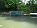 Accessible Boating - geograph.org.uk - 2424968.jpg 640 × 480; 90 KB
-
 After the Deluge - geograph.org.uk - 2943225.jpg 4,288 × 3,216; 3.62 MB
-
 All Saints Church at Odiham - geograph.org.uk - 4712006.jpg 4,000 × 3,000; 2.91 MB
-
 Alton Ales ^ Stout - geograph.org.uk - 2433543.jpg 640 × 480; 86 KB
-
 Alton Road - B3349 - geograph.org.uk - 2964217.jpg 640 × 454; 57 KB
-
 Alton Road at the junction of Hayley Lane - geograph.org.uk - 5034155.jpg 2,304 × 1,728; 1.08 MB
-
 An old ford - River Whitewater - geograph.org.uk - 2763362.jpg 1,024 × 767; 188 KB
-
 Approach to Poland Mill - geograph.org.uk - 2767677.jpg 640 × 480; 57 KB
-
 Approach to Potbridge Farm - geograph.org.uk - 2772427.jpg 640 × 480; 59 KB
-
 Approaching Broad Oak Bridge - geograph.org.uk - 2424976.jpg 640 × 480; 124 KB
-

-
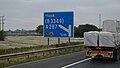 Approaching J5, M3 - geograph.org.uk - 5268830.jpg 640 × 363; 43 KB
-
 Assorted ages - Potbridge Farm - geograph.org.uk - 2772429.jpg 640 × 480; 86 KB
-
 Assorted power supplies - geograph.org.uk - 2772407.jpg 639 × 453; 50 KB
-
 Awaiting the call for demolition - geograph.org.uk - 4135420.jpg 800 × 600; 172 KB
-
 B3016 - Odiham Common - geograph.org.uk - 2767669.jpg 640 × 480; 86 KB
-
 B3349 at Odiham - geograph.org.uk - 5914783.jpg 4,288 × 2,848; 1.8 MB
-
 B3349 crossroads with Firs Lane - geograph.org.uk - 4074189.jpg 3,648 × 2,736; 1.99 MB
-
 B3349 is Dunley's Hill - geograph.org.uk - 4083709.jpg 3,648 × 2,736; 1.94 MB
-
 B3349 near Odiham airfield - geograph.org.uk - 3126497.jpg 640 × 480; 61 KB
-
 B3349 north of Down Farm - geograph.org.uk - 4074035.jpg 3,648 × 2,736; 2.65 MB
-
 B3349 northwest of Down Farm - geograph.org.uk - 4074024.jpg 3,648 × 2,736; 2.16 MB
-
 B3349 passing The Mill House - geograph.org.uk - 5212715.jpg 640 × 426; 88 KB
-

-
 B3349, Alton Rd - geograph.org.uk - 5212710.jpg 640 × 426; 63 KB
-
 Bagwell Lane - geograph.org.uk - 2763368.jpg 640 × 480; 91 KB
-
 Bagwell Lane - geograph.org.uk - 2767671.jpg 640 × 480; 78 KB
-

-
 Barn at Stapeley Farm - geograph.org.uk - 1926670.jpg 2,560 × 1,920; 1.95 MB
-
 Barn at top of hill - geograph.org.uk - 4135465.jpg 800 × 600; 183 KB
-
 Barns at Roke Farm - geograph.org.uk - 2943361.jpg 4,288 × 3,216; 3.75 MB
-
 Basingstoke canal - Broad Oak - geograph.org.uk - 2425718.jpg 640 × 480; 104 KB
-
 Basingstoke canal - Colt Hill - geograph.org.uk - 2425720.jpg 640 × 480; 113 KB
-
 Basingstoke Canal - geograph.org.uk - 1817752.jpg 2,272 × 1,704; 2.58 MB
-
 Basingstoke Canal - geograph.org.uk - 2073312.jpg 3,072 × 2,304; 1.97 MB
-
 Basingstoke Canal - geograph.org.uk - 2421600.jpg 800 × 600; 164 KB
-
 Basingstoke canal - geograph.org.uk - 2570769.jpg 1,600 × 1,200; 310 KB
-
 Basingstoke canal - geograph.org.uk - 2570776.jpg 1,600 × 1,200; 726 KB
-
 Basingstoke canal - geograph.org.uk - 2570792.jpg 1,600 × 1,200; 389 KB
-
 Basingstoke canal - geograph.org.uk - 2570795.jpg 1,504 × 1,600; 834 KB
-
 Basingstoke Canal - geograph.org.uk - 2572217.jpg 1,600 × 1,200; 820 KB
-
 Basingstoke Canal - geograph.org.uk - 2572301.jpg 1,600 × 1,137; 829 KB
-
 Basingstoke Canal - geograph.org.uk - 2572323.jpg 1,600 × 1,070; 549 KB
-
 Basingstoke Canal - geograph.org.uk - 2572328.jpg 1,600 × 1,150; 519 KB
-
 Basingstoke Canal - geograph.org.uk - 2572333.jpg 1,600 × 1,083; 320 KB
-
 Basingstoke Canal at Colt Hill Bridge - geograph.org.uk - 2251857.jpg 640 × 471; 231 KB
-
 Basingstoke Canal from Broad Oak Bridge - geograph.org.uk - 3623575.jpg 640 × 427; 105 KB
-

-
 Basingstoke Canal near Odiham - geograph.org.uk - 88186.jpg 632 × 475; 350 KB
-
 Basingstoke Canal, North Warnborough - geograph.org.uk - 4019361.jpg 640 × 480; 184 KB
-
 Bend in Bagwell Lane - geograph.org.uk - 2772474.jpg 640 × 480; 90 KB
-
 Bend on lane east of "Buttnidge" - geograph.org.uk - 4135393.jpg 800 × 600; 166 KB
-
 Bend on Wood Hill Lane - geograph.org.uk - 4153995.jpg 800 × 600; 205 KB
-
 Bidden Road - geograph.org.uk - 3008598.jpg 639 × 452; 63 KB
-
 Bidden Road near North Warnborough (1) - geograph.org.uk - 4219286.jpg 640 × 555; 167 KB
-
 Bidden Road near North Warnborough (2) - geograph.org.uk - 4219291.jpg 612 × 640; 205 KB
-
 Boating on the Basingstoke Canal - geograph.org.uk - 4019379.jpg 640 × 480; 159 KB
-

-
 Bridal shop in Odiham - geograph.org.uk - 2743826.jpg 480 × 640; 61 KB
-
-

-
 Bright green tree - geograph.org.uk - 2432640.jpg 480 × 640; 153 KB
-
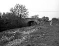
 Broad Oak Bridge - geograph.org.uk - 478573.jpg 640 × 501; 153 KB
-
 Broad Oak Bridge - geograph.org.uk - 546449.jpg 640 × 480; 181 KB
-
 Broad Oak Bridge - geograph.org.uk - 88183.jpg 632 × 475; 373 KB
-

-
 Broad Oak Bridge, Basingstoke Canal - geograph.org.uk - 3623570.jpg 640 × 427; 125 KB
-
 Broad Oak Bridge, Basingstoke Canal - geograph.org.uk - 4019433.jpg 640 × 480; 163 KB
-
 Broad Oak Bridge, Basingstoke Canal - geograph.org.uk - 588914.jpg 640 × 569; 176 KB
-
 Broad Oak Bridge, Basingstoke Canal - geograph.org.uk - 788810.jpg 640 × 410; 117 KB
-
 Broad Oak canal bridge - geograph.org.uk - 2425711.jpg 640 × 480; 129 KB
-
 Broad Oak Common - geograph.org.uk - 2421618.jpg 800 × 578; 120 KB
-
 Brow of the hill - Potbridge Farm - geograph.org.uk - 2772406.jpg 640 × 480; 52 KB
-
 Bullocks Farm, Hillside Road - geograph.org.uk - 5900081.jpg 5,016 × 3,344; 2.51 MB
-
 Bury House, Odiham 01.jpg 4,000 × 3,000; 3.34 MB
-
 Bury House, Odiham 02.jpg 4,000 × 3,000; 3.44 MB
-
 Bury House, Odiham 03.jpg 4,000 × 3,000; 2.74 MB
-
 Buryfield House, Odiham 01.jpg 4,000 × 3,000; 3.59 MB
-
 Buryfield House, Odiham 02.jpg 3,000 × 4,000; 3.16 MB
-
 Bus stop on Odiham Road - geograph.org.uk - 3788571.jpg 800 × 600; 201 KB
-
 By Chalk Pit Farm - geograph.org.uk - 2943662.jpg 4,288 × 3,216; 3.78 MB
-
 Byway leads off lane corner - geograph.org.uk - 4135396.jpg 800 × 600; 195 KB
-
 Canoe on Basingstoke Canal - geograph.org.uk - 2572319.jpg 1,600 × 1,200; 827 KB
-
 Canoes for hire - geograph.org.uk - 2433532.jpg 640 × 480; 91 KB
-
 Car showroom in the High Street - geograph.org.uk - 2742599.jpg 640 × 480; 83 KB
-
 Cattle at Bullock's Farm - geograph.org.uk - 170284.jpg 640 × 480; 334 KB
-
 Cemetery Hill looking towards Odiham - geograph.org.uk - 4154024.jpg 800 × 600; 119 KB
-
 Central House and Ivy House, Odiham - geograph.org.uk - 4219180.jpg 640 × 502; 155 KB
-
 Central Odiham - geograph.org.uk - 2924733.jpg 4,288 × 3,216; 3.54 MB
-
 Charity shop in the High Street - geograph.org.uk - 2743810.jpg 640 × 480; 80 KB
-
 Chinook and mast at RAF Odiham - geograph.org.uk - 4148642.jpg 800 × 600; 140 KB
-
 Choice of paths - geograph.org.uk - 2425710.jpg 640 × 480; 144 KB
-
 Chosley Farm Access - geograph.org.uk - 3140011.jpg 800 × 600; 122 KB
-
 Chosley Farm, Hampshire - geograph.org.uk - 2244993.jpg 3,504 × 2,336; 480 KB
-
 Church of All Saints, Odiham - geograph.org.uk - 5915548.jpg 1,803 × 1,407; 245 KB
-
 Church Path, Odiham - geograph.org.uk - 2924773.jpg 4,288 × 3,216; 3.56 MB
-
 Church Street - geograph.org.uk - 2924692.jpg 4,288 × 3,216; 3.39 MB
-
 Church Street in late November - geograph.org.uk - 2743812.jpg 640 × 480; 60 KB
-
 Church Street in late November 2011 - geograph.org.uk - 2742592.jpg 640 × 480; 72 KB
-
 Church Street, Odiham - geograph.org.uk - 5915551.jpg 4,288 × 2,848; 907 KB
-
 Church Street, Odiham - geograph.org.uk - 5915554.jpg 2,600 × 3,138; 503 KB
-
 Churchyard, Odiham - geograph.org.uk - 5916291.jpg 4,288 × 2,848; 1.27 MB
-
 Classic car in the High Street - geograph.org.uk - 2743776.jpg 640 × 480; 80 KB
-
 Clearance on the Basingstoke Canal - geograph.org.uk - 2251855.jpg 640 × 439; 226 KB
-
 Clearance work on the Basingstoke Canal - geograph.org.uk - 2251854.jpg 640 × 427; 204 KB
-
 Closed pub, Warnborough Green - geograph.org.uk - 4019905.jpg 640 × 480; 125 KB
-
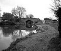
 Colt Hill bridge - Basingstoke canal - geograph.org.uk - 2432657.jpg 640 × 480; 122 KB
-
 Colt Hill Bridge - geograph.org.uk - 2251860.jpg 640 × 470; 238 KB
-
 Colt Hill Bridge - geograph.org.uk - 2570528.jpg 1,600 × 1,200; 427 KB
-
 Colt Hill Bridge - geograph.org.uk - 670775.jpg 640 × 480; 130 KB
-
 Colt Hill Bridge, Basingstoke Canal - geograph.org.uk - 478579.jpg 640 × 502; 116 KB
-
 Colt Hill Bridge, Basingstoke Canal - geograph.org.uk - 588933.jpg 640 × 537; 120 KB
-
 Colt Hill canal bridge - geograph.org.uk - 2433554.jpg 640 × 480; 96 KB
-
 Colt Hill Wharf - geograph.org.uk - 2251849.jpg 640 × 481; 241 KB
-
 Colt Hill wharf - geograph.org.uk - 2432661.jpg 640 × 480; 103 KB
-
 Colt Hill wharf - geograph.org.uk - 2433546.jpg 640 × 480; 80 KB
-
 Cottage in the High Street - geograph.org.uk - 2743786.jpg 480 × 640; 69 KB
-
 Cottage, West Street, Odiham - geograph.org.uk - 5914491.jpg 2,307 × 1,340; 308 KB
-
 Cottages on Broad Oak Lane - geograph.org.uk - 3787942.jpg 800 × 600; 155 KB
-
 Cross the drain here - geograph.org.uk - 2772402.jpg 640 × 480; 123 KB
-
 Crossing a ditch - geograph.org.uk - 2772431.jpg 640 × 480; 89 KB
-
 Crossing the River Whitewater - geograph.org.uk - 2772378.jpg 640 × 480; 156 KB
-
 Curve in Hook Road - geograph.org.uk - 2714059.jpg 640 × 415; 51 KB
-
 Cygnets - Basingstoke Canal - geograph.org.uk - 2570783.jpg 1,600 × 1,200; 617 KB
-
 Damn^ no dog gate - geograph.org.uk - 2772394.jpg 640 × 453; 74 KB
-
 Damp woodland - Potbridge - geograph.org.uk - 2772443.jpg 640 × 480; 139 KB
-

-
 Disused Chalk Pit - geograph.org.uk - 2943658.jpg 4,288 × 3,216; 3.33 MB
-
 Doorway, Church of All Saints, Odiham - geograph.org.uk - 5916311.jpg 2,661 × 1,747; 559 KB
-
 Downland at Odiham - geograph.org.uk - 2943493.jpg 4,288 × 3,216; 3.59 MB
-
 Downland Below Wassels Copse - geograph.org.uk - 2943477.jpg 4,288 × 3,216; 3.52 MB
-
 Downland by Newlands Farm - geograph.org.uk - 2943399.jpg 4,288 × 3,216; 3.67 MB
-
 Downland by Odiham - geograph.org.uk - 2943266.jpg 4,288 × 3,216; 3.61 MB
-
 Downland by Stapeley Farm - geograph.org.uk - 1926605.jpg 2,560 × 1,920; 1.75 MB
-
 Downland by the Alton Road - geograph.org.uk - 2943631.jpg 4,288 × 3,216; 3.64 MB
-
 Downland North of Roke Farm - geograph.org.uk - 2943280.jpg 4,288 × 3,216; 3.89 MB
-
 Downland Oilseed Rape Field - geograph.org.uk - 2943390.jpg 4,288 × 3,216; 3.86 MB
-
 Downland South of Odiham - geograph.org.uk - 2943459.jpg 4,288 × 3,216; 3.6 MB
-
 Downland Track by Roke Farm - geograph.org.uk - 2943273.jpg 4,288 × 3,216; 3.7 MB
-
 Downs South of Odiham - geograph.org.uk - 2943592.jpg 4,288 × 3,216; 3.81 MB
-
 Drainage ditch - Potbridge farm - geograph.org.uk - 2772403.jpg 640 × 480; 110 KB
-
 Drawbridge on the Basingstoke Canal - geograph.org.uk - 2049583.jpg 2,272 × 1,704; 2.58 MB
-
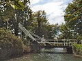 Drawbridge over Basingstoke Canal - geograph.org.uk - 2572239.jpg 1,600 × 1,200; 615 KB
-
 Drawbridge over Basingstoke Canal - geograph.org.uk - 2572291.jpg 1,600 × 1,200; 730 KB
-
 Drunk postbox^ - geograph.org.uk - 2772450.jpg 640 × 480; 123 KB
-
 Dry dock - Galleon Marine - geograph.org.uk - 2433536.jpg 640 × 480; 131 KB
-
 Dry dock - Galleon Marine - geograph.org.uk - 2433541.jpg 640 × 480; 145 KB
-
 Dunflyin - geograph.org.uk - 2943619.jpg 4,288 × 3,216; 3.85 MB
-
 Eastbound M3 near Hook - geograph.org.uk - 4158423.jpg 640 × 427; 222 KB
-
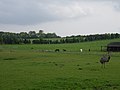 Emu and horses near Buttnidge. - geograph.org.uk - 170467.jpg 640 × 480; 314 KB
-
 Entering North Warnborough, B3349 - geograph.org.uk - 5212713.jpg 640 × 426; 87 KB
-
 Entering Odiham on Farnham Road - geograph.org.uk - 3787884.jpg 800 × 600; 198 KB
-
 Entering Odiham, B3349 - geograph.org.uk - 5212711.jpg 640 × 426; 90 KB
-
 Entrance to industrial site beside lane - geograph.org.uk - 4135451.jpg 800 × 600; 166 KB
-
-
 Extended garden by Basingstoke canal - geograph.org.uk - 2425707.jpg 640 × 480; 89 KB
-
 Farm bridge over A287 - geograph.org.uk - 2516949.jpg 800 × 600; 309 KB
-
 Farmland near Poland Mill - geograph.org.uk - 2772398.jpg 640 × 480; 66 KB
-
 Farmland south of Greywell - geograph.org.uk - 3008595.jpg 640 × 480; 98 KB
-
 Farmland south of Greywell - geograph.org.uk - 3008596.jpg 640 × 480; 88 KB
-
 Farmland south of Greywell - geograph.org.uk - 3008597.jpg 640 × 480; 97 KB
-
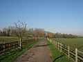
 Farmland, Odiham - geograph.org.uk - 2123027.jpg 640 × 480; 124 KB
-
 Farmland, Odiham - geograph.org.uk - 2123889.jpg 640 × 480; 140 KB
-
 Farmland, Odiham - geograph.org.uk - 2123895.jpg 640 × 480; 116 KB
-
 Farmland, Odiham - geograph.org.uk - 956236.jpg 640 × 480; 104 KB
-
 Farmland, Odiham - geograph.org.uk - 956238.jpg 640 × 480; 116 KB
-
 Farmland, Odiham - geograph.org.uk - 956243.jpg 640 × 480; 146 KB


_-_geograph.org.uk_-_4219286.jpg)
_-_geograph.org.uk_-_4219291.jpg)


