Category:Oeger Straße (Hagen)
Jump to navigation
Jump to search
| Object location | | View all coordinates using: OpenStreetMap |
|---|
Subcategories
This category has the following 4 subcategories, out of 4 total.
Media in category "Oeger Straße (Hagen)"
The following 14 files are in this category, out of 14 total.
-
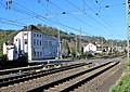 Bahnübergang Oeger Straße (2).jpg 4,000 × 2,825; 3.53 MB
-
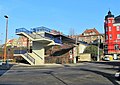 Fussgängerbrücke Oeger Straße.jpg 3,904 × 2,760; 2.3 MB
-
 Hohenlimburg, Oeger Fabrikkamin.JPG 3,999 × 2,950; 1.36 MB
-
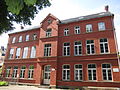
 Hohenlimburg, Oeger Schule.jpg 5,333 × 3,555; 6.87 MB
-
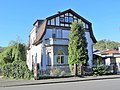
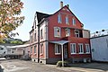
 Hohenlimburg, Oeger Straße 8.jpg 3,648 × 2,356; 1.75 MB
-
 Hohenlimburg, Oeger Straße 34.JPG 4,000 × 2,839; 3.8 MB
-
 Hohenlimburg, Oeger Straße 56.JPG 4,000 × 3,000; 3.02 MB
-
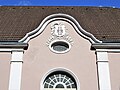 Hohenlimburg, Oeger Straße 64, Relief Turnhalle.JPG 4,000 × 3,000; 3.17 MB
-
 Hohenlimburg, Oeger Straße 64.JPG 4,320 × 3,240; 3.65 MB
-
 Hohenlimburg, Oeger Straße 66.JPG 2,359 × 2,753; 1.18 MB
-
 Hohenlimburg, Oeger Straße 76.jpg 5,472 × 3,648; 4.42 MB
-
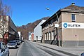
 Kaltwalzwerk Bilstein Oeger Straße 11-35.jpg 5,472 × 3,647; 4.99 MB
-
 Kaltwalzwerk Bilstein Werk II.jpg 5,472 × 3,648; 4.97 MB
-
 Oeger Straße Bahnübergang.JPG 4,000 × 2,820; 2.93 MB
.jpg)


