Category:Old maps of Bath, Somerset
Jump to navigation
Jump to search
Subcategories
This category has the following 2 subcategories, out of 2 total.
Media in category "Old maps of Bath, Somerset"
The following 15 files are in this category, out of 15 total.
-
 150 of '(Our own country. Descriptive, historical, pictorial.)' (11245496335).jpg 1,935 × 1,703; 1,018 KB
-
 152 of '(Our own country. Descriptive, historical, pictorial.)' (11180059216).jpg 1,928 × 1,736; 1.03 MB
-
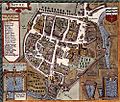
 Print, map (BM Ee,2.92).jpg 1,966 × 2,424; 1.3 MB
-
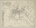
 A NEW AND CORRECT PLAN of the CITY of BATH (1818).jpg 2,710 × 2,936; 5.89 MB
-
 EW(1884) p.160 - Bath - A + C Black (pub).jpg 1,225 × 1,902; 627 KB
-
 221 of 'Handbook to Bath' (11291356513).jpg 1,187 × 1,718; 356 KB
-
 51 of 'The Penny Illustrated History of Bath and District, etc' (11248795104).jpg 2,352 × 1,488; 1.26 MB
-

-
 Bath Sydney Gardens 1886.jpg 2,220 × 2,296; 2.58 MB
-
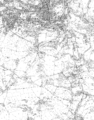 Bath To Midford 1903.png 4,257 × 5,428; 6.05 MB
-

-
-
 Speed baths.jpg 500 × 424; 131 KB
-

-
 Westmoreland Road goods yard map.PNG 1,141 × 456; 990 KB
%27_(11245496335).jpg)
%27_(11180059216).jpg)
.jpg)
.jpg)
_p.160_-_Bath_-_A_%2B_C_Black_(pub).jpg)
.jpg)
.jpg)


,_planned_on_a_scale_of_one_inch_to_the_mile_accompanied_by_indexes,_topographic_(14782039981).jpg)