Category:Old maps of Cherbourg-en-Cotentin
Jump to navigation
Jump to search
Media in category "Old maps of Cherbourg-en-Cotentin"
The following 32 files are in this category, out of 32 total.
-
 Cherbourg au 16e siecle.jpg 1,475 × 983; 546 KB
-
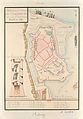 Chateau-cherbourg-1689b.jpg 2,048 × 2,943; 4 MB
-
 Plan du raid anglais sur Cherbourg en 1758.jpg 946 × 658; 331 KB
-

-

-

-
 Rade de Cherbourg. 1786 - btv1b8441583g.jpg 9,322 × 5,797; 6.35 MB
-

-
 Rade de Cherbourg - btv1b8445991n.jpg 11,026 × 7,731; 10.13 MB
-
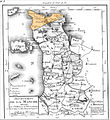 District de Cherbourg, 1792.jpg 1,651 × 1,805; 1.26 MB
-

-
 Cherbourg-Cessart.jpg 627 × 396; 46 KB
-

-
 Rade de Cherbourg - btv1b55005231v.jpg 5,571 × 3,703; 1.42 MB
-
 Rade de Cherbourg - btv1b8439318d.jpg 10,282 × 7,938; 8.23 MB
-
 Ile St Marcouf, Ile de large - btv1b530128202.jpg 7,946 × 5,786; 4.12 MB
-
 Ile St Marcouf, Ile de Terre - btv1b530127716.jpg 9,866 × 5,179; 4.81 MB
-
 Civil War proof maps - United States LOC 2002626097-42.jpg 4,727 × 5,082; 2.46 MB
-
 Civil War proof maps - United States LOC 2002626097-42.tif 4,727 × 5,082; 68.73 MB
-

-
 Meyers b3 s0995 b1.png 379 × 387; 90 KB
-
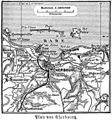 Plan von cherbourg.jpg 365 × 390; 51 KB
-
 Admiralty Chart No 1106 C. de Flamanville to Is. St. Marcouf, Published 1888.jpg 16,351 × 11,334; 50.14 MB
-

-

-
 Rade de Cherbourg. Port Napoléon - btv1b8442715n.jpg 11,310 × 8,254; 20.2 MB
-

-

-

-
 PONT CONARD CARTE CASSINI.JPG 3,264 × 2,448; 4.06 MB
-
 Rade de Cherbourg - btv1b530129069.jpg 8,235 × 5,081; 4.1 MB
-
 Rade de Cherbourg - btv1b530129425.jpg 3,810 × 2,482; 1.32 MB


.jpg)
_-_dessin%C3%A9s_par..._-_btv1b52503974g_(039_of_106).jpg)
.jpg)

.jpg)


.jpg)

.jpg)


.jpg)


_(14589586780).jpg)
_(14796161953).jpg)

_(14761091421).jpg)
_(14780184274).jpg)
_(14802401853).jpg)


