Category:Old maps of Delfland
Jump to navigation
Jump to search
Media in category "Old maps of Delfland"
The following 131 files are in this category, out of 131 total.
-
 Jan Potter 1590 Maasdijk.jpg 7,288 × 2,290; 2.42 MB
-
 1612, Kaart van Delfland met Den Haag, Scheveningen en Loosduinen.jpg 3,920 × 4,516; 3.11 MB
-
 Babberspolder1712.JPG 420 × 274; 34 KB
-

-
 Aalkeet polders 1712.JPG 664 × 485; 89 KB
-
 Ackerdyksepolder1712.JPG 607 × 460; 79 KB
-
 Bieslandsepolder1712.JPG 550 × 412; 65 KB
-
 Binkhorstpolder 1712.JPG 553 × 463; 70 KB
-
 Boontjesmolen 1712.jpg 370 × 546; 46 KB
-
 Broekpolder Rijswijk 1712.JPG 474 × 450; 59 KB
-
 Broekpolder Vlaardingen 1712.JPG 362 × 407; 42 KB
-
 Broekpolders Naaldwijk 1712.JPG 514 × 479; 69 KB
-
 Broekslootmolen 1712.jpg 848 × 489; 100 KB
-
 Buitenplaats Duivenstein.jpg 1,042 × 607; 394 KB
-
 Buitenplaatsen Leeuwensteijn en Damsigt, Voorburg.jpg 1,069 × 1,043; 691 KB
-
 Commandeurs polder 1712.JPG 599 × 421; 71 KB
-
 Delfland 1712 blad 9 00013001507.jpg 7,284 × 6,341; 13.39 MB
-
 Delflant1712.png 671 × 570; 998 KB
-
 Dijkpolder Poeldijk 1712.JPG 556 × 453; 72 KB
-
 Dorppolder1712.JPG 532 × 472; 69 KB
-
 Duifpolder1712.JPG 626 × 405; 77 KB
-
 Dykpolder 1712.JPG 526 × 420; 65 KB
-
 Escamppolders1712.JPG 660 × 457; 84 KB
-
 Foppenpolder1712.JPG 638 × 472; 83 KB
-
 Groeneveldsepolder1712.JPG 517 × 439; 61 KB
-
 Groote Vettenoordsche polder 1712.JPG 465 × 371; 44 KB
-
 Harnaschpolder 1712.JPG 521 × 444; 60 KB
-
 Hoekpolder1712.JPG 417 × 462; 57 KB
-
 Holierhoeksepolder1712.JPG 629 × 407; 73 KB
-
 Kaart Delfland nummer 1 - Unknown - 20318118 - RCE.jpg 1,200 × 945; 315 KB
-
 Kaart detail nummer 2 Delfland - Unknown - 20318119 - RCE.jpg 1,200 × 939; 341 KB
-
 Kaart detail nummer 3 Delfland - Unknown - 20318120 - RCE.jpg 1,200 × 953; 331 KB
-
 Kaart detail nummer 4 Delfland - Unknown - 20318121 - RCE.jpg 1,200 × 948; 333 KB
-
 Kaart detail nummer 5 Delfland - Unknown - 20318122 - RCE.jpg 1,200 × 959; 315 KB
-
 Kaart detail nummer 6 Delfland - Unknown - 20318123 - RCE.jpg 1,200 × 960; 304 KB
-
 Kaart nummer 10, detail Delfland - Unknown - 20318127 - RCE.jpg 1,200 × 955; 327 KB
-
 Kaart nummer 11, detail Delfland - Unknown - 20318128 - RCE.jpg 1,200 × 961; 319 KB
-
 Kaart nummer 12, detail Delfland - Unknown - 20318129 - RCE.jpg 1,200 × 961; 369 KB
-
 Kaart nummer 13, detail Delfland - Unknown - 20318130 - RCE.jpg 1,200 × 962; 361 KB
-
 Kaart nummer 14, detail Delfland - Unknown - 20318131 - RCE.jpg 1,200 × 956; 349 KB
-
 Kaart nummer 15, detail Delfland - Unknown - 20318132 - RCE.jpg 1,200 × 944; 325 KB
-
 Kaart nummer 16, detail Delfland - Unknown - 20318133 - RCE.jpg 1,200 × 949; 330 KB
-
 Kaart nummer 17, detail Delfland - Unknown - 20318134 - RCE.jpg 1,200 × 965; 369 KB
-
 Kaart nummer 18, detail Delfland - Unknown - 20318135 - RCE.jpg 1,200 × 956; 371 KB
-
 Kaart nummer 19, detail Delfland - Unknown - 20318136 - RCE.jpg 1,200 × 952; 354 KB
-
 Kaart nummer 20, detail Delfland - Unknown - 20318137 - RCE.jpg 1,200 × 960; 324 KB
-
 Kaart nummer 21, detail Delfland - Unknown - 20318138 - RCE.jpg 1,200 × 942; 314 KB
-
 Kaart nummer 22, detail Delfland - Unknown - 20318139 - RCE.jpg 1,200 × 958; 345 KB
-
 Kaart nummer 23, detail Delfland - Unknown - 20318140 - RCE.jpg 1,200 × 955; 350 KB
-
 Kaart nummer 24, detail Delfland - Unknown - 20318141 - RCE.jpg 1,200 × 959; 349 KB
-
 Kaart nummer 25, detail Delfland - Unknown - 20318142 - RCE.jpg 1,200 × 951; 333 KB
-
 Kaart nummer 26, detail Delfland - Unknown - 20318143 - RCE.jpg 1,200 × 956; 248 KB
-
 Kaart nummer 27, detail Delfland - Unknown - 20370973 - RCE.jpg 953 × 1,200; 259 KB
-
 Kaart nummer 7 Delfland - Unknown - 20318124 - RCE.jpg 1,200 × 953; 343 KB
-
 Kaart nummer 8 Delfland - Unknown - 20318125 - RCE.jpg 1,200 × 955; 337 KB
-
 Kaart nummer 9 Delfland - Unknown - 20318126 - RCE.jpg 1,200 × 951; 363 KB
-
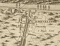 Kaart Scheveningen1712.jpg 1,278 × 976; 430 KB
-
 Kaart van de landen gelegen tusschen Maassluisen den Hoek van Holland.jpg 19,024 × 6,520; 27.04 MB
-
 Kaart van de Oostduinen en Waalsdorp tot aan de bezuidenhoutseweg, circa 1650.png 5,712 × 4,096; 19.64 MB
-
 Kaart van Delfland - Unknown - 20317097 - RCE.jpg 1,200 × 949; 288 KB
-
 Kaart van Delfland - Unknown - 20317098 - RCE.jpg 1,200 × 950; 352 KB
-
 Kaart van Delfland - Unknown - 20317099 - RCE.jpg 1,200 × 954; 334 KB
-
 Kaart van Delfland - Unknown - 20317197 - RCE.jpg 1,200 × 940; 409 KB
-
 Kaart van Delfland - Unknown - 20317198 - RCE.jpg 1,200 × 876; 383 KB
-
 Kaart van den Oranjepolder.jpg 10,000 × 7,519; 9.24 MB
-
 Kaart van Honderdland.jpg 10,000 × 7,519; 18 MB
-
 Kerkpolder1712.JPG 776 × 482; 119 KB
-
 Klein Vrijenban 1712.JPG 564 × 404; 58 KB
-
 Kleine Vettenoordsche polder 1712.JPG 477 × 342; 38 KB
-
 Kralingerpolder 1712.JPG 621 × 471; 83 KB
-
 Landgoederen Rijswijk 1712.jpg 4,242 × 2,482; 3 MB
-
 Map - Special Collections University of Amsterdam - OTM- HB-KZL I 2 A 3 (28).jpg 9,965 × 6,998; 41.17 MB
-
 Map - Special Collections University of Amsterdam - OTM- HB-KZL I 2 A 3 (29).jpg 9,992 × 7,027; 41.25 MB
-
 Map - Special Collections University of Amsterdam - OTM- HB-KZL I 2 A 3 (30).jpg 9,953 × 7,009; 38.51 MB
-
 Map - Special Collections University of Amsterdam - OTM- HB-KZL I 2 A 3 (31).jpg 9,955 × 6,957; 38.22 MB
-
 Map - Special Collections University of Amsterdam - OTM- HB-KZL I 2 A 3 (32).jpg 9,955 × 6,957; 36.32 MB
-
 Map - Special Collections University of Amsterdam - OTM- HB-KZL I 2 A 3 (33).jpg 9,955 × 6,957; 35.99 MB
-
 Map - Special Collections University of Amsterdam - OTM- HB-KZL I 2 A 3 (34).jpg 9,955 × 6,957; 37.39 MB
-
 Map - Special Collections University of Amsterdam - OTM- HB-KZL I 2 A 3 (35).jpg 9,967 × 6,982; 39.39 MB
-
 Map - Special Collections University of Amsterdam - OTM- HB-KZL I 2 A 3 (36).jpg 9,967 × 6,969; 37.48 MB
-
 Map - Special Collections University of Amsterdam - OTM- HB-KZL I 2 A 3 (37).jpg 9,979 × 7,005; 35.04 MB
-
 Map - Special Collections University of Amsterdam - OTM- HB-KZL I 2 A 3 (38).jpg 9,966 × 6,981; 33.98 MB
-
 Map - Special Collections University of Amsterdam - OTM- HB-KZL I 2 A 3 (39).jpg 9,967 × 6,957; 36.69 MB
-
 Map - Special Collections University of Amsterdam - OTM- HB-KZL I 2 A 3 (40).jpg 9,954 × 6,981; 37.44 MB
-
 Map - Special Collections University of Amsterdam - OTM- HB-KZL I 2 A 3 (41).jpg 9,967 × 6,970; 37.37 MB
-
 Map - Special Collections University of Amsterdam - OTM- HB-KZL I 2 A 3 (42).jpg 9,967 × 6,957; 34.42 MB
-
 Map - Special Collections University of Amsterdam - OTM- HB-KZL I 2 A 3 (43).jpg 9,967 × 6,969; 35.47 MB
-
 Map - Special Collections University of Amsterdam - OTM- HB-KZL I 2 A 3 (44).jpg 9,955 × 6,957; 35.49 MB
-
 Map - Special Collections University of Amsterdam - OTM- HB-KZL I 2 A 3 (45).jpg 9,968 × 6,969; 37.33 MB
-
 Map - Special Collections University of Amsterdam - OTM- HB-KZL I 2 A 3 (46).jpg 9,955 × 6,993; 37.27 MB
-
 Map - Special Collections University of Amsterdam - OTM- HB-KZL I 2 A 3 (47).jpg 9,943 × 6,969; 34.58 MB
-
 Map - Special Collections University of Amsterdam - OTM- HB-KZL I 2 A 3 (48).jpg 9,943 × 6,993; 34.31 MB
-
 Map - Special Collections University of Amsterdam - OTM- HB-KZL I 2 A 3 (49).jpg 9,955 × 6,981; 35.45 MB
-
 Map - Special Collections University of Amsterdam - OTM- HB-KZL I 2 A 3 (50).jpg 9,943 × 6,969; 38.78 MB
-
 Map - Special Collections University of Amsterdam - OTM- HB-KZL I 2 A 3 (51).jpg 9,943 × 6,993; 39.15 MB
-
 Map - Special Collections University of Amsterdam - OTM- HB-KZL I 2 A 3 (52).jpg 9,931 × 6,981; 36.08 MB
-
 Map - Special Collections University of Amsterdam - OTM- HB-KZL I 2 A 3 (53).jpg 9,931 × 6,969; 36.77 MB
-
 Map - Special Collections University of Amsterdam - OTM- HB-KZL I 2 A 3 (54).jpg 9,931 × 6,981; 37.07 MB
-
 Map - Special Collections University of Amsterdam - OTM- HB-KZL I 2 A 3 (55).jpg 9,955 × 6,993; 38.65 MB
-
 Midden Delfland Floris Balthasar 1611.jpg 3,404 × 4,489; 4.53 MB
-
 Netherlands, Tedingerbroekpolder (1).jpg 1,440 × 1,312; 1.13 MB
-
 Nicolaas Samuel Cruquius - Map of Delfland - WGA05811.jpg 1,149 × 1,000; 291 KB
-
 Nieuwland en Noordland 1712.JPG 572 × 483; 72 KB
-
 Nieuwlandsche polder1712.JPG 515 × 319; 50 KB
-
 Noord Kethelse polder1712.JPG 492 × 411; 61 KB
-
 Noordpolder van Delfgauw1712.JPG 436 × 337; 45 KB
-
 Noordpolder1712.JPG 637 × 488; 86 KB
-
 Oost abtspolder1712.JPG 403 × 354; 44 KB
-
 Oud- en Nieuw Wateringveldsche polder 1712.JPG 543 × 477; 72 KB
-
 Oude Campspolder 1712.JPG 601 × 473; 76 KB
-
 Oude Lier polder 1712.JPG 646 × 491; 94 KB
-
 Oudeland1712.JPG 397 × 418; 47 KB
-
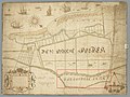
 Overzichtskaart Westland 1606.jpg 1,375 × 1,354; 375 KB
-
 Papsouwsepolder1712.JPG 416 × 423; 59 KB
-
 Plaspoelpolder1712.JPG 586 × 479; 78 KB
-
 Poelpolder1712.JPG 369 × 461; 45 KB
-
 Polder van Nootdorp1712.JPG 494 × 484; 66 KB
-
 Poldervaart1712.JPG 802 × 291; 71 KB
-
 Rotterdamse Schie 1611.jpg 978 × 1,516; 533 KB
-
 Sarijnenhove.jpg 1,133 × 578; 377 KB
-
 Schapenweipolder1712.JPG 657 × 466; 88 KB
-
 Scheveningen - kaart Delfland.jpg 7,402 × 6,294; 15.07 MB
-
 Schieveense polder1712.JPG 572 × 488; 83 KB
-
 Steendijkpolder1712.JPG 463 × 403; 49 KB
-
 Tedingerbroekpolder 1712.JPG 577 × 464; 71 KB
-
 Topografische kaart van Delfland - Unknown - 20317100 - RCE.jpg 1,200 × 935; 301 KB
-
 Uithofspolder 1712.JPG 532 × 474; 72 KB
-
 Vlaardingen(1712)Cruquis1a.jpg 198 × 200; 44 KB
-
 Vlietenburgh in 1712.jpg 992 × 796; 513 KB
-
 Westland Floris Balthasar 1611.jpg 3,586 × 4,665; 5.71 MB
-
 Zouteveensepolder1712.JPG 535 × 447; 71 KB


.jpg)


.jpg)
.jpg)
.jpg)
.jpg)
.jpg)
.jpg)
.jpg)
.jpg)
.jpg)
.jpg)
.jpg)
.jpg)
.jpg)
.jpg)
.jpg)
.jpg)
.jpg)
.jpg)
.jpg)
.jpg)
.jpg)
.jpg)
.jpg)
.jpg)
.jpg)
.jpg)
.jpg)
.jpg)

.jpg)


Cruquis1a.jpg)


