Category:Old maps of Kristiansund
Jump to navigation
Jump to search
Media in category "Old maps of Kristiansund"
The following 9 files are in this category, out of 9 total.
-
 251 of 'Illustreret Norges historie. (With plates.)' (11179606535).jpg 2,496 × 1,599; 1.57 MB
-
 Kart over Kristiansund (1887).jpg 3,291 × 3,986; 14.56 MB
-
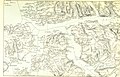
 Kartblad 119- Situations Kaart over det Gimnatsche Compagnie District, 1745.jpg 7,042 × 5,654; 5.06 MB
-
 Kristiansund map 1911.jpg 2,000 × 2,394; 4.02 MB
-
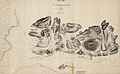
 Romsdals amt nr 16- Cart over Christianssunds Bye, 1790.jpg 4,512 × 5,425; 2.89 MB
-
 Romsdals amt nr 17- Christiansunds Bye med dens Avenuer, 1800.jpg 9,881 × 6,117; 6.47 MB
-
 Romsdals amt nr 18- Cart over Christianssund og dets Batterier, 1801.jpg 4,589 × 5,224; 2.86 MB
-
 Romsdals amt nr 25- Kart over Kristiansund, 1881.jpg 5,425 × 7,475; 4.83 MB
-
 Romsdals amt nr 8- Kart over Kristianssund med Omegn, 1750.jpg 7,863 × 7,800; 6.02 MB
%27_(11179606535).jpg)
.jpg)


