Category:Old maps of Mecklenburg
Jump to navigation
Jump to search
Use the appropriate category for maps showing all or a large part of Mecklenburg. See subcategories for smaller areas:
| If the map shows | Category to use |
|---|---|
| Mecklenburg on a recently created map | Category:Maps of Mecklenburg or its subcategories |
| Mecklenburg on a map created more than 70 years ago | Category:Old maps of Mecklenburg or its subcategories |
| the history of Mecklenburg on a recently created map | Category:Maps of the history of Mecklenburg or its subcategories |
| the history of Mecklenburg on a map created more than 70 years ago | Category:Old maps of the history of Mecklenburg or its subcategories |
Subcategories
This category has the following 4 subcategories, out of 4 total.
Media in category "Old maps of Mecklenburg"
The following 69 files are in this category, out of 69 total.
-
 Tilemann Stella Elbe-Ostsee-Kanal 1576.png 545 × 1,449; 192 KB
-
 Map - Special Collections University of Amsterdam - OTM- HB-KZL 31-24-59.tif 7,128 × 6,012; 122.61 MB
-
 Mecklenburg ducatus - auctore Joanne Laurenbergio - btv1b84465030.jpg 7,860 × 6,084; 8.5 MB
-
 Meklenburg Ducatus (8343082744).jpg 6,793 × 5,755; 37.44 MB
-
 Atlas ou Representation du Monde Universel t. 2. 1633 (110100969).jpg 16,913 × 11,929; 33.3 MB
-
 Blaeu 1645 - Meklenburg Ducatus.jpg 3,720 × 3,120; 1.34 MB
-
 Mecklenburg Karte1645.jpg 2,899 × 2,209; 1.38 MB
-
 "Meklenburg ducatus - Auctore Ioanne Laurenbergio" (22070559558).jpg 3,882 × 3,018; 2.62 MB
-
 Blaeu, Willem - Kaart van Mecklenburg.jpg 5,500 × 4,187; 2.51 MB
-
 Butzow 1692.jpg 4,719 × 3,790; 1.64 MB
-
 Mecklenburg ducatus - auctore Ioanne Laurenbergio - btv1b53040879d (1 of 2).jpg 5,832 × 4,549; 4.69 MB
-
 Mecklenburg ducatus - auctore Ioanne Laurenbergio ; S. Rogiers sculp. - btv1b53040316p.jpg 6,139 × 5,162; 5.06 MB
-
 Meklenburg ducatus - CBT 5874386.jpg 5,577 × 4,301; 5.17 MB
-
-
 MarktGuestrow.jpg 1,288 × 1,058; 695 KB
-
 Johann Lauremberg - Meklenbvrg Dvcatvs (ca.1709).jpg 7,662 × 5,850; 12.67 MB
-

-
 1790 Weg von Peckatel nach Penzlin über die Wehdenfurt, heute B193jpg.jpg 4,326 × 4,224; 5.57 MB
-
 Permin wiebeking.png 734 × 762; 1.11 MB
-
 Wiebeking roegeliner see.jpg 798 × 1,100; 262 KB
-
 WiebekingRZ.jpg 796 × 1,100; 239 KB
-
 Schmettau Poseriner See 1794.JPG 3,615 × 3,226; 5.66 MB
-
 Carte von Meklenburg - btv1b53100500c.jpg 9,815 × 6,615; 10.26 MB
-
 Meyer‘s Zeitungsatlas 037 – Mecklenburg- Schwerin und Strelitz.jpg 7,358 × 6,238; 14.53 MB
-
 Hohemeile bei Schoenberg.jpg 1,090 × 607; 285 KB
-

-
 Mecklenburg1880Andree.tif 3,913 × 2,577; 28.85 MB
-
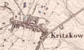 Kritzkow 1882.png 650 × 385; 596 KB
-

-
 Provinz Saschen, Mecklenburg und Anhalt - btv1b53078187z.jpg 3,442 × 4,997; 3.39 MB
-

-

-

-
 Neu Germania pg10 11210138266.jpg 2,326 × 2,740; 1.29 MB
-
 Archiv des Vereins der Freunde der Naturgeschichte in Mecklenburg.. (1892) (19745283072).jpg 2,148 × 3,796; 1.39 MB
-
 Karte des Deutschen Reiches - Composite 85, Kropelin 5820085c.jpg 10,728 × 9,368; 16.01 MB
-

-
 C. 1350 Brandenburg Pomerania.jpg 1,299 × 740; 1.27 MB
-
 C. 1417 Holy Roman Empire (Brandenburg region).jpg 937 × 925; 1.05 MB
-
 C. 1450 Brandenburg Pomerania.jpg 1,151 × 789; 1.03 MB
-
 C. 1540 Brandenburg Pomerania region.jpg 1,215 × 917; 1.24 MB
-
 Die Grossherzogthümer Mecklenburg.jpg 5,472 × 4,500; 6.04 MB
-
 Dobbiner Plage Hervorhebung Paradieskoppel.png 885 × 764; 491 KB
-
 Dobbiner Plage Mecklenburg.jpg 895 × 783; 280 KB
-
 Dobbiner Plage Mecklenburg.png 885 × 764; 350 KB
-
 Domhof RZ 001.jpg 1,617 × 2,490; 899 KB
-

-

-
 Grafschaften Holstein Ratzeburg Schwerin Dannenberg Luechow 1250.svg 700 × 794; 1.66 MB
-
 Inferioris Saxoniae Circvlvs+90°.png 5,414 × 6,733; 74.79 MB
-
 Inferioris Saxoniae Circvlvs.png 6,733 × 5,414; 76.77 MB
-
 Karta över del av Tyskland 1780 - Skoklosters slott - 98050.tif 5,242 × 3,669; 55.04 MB
-

-

-
 Le duché de Mecklenbourg - btv1b8445041n.jpg 5,760 × 3,995; 3.66 MB
-
 Map of Mecklenburg 1803.jpg 290 × 181; 26 KB
-
-
 Mecklenburg 1230.PNG 543 × 428; 184 KB
-
 Mecklenburg 1905.png 1,837 × 1,105; 1.24 MB
-
 Mecklenburg-Schwerin und Mecklenburg-Strelitz (1908).jpg 4,243 × 3,473; 4.52 MB
-
 Meklenburg Ducatus (Saxoniae Inferioris, Merian) b 002.jpg 3,809 × 3,019; 6.58 MB
-
 Meklenburg ducatus - auctore Ioanne Laurenbergio - btv1b55004538s.jpg 7,694 × 5,972; 4.55 MB
-
 Meklenburg ducatus - auctore Ioanne Laurenbergio - btv1b8443507q.jpg 8,900 × 7,179; 10.28 MB
-
 Meyers b11 s0385a.jpg 2,048 × 1,682; 890 KB
-
 Meßtischblatt-2734-Eldena-von 1879.jpg 1,029 × 614; 563 KB
-
 Rückzug Heeresgruppe Weichsel (1945).jpg 929 × 1,339; 449 KB
-
 Schweriner See 1582.png 1,049 × 1,358; 177 KB
-
 Siechenhauskarte crop.jpg 784 × 529; 126 KB
-
 Wiebeking Selmsdorf.jpg 796 × 1,100; 276 KB

.jpg)
.jpg)


.jpg)


.jpg)


.jpg)
.jpg)


_(19745283072).jpg)


.jpg)


.jpg)
_b_002.jpg)


.jpg)


