Category:Old maps of Tangier
Jump to navigation
Jump to search
Subcategories
This category has only the following subcategory.
M
Media in category "Old maps of Tangier"
The following 21 files are in this category, out of 21 total.
-
 La Baÿe De Tanger En Barbarie - Henry Michelot - btv1b5966457b (1 of 2).jpg 5,088 × 3,504; 1.93 MB
-
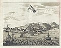 1686 Dapper View of Tangier, Morocco.jpg 4,000 × 3,156; 3.86 MB
-
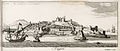 Tangere - Peeters Jacob - 1686.jpg 1,500 × 636; 396 KB
-

-
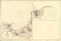 Admiralty Chart No 1912 Tangier Bay, Published 1936.jpg 16,194 × 11,022; 31.97 MB
-
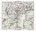 ATLAS JUSTUS PERTHES 08.jpg 4,547 × 3,933; 10.25 MB
-
 Baedeker's Spain and Portugal- Tangier (1901).jpg 1,366 × 2,044; 909 KB
-

-

-

-

-

-

-

-

-

-

-
 Lange diercke sachsen europaeische landschaften gibraltar.jpg 1,251 × 1,052; 664 KB
-
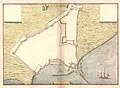
 PLAN Des Rade & Ville de TANGER - (par) Lemoine - btv1b5966465w.jpg 6,128 × 4,848; 2.75 MB
-
 Planta de Tanger, Leonardo de Ferrari, 1655.jpg 8,293 × 6,110; 7.21 MB
-
 Tangier under English rule, 1680.jpg 996 × 711; 368 KB
.jpg)


.jpg)
_1664-70._Plans_of_Tangier,_executed_by_various_hands_including_Thomas_Phillips,_military_engineer._RMG_L8155.jpg)
_1664-70._Plans_of_Tangier,_executed_by_various_hands_including_Thomas_Phillips,_military_engineer._RMG_S0215.jpg)


_Lemoine_-_btv1b5966465w.jpg)

