Category:Old maps of Weimar
Jump to navigation
Jump to search
Subcategories
This category has only the following subcategory.
M
Media in category "Old maps of Weimar"
The following 14 files are in this category, out of 14 total.
-
 Asbach-Tal in Weimar auf dem Wolfschen Plan, 1569.png 982 × 853; 1.36 MB
-
 Frauentor Weimar 1569.png 752 × 525; 650 KB
-
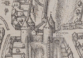
 S. Iacobs Thor Weimar.png 664 × 436; 460 KB
-
 Weimar, Stadtplan von Franz Ludwig Güssefeld, 1784.jpg 9,004 × 7,483; 19.3 MB
-
 Plan des Herzoglichen Parks bey Weimar.jpg 8,806 × 6,185; 21.09 MB
-
 Stadtplan von Weimar 1824.jpeg 400 × 321; 53 KB
-
 BV042512947.tif 3,573 × 2,181; 12.99 MB
-
 Deutschland BV042512947.jpg 3,573 × 2,181; 1.12 MB
-
 BECHSTEIN(1844) p468 Plan der Grossherzoglichen Residenzstadt Weimar.jpg 4,666 × 3,022; 6.82 MB
-
 Meyer‘s Zeitungsatlas 025 – Gross-Herzogthum Sachsen-Weimar und Eisenach.jpg 7,386 × 6,231; 18.21 MB
-
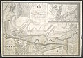
 Weimar map 1860.jpg 1,544 × 1,025; 315 KB
-
 EB9 - Plan of Weimar.png 1,321 × 1,937; 846 KB
-
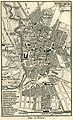 Weimar map 1894.jpg 969 × 1,595; 496 KB
-
 StadtplanWeimar1925.jpg 1,138 × 1,283; 404 KB


_p468_Plan_der_Grossherzoglichen_Residenzstadt_Weimar.jpg)


