Category:Old maps of the Holy Land
Jump to navigation
Jump to search
Use the appropriate category for maps showing all or a large part of the Holy Land. See subcategories for smaller areas:
| If the map shows | Category to use |
|---|---|
| the Holy Land on a recently created map | Category:Maps of the Holy Land or its subcategories |
| the Holy Land on a map created more than 70 years ago | Category:Old maps of the Holy Land or its subcategories |
| the history of the Holy Land on a recently created map | Category:Maps of the history of the Holy Land or its subcategories |
| the history of the Holy Land on a map created more than 70 years ago | Category:Old maps of the history of the Holy Land or its subcategories |
| Upload media | |||||
| |||||
Subcategories
This category has the following 12 subcategories, out of 12 total.
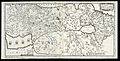
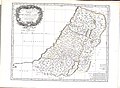
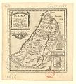
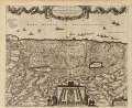
Media in category "Old maps of the Holy Land"
The following 132 files are in this category, out of 132 total.
-
 Copy of Palestina map by Marino Sanudo (originally drawn in 1320).jpg 10,360 × 7,344; 10.7 MB
-
 The map of the Holy Land by Marino Sanudo (drawn in 1320).jpg 1,950 × 1,272; 1.07 MB
-

-
 Rudimentum Holy Land.jpg 1,536 × 1,024; 535 KB
-
 Civitas Iherusalem.jpg 5,068 × 1,235; 1.87 MB
-
 Terre Saincte - btv1b55004909h (1 of 2).jpg 6,510 × 5,083; 3.98 MB
-
 Burchard of Mount Sion map of the Holy Land.jpg 11,456 × 7,936; 16.06 MB
-
 1513 map of Palestina by Martin Waldseemüller.jpg 2,047 × 1,400; 687 KB
-

-
 1543 print of Burchard of Mt. Sion's medieval map of Palestine.jpg 10,658 × 7,611; 27.33 MB
-
 Sebastian Münster, Das Heilig Juedisch Landt (FL200255483 2368805).jpg 5,976 × 4,904; 17.02 MB
-
 Das Heilige Land RMG F1745.tiff 7,442 × 4,840; 103.05 MB
-
 Palestinae sive Terrae Sanctae Descriptio (BM 1874,0613.585).jpg 2,500 × 1,829; 1.03 MB
-
 1561 map of the Levante by Girolamo Ruscelli.jpg 6,326 × 4,930; 4.47 MB
-
 Soria et Terra Santa Nuova Tavola (the Holy Land) southwest.jpg 800 × 600; 126 KB
-
 1571 map of the Holy Land by Arnoldus Montanus.jpg 4,611 × 3,302; 2.59 MB
-

-
 Das heylig Jüdisch land mit auftheilung der zwölf geschlechter — um 1579.jpg 8,759 × 6,808; 17.74 MB
-
 1581 Bunting clover leaf map.jpg 4,441 × 3,496; 14.36 MB
-
 1570 1584 Palestinae 6391.jpg 2,881 × 2,223; 4.65 MB
-
 Description of the Holy Land WDL2891.png 1,322 × 1,024; 2.54 MB
-
 Das Heilig Landt mit Auftheilung der zwolff Geschlechter.jpg 8,944 × 7,889; 17.92 MB
-

-
 1570 Palestinae Hondius.jpg 1,719 × 1,310; 1.04 MB
-
 Houghton Asia 9215.98 - Rosaccio, Siria.jpg 2,109 × 1,561; 2.76 MB
-

-
 Jakob Ziegler. Israelitis cum Galilaea ex observatione I. Ziegleri (16th century).jpg 9,448 × 5,104; 7.24 MB
-
 Map of the Holy Land (1600) small.jpg 800 × 600; 160 KB
-

-
 Map of the Holy Land, C. Harper 1600.jpg 3,500 × 1,769; 2.48 MB
-
 Map of Palestine c1600.jpg 680 × 579; 282 KB
-
 Print, book-illustration, map (BM 1895,1031.938).jpg 1,532 × 1,258; 771 KB
-
 Pietro Vesconte, The Holy Land (FL199398406 2369099).jpg 6,546 × 5,455; 13.95 MB
-
 1624 detail map of the Holy Land by Abraham Ortelius.jpg 2,013 × 3,994; 2.38 MB
-
 1624 map of the Ancient World based upon the Bible by Abraham Ortelius.jpg 13,020 × 8,862; 22.85 MB
-
 Description de la Terre Ste.jpg 2,659 × 1,902; 2.02 MB
-
 Chorographia Terrae Sancta sev Terrae Promissionis nova descriptio.jpg 2,542 × 1,772; 1.81 MB
-

-
 Print, book-illustration, map (BM 1972,U.40.9).jpg 2,500 × 1,705; 813 KB
-

-

-
 Palestina, siue Terræ Sanctæ descriptio LOC 2005625327.jpg 6,876 × 5,421; 6.84 MB
-
 Palestina, siue Terræ Sanctæ descriptio LOC 2005625327.tif 6,876 × 5,421; 106.64 MB
-
 A-3-37-70-Holy-Roman-Empire.jpg 3,000 × 2,198; 784 KB
-
 Nicolas Sanson. Iudæa. 1653.jpg 13,567 × 15,022; 10.39 MB
-

-

-
 Atlas Van der Hagen-KW1049B13 008-TERRA SANCTAE SIVE PROMISSIONIS, olim PALESTINA.jpeg 5,500 × 4,592; 4.2 MB
-
 Map - Special Collections University of Amsterdam - OTM- HB-KZL 33.09.42.tif 7,296 × 6,393; 133.45 MB
-

-
-
 1660 map - Terrae Sanctae, Seu Terrae Promissionis, Novissima Descriptio.jpg 7,678 × 6,310; 16.34 MB
-
 1660 map - Terrae Sanctae, Seu Terrae Promissionis, Novissima Descriptio (2).jpg 7,613 × 6,319; 11.77 MB
-
 Ca. 1690 map of the Holy Land by Daniel Stoopendaal.jpg 11,144 × 7,500; 16.8 MB
-
 1695 map of Palestine in Hebrew.jpg 11,935 × 6,756; 13.08 MB
-
-
 Map - Special Collections University of Amsterdam - OTM- HB-KZL 33.09.34.tif 7,166 × 6,235; 127.83 MB
-
 Canaan, or The Land of promise. LOC 99466735.jpg 5,899 × 4,114; 5.79 MB
-
 Canaan, or The Land of promise. LOC 99466735.tif 5,899 × 4,114; 69.43 MB
-
 Joseph Moxon. Canaan, or The Land of promise. 1700.jpg 5,899 × 4,083; 15.71 MB
-
 Nolin Map.Jpg 2,806 × 2,208; 1.57 MB
-
 Totius Terræ Sanctæ Delineatio. LOC 99466738.jpg 2,529 × 3,140; 1.96 MB
-
 Totius Terræ Sanctæ Delineatio. LOC 99466738.tif 3,462 × 4,038; 40 MB
-

-
-

-
 Carte de la Terre Promise. LOC 99466734.jpg 2,805 × 5,641; 3.3 MB
-

-
 Carte de la Terre Promise. LOC 99466734.tif 2,805 × 5,641; 45.27 MB
-

-
 Map - Special Collections University of Amsterdam - OTM- HB-KZL 33.10.23.tif 7,597 × 6,284; 136.58 MB
-
 1729 map of the Holy Land by Pierre Vander.jpg 1,700 × 1,308; 1.04 MB
-
 Terre Sainte.jpg 2,780 × 2,241; 1.68 MB
-
 Judaea seu Palaestina map by Homann c1741.jpg 2,953 × 2,561; 4.48 MB
-
 1744 map of the Holy Land by Matthaus Seutter.jpg 6,469 × 5,036; 8.03 MB
-
 A Map of the Holy Land and Syria - Pococke Richard - 1745.jpg 1,599 × 2,000; 1.09 MB
-

-
-
-

-
 1759 map Holy Land and 12 Tribes.jpg 2,000 × 1,676; 1.74 MB
-
 1770 Bonne Map of Israel showing the Twelve Tribes - Geographicus - Israel-bonne-1770.jpg 4,000 × 2,847; 2.61 MB
-
 Map - Special Collections University of Amsterdam - OTM- HB-KZL 33.10.24.tif 5,555 × 4,259; 67.69 MB
-
 Map of the Holy Land by Samuel Dunn, published 1804.jpg 12,176 × 16,971; 33.83 MB
-

-
 Carte de la Palestine ou Terre Sainte LOC 2012590215.tif 7,657 × 10,193; 223.3 MB
-
 Rawson, A.L. Map of Palestine and all Bible lands. 1873.jpg 5,823 × 8,139; 44.47 MB
-
 136 of '“Those Holy Fields.” Palestine, illustrated by pen and pencil' (11106365845).jpg 2,992 × 2,070; 1.85 MB
-
 Chaim Solomon Pinia. Panorama des heiligen Landes. 1875.jpg 2,814 × 2,200; 1.33 MB
-
 Edward Weller, Map of the Holy Land (FL7330201 2649689).jpg 7,100 × 6,208; 60.49 MB
-
 Edward Weller, Map of the Holy Land (FL7330207 2649689).jpg 7,184 × 6,392; 72.34 MB
-
 Land of Israel by Rabbi Chaim Salomon Pinta of Zefat.1875.jpg 800 × 600; 735 KB
-
 Det Heliga Landet (FL49973606 4073171).jpg 4,397 × 6,367; 22.76 MB
-
 Palestine or The Holy Land.jpg 8,505 × 11,945; 14.21 MB
-
 A dictionary of the Bible.. (1887) (14781750285).jpg 1,848 × 1,928; 645 KB
-
 A dictionary of the Bible.. (1887) (14781539332).jpg 2,000 × 3,208; 668 KB
-
 105 of 'Buried Cities and Bible Countries' (11212909116).jpg 1,325 × 1,780; 570 KB
-
 Birds Eye View of the Holy Land.jpg 8,149 × 6,503; 17.7 MB
-
 20 of 'Jerusalem and the Holy Land in 1882' (11163372084).jpg 2,100 × 3,270; 1.41 MB
-

-
 3.1 Canaan 1595 Speed².JPG 7,831 × 6,161; 48.77 MB
-

-
 A dictionary of the Bible.. (1887) (14595257738).jpg 3,328 × 2,116; 1,003 KB
-
 Ca. 1850 manuscript map of the Holy Land.jpg 5,580 × 9,650; 6.31 MB
-
 Canaan (Spruner-Menke, Atlas Antiquus, 1865).jpg 6,698 × 5,448; 27.02 MB
-

-

-
 HOLY LAND Gerard de Jode. Speculum Orbis Terrarum.jpg 800 × 588; 269 KB
-

-
 Kaart van het Heilige Land Bijbelkaarten (serietitel), RP-P-1990-414.jpg 6,300 × 4,258; 7.13 MB
-
 Kaart van het Koninkrijk Israël, RP-P-OB-46.322.jpg 5,530 × 4,410; 3.2 MB
-
 Kaart van Israël Carte de la Terre Sainte (titel op object), RP-P-1896-A-19368-2444.jpg 6,442 × 5,408; 4.39 MB
-

-
 Karta egypten gamla tiden.jpg 1,767 × 1,282; 803 KB
-
 Map of The River Jordan. 1871.jpg 1,679 × 2,734; 1.09 MB
-

-
 Part IId. of the compleat map of the Holy Land (NYPL b13919861-5207426).jpg 8,018 × 6,658; 43.45 MB
-
 A map of the countries and places, mentioned in the New Testament (NYPL b13919861-5207427).jpg 8,081 × 6,647; 39.76 MB
-
 A compleat map of the Holy Land; adapted to the Old and New Testament (NYPL b13919861-5207425).tiff 10,326 × 7,758, 2 pages; 229.46 MB
-
 Part IId. of the compleat map of the Holy Land (NYPL b13919861-5207426).tiff 10,326 × 7,758, 2 pages; 229.46 MB
-
 A map of the countries and places, mentioned in the New Testament (NYPL b13919861-5207427).tiff 10,326 × 7,758, 2 pages; 229.46 MB
-

-

-
 Terra Sancta quae in Sacris Terra Promissionis olim Palestina (NYPL b13963883-ps map 193).tiff 4,072 × 4,072; 47.47 MB
-
 Palestine in the time of Jesus.jpg 1,826 × 2,573; 720 KB
-

-

-
 Promised Land Armenian map.jpg 411 × 310; 84 KB
-
 Routes et Villes de la Palestine. 1905-1905.jpg 1,870 × 2,365; 1.34 MB
-
 Terra Canaan.jpg 2,172 × 1,888; 1.67 MB
-
 Terra Moriath sive Solymarum ager suburbanus - William Marshall Sculp.jpg 1,536 × 1,309; 503 KB
-

.jpg)
.jpg)
%27_(11254181254).jpg)

.jpg)


.jpg)
.jpg)

_southwest.jpg)


_57.jpg)
.jpg)
_small.jpg)


.jpg)
.jpg)


.jpg)
.jpg)
,_Recently_Depicted_and_Published_WDL210.png)


.jpg)


.jpg)


.jpg)


_-_Geographicus_-_Palestina-homannheirs-1750.jpg)
.jpg)


%27_(11005378264).jpg)

.jpg)

.jpg)
.jpg)

.jpg)

_(14781750285).jpg)
_(14781539332).jpg)
.jpg)

.jpg)
_With_..._illustrations_from_photographs,_engraved_by_J._Swain%27_(11072765766).jpg)

_With_..._illustrations_from_photographs,_engraved_by_J._Swain%27_(11052359113).jpg)
_(14595257738).jpg)

.jpg)


.jpg)
,_RP-P-1990-414.jpg)

,_RP-P-1896-A-19368-2444.jpg)
_(titel_op_object),_RP-P-1905-6619.jpg)


.jpg)
.jpg)
.jpg)
.jpg)
.jpg)

.jpg)
_(cropped).jpg)


