Category:Old maps of the history of New Zealand
Jump to navigation
Jump to search
Use the appropriate category for maps showing all or a large part of New Zealand. See subcategories for smaller areas:
| If the map shows | Category to use |
|---|---|
| New Zealand on a recently created map | Category:Maps of New Zealand or its subcategories |
| New Zealand on a map created more than 70 years ago | Category:Old maps of New Zealand or its subcategories |
| the history of New Zealand on a recently created map | Category:Maps of the history of New Zealand or its subcategories |
| the history of New Zealand on a map created more than 70 years ago | Category:Old maps of the history of New Zealand or its subcategories |
Media in category "Old maps of the history of New Zealand"
The following 14 files are in this category, out of 14 total.
-
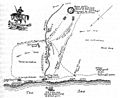 Battlefield of katikara 1863.jpg 694 × 568; 85 KB
-
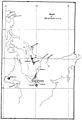
 Lake Waikaremoana and Urewera Country.jpg 515 × 718; 26 KB
-
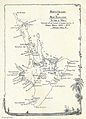
 Locality plan of orakau.jpg 759 × 756; 147 KB
-
 New Zealand-Map-by-Tuki-1798.jpg 2,413 × 3,217; 483 KB
-
 North island of new zealand showing sites of engagements in maori campaigns.jpg 1,359 × 1,884; 425 KB
-
 Old Westland Tasman map.jpg 2,553 × 1,772; 551 KB
-
 Plan of tauranga ika pa.jpg 1,870 × 1,364; 533 KB
-
 Plan of waerenga-a-hika pa and battlefield.jpg 1,886 × 1,353; 516 KB
-
 Rambles in New Zealand p10.jpg 1,521 × 2,231; 240 KB
-
 Rangiaowhia.jpg 1,281 × 711; 215 KB
-
 Rough sketch map of Rangiriri, and Paetai on the Waikato River c1863 (27834851896).jpg 4,667 × 3,269; 2.33 MB
-
 Tahiti and New Zealand map with track of the Endeavour.jpg 738 × 1,283; 332 KB
-
 Te Ngutu o te Manu (14882374558).jpg 3,532 × 6,736; 11.82 MB
-
 The battlefield of moturoa.jpg 1,138 × 1,749; 414 KB


.jpg)

.jpg)
