Category:Op Hoop Van Beter, Ingen
Jump to navigation
Jump to search
| Object location | | View all coordinates using: OpenStreetMap |
|---|
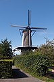
windmill in Ingen, Netherlands  | |||||
| Upload media | |||||
| Instance of | |||||
|---|---|---|---|---|---|
| Location | Ingen, Buren, Gelderland, Netherlands | ||||
| Street address |
| ||||
| Located on street |
| ||||
| Has use | |||||
| Heritage designation |
| ||||
| Source of energy | |||||
 | |||||
|
This is a category about rijksmonument number 25844
|
| Address |
|
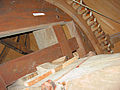
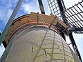
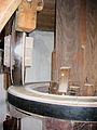
Media in category "Op Hoop Van Beter, Ingen"
The following 41 files are in this category, out of 41 total.
-
 Exterieur IN RESTAURATIE - Ingen - 20290194 - RCE.jpg 1,200 × 1,200; 246 KB
-
 Exterieur IN RESTAURATIE - Ingen - 20290195 - RCE.jpg 1,186 × 1,200; 256 KB
-
 Exterieur KAP - Ingen - 20290032 - RCE.jpg 1,200 × 1,188; 263 KB
-

-
 Exterieur OVERZICHT (TIJDENS RESTAURATIE) - Ingen - 20292743 - RCE.jpg 1,197 × 1,200; 178 KB
-
 Ingen, stellingmolen Op Hoop Van Beter RM25844 IMG 2483 2019-09-15 13.29.jpg 3,648 × 5,472; 11.9 MB
-
 Molen Op Hoop Van Beter 17 september 2010 (1).jpg 2,293 × 3,143; 1.52 MB
-
 Molen Op Hoop Van Beter 17 september 2010.jpg 2,373 × 3,201; 2.06 MB
-
 Molen Op Hoop Van Beter askop.jpg 2,448 × 3,264; 2.57 MB
-
 Molen op Hoop van Beter baard (1).jpg 2,448 × 3,264; 1.52 MB
-
 Molen op Hoop van Beter baard.jpg 1,704 × 2,272; 670 KB
-
 Molen op Hoop van Beter bovenrondsel.jpg 1,704 × 2,272; 882 KB
-
 Molen Op Hoop Van Beter bovenwiel (1).jpg 3,264 × 2,448; 1.58 MB
-
 Molen Op Hoop Van Beter bovenwiel bovenschijfloop (1).jpg 2,448 × 3,264; 1.68 MB
-
 Molen Op Hoop Van Beter bovenwiel bovenschijfloop.jpg 2,448 × 3,264; 1.83 MB
-
 Molen Op Hoop Van Beter bovenwiel pal.jpg 2,448 × 3,264; 1.8 MB
-
 Molen Op Hoop Van Beter bovenwiel vulstukken.jpg 2,448 × 3,264; 1.67 MB
-
 Molen Op Hoop Van Beter bovenwiel.jpg 2,272 × 1,704; 768 KB
-
 Molen Op Hoop Van Beter buil zeef.jpg 2,293 × 3,139; 2.13 MB
-
 Molen Op Hoop Van Beter Engels kruiwerk.jpg 3,110 × 2,261; 1.35 MB
-
 Molen Op Hoop Van Beter gaffelwiel.jpg 1,704 × 2,272; 671 KB
-
 Molen op Hoop van Beter ingang.jpg 1,704 × 2,272; 1.26 MB
-
 Molen Op Hoop Van Beter kap stijgergaten.jpg 3,201 × 2,374; 1.51 MB
-
 Molen Op Hoop Van Beter kap verven.jpg 3,264 × 2,448; 1.98 MB
-
 Molen Op Hoop Van Beter kruiwiel.jpg 2,448 × 3,264; 1.56 MB
-
 Molen op Hoop van Beter lendestut.jpg 2,272 × 1,704; 707 KB
-
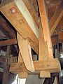
 Molen op Hoop van Beter maalkoppel met strijker.jpg 2,448 × 3,264; 1.59 MB
-
 Molen Op Hoop Van Beter sleepluiwerk.jpg 1,704 × 2,272; 929 KB
-
 Molen Op Hoop Van Beter spoorwiel met steenrondsel.jpg 1,704 × 2,272; 840 KB
-
 Molen Op Hoop Van Beter spoorwiel.jpg 1,704 × 2,272; 977 KB
-
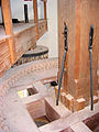
 Molen Op Hoop Van Beter stelling.jpg 1,704 × 2,272; 835 KB
-
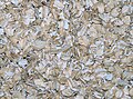 Molen op Hoop van Beter tarwe (Triticum aestivum) geplet.jpg 2,812 × 2,074; 1.83 MB
-
 Molen op Hoop van Beter vanganker koebout.jpg 2,448 × 3,264; 1.74 MB
-
 Molen op Hoop van Beter vanganker.jpg 1,704 × 2,272; 794 KB
-
 Molen op Hoop van Beter vangbalk en ezel.jpg 1,704 × 2,272; 947 KB
-
 Molen op Hoop van Beter vangbalk haak hangereel.jpg 2,319 × 3,174; 1.24 MB
-
 Molen Op Hoop Van Beter vangbalk luiwerk.jpg 1,704 × 2,272; 702 KB
-
 Molen op Hoop van Beter vangbalk met haak.jpg 1,704 × 2,272; 797 KB
-
 Molen op Hoop van Beter.jpg 1,704 × 2,272; 702 KB
-
 Romp van korenmolen - Ingen - 20120298 - RCE.jpg 791 × 1,200; 166 KB
-
 Zicht op de kale romp voor restauratie met omgeving - Ingen - 20369784 - RCE.jpg 1,200 × 1,200; 279 KB


_-_Ingen_-_20292743_-_RCE.jpg)

.jpg)


.jpg)


.jpg)
.jpg)


_geplet.jpg)


