Category:Ophaalbrug Garnwerd
Jump to navigation
Jump to search
| Object location | | View all coordinates using: OpenStreetMap |
|---|
| Upload media | |||||
| Instance of | |||||
|---|---|---|---|---|---|
| Location | Garnwerd, Het Hogeland, Groningen, Netherlands | ||||
| Has part(s) | |||||
| Heritage designation |
| ||||
 | |||||
Nederlands: IJzeren ophaalbrug over het Reitdiep, Garnwerd
|
This is a category about rijksmonumentcomplex number 510787
|
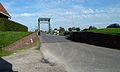
Brug
|
This is a category about rijksmonument number 510788
|
Oostelijke dijkcoupure
|
This is a category about rijksmonument number 510789
|
Schotbalkhuisje
|
This is a category about rijksmonument number 510790
|
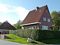
Brugwachterswoning (Hunzeweg 36)
|
This is a category about rijksmonument number 510791
|
Westelijke dijkcoupure
|
This is a category about rijksmonument number 510792
|
| Address |
|
Media in category "Ophaalbrug Garnwerd"
The following 13 files are in this category, out of 13 total.
-
 Dijk coupure.JPG 4,608 × 3,456; 1.87 MB
-
 Exterieur OVERZICHT - Garnwerd - 20280857 - RCE.jpg 1,197 × 1,200; 366 KB
-
 Exterieur OVERZICHT - Garnwerd - 20280885 - RCE.jpg 1,195 × 1,200; 233 KB
-
 Exterieur OVERZICHT NAAR HET NOORDEN - Garnwerd - 20280868 - RCE.jpg 1,192 × 1,200; 241 KB
-
 Exterieur OVERZICHT NAAR HET OOSTEN - Garnwerd - 20280864 - RCE.jpg 1,192 × 1,200; 367 KB
-
 Exterieur OVERZICHT VANUIT HET OOSTEN - Garnwerd - 20280852 - RCE.jpg 1,195 × 1,200; 316 KB
-
 Exterieur OVERZICHT VANUIT ZUIDOOSTEN - Garnwerd - 20280845 - RCE.jpg 1,197 × 1,200; 291 KB
-
 Garnwerd - dijkcoupure binnen.jpg 3,885 × 2,330; 2.57 MB
-
 Garnwerd - dijkcoupure buiten.jpg 3,237 × 2,428; 2.64 MB
-
 Garnwerd - Hunzeweg 36.jpg 2,835 × 2,127; 2.45 MB
-
 Garnwerd - ophaalbrug.jpg 3,777 × 2,267; 2.91 MB
-
 Garnwerd - schotbalkhuisje.jpg 4,000 × 3,000; 4.04 MB
-
 Garnwerd entree met brug en molen (33972878254).jpg 1,536 × 1,024; 1.09 MB


.jpg)