Category:Oppenweher Klus
Jump to navigation
Jump to search
| Object location | | View all coordinates using: OpenStreetMap |
|---|
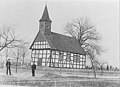
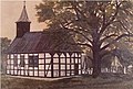
church building in Stemwede, Germany  | |||||
| Upload media | |||||
| Instance of | |||||
|---|---|---|---|---|---|
| Location | Stemwede, Minden-Lübbecke District, Detmold Government Region, North Rhine-Westphalia, Germany | ||||
 | |||||
Media in category "Oppenweher Klus"
The following 5 files are in this category, out of 5 total.
-
 2019-08-04 Friedhofslinde Stemwede-Oppenwehe (NRW) 01.jpg 4,632 × 3,464; 25.02 MB
-
 Alte Klus.jpg 854 × 620; 58 KB
-
 Friedhofslinde-Oppenwehe.jpg 2,269 × 2,420; 4.06 MB
-
 Neue Klus bei Nacht.jpg 1,600 × 1,067; 331 KB
-
 Oppenweher Klus.jpg 271 × 184; 14 KB
_01.jpg)


