Category:Ortsbildschutzzone Gais AR
Jump to navigation
Jump to search
| Object location | | View all coordinates using: OpenStreetMap |
|---|
| NO WIKIDATA ID FOUND! Search for Ortsbildschutzzone Gais AR on Wikidata | |
| Upload media |
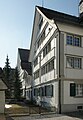
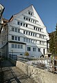
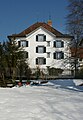
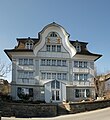
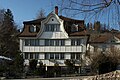
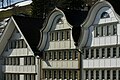
- Deutsch: Die Ortsbildschutzzone von nationaler Bedeutung bezeichnet den Dorfplatz von Gais, mit den umliegenden Häusern. Gais wurde 1977 für seinen Dorfplatz mit dem Wakkerpreis ausgezeichnet.
Media in category "Ortsbildschutzzone Gais AR"
The following 22 files are in this category, out of 22 total.
-
 Dorfplatz 1 Gais AR.JPG 2,601 × 3,757; 1.78 MB
-
 Dorfplatz 10 9056 Gais P1031501.jpg 3,888 × 5,184; 2.22 MB
-
 Dorfplatz 11 9056 Gais P1031524.jpg 3,888 × 5,184; 8.87 MB
-
 Dorfplatz 12 Gais AR.JPG 2,587 × 3,737; 1.69 MB
-
 Dorfplatz 2 Gais AR 1.JPG 2,655 × 3,835; 2.02 MB
-
 Dorfplatz 4 Gais AR 2.JPG 2,759 × 3,985; 2.26 MB
-
 Dorfplatz 4 Gais AR 3.JPG 2,695 × 3,892; 1.79 MB
-
 Dorfplatz 4 Gais AR.JPG 2,691 × 3,887; 2.11 MB
-
 Dorfplatz 5 Gais AR UBS.JPG 2,591 × 3,742; 2.45 MB
-
 Dorfplatz 8 9056 Gais P1031496.jpg 3,888 × 5,184; 2.22 MB
-
 Dorfplatz 9 9056 Gais P1031498.jpg 3,888 × 5,184; 9.55 MB
-
 Dorfplatz Gais AR 1.JPG 3,764 × 2,759; 2.33 MB
-
 Dorfplatz Gais AR 2.JPG 4,149 × 2,638; 2.39 MB
-
 Gais AR Dorfplatz Panorama 1.jpg 6,351 × 1,435; 6.67 MB
-
 Gais AR Dorfplatz Panorama.jpg 6,480 × 1,748; 2.81 MB
-
 Hinterdorf 1 Gais AR.JPG 2,848 × 4,272; 3.24 MB
-
 Hinterdorf 5 Gais AR.jpg 3,465 × 3,771; 2.18 MB
-
 Hinterdorf 7 Gais AR.JPG 2,475 × 3,368; 1.2 MB
-
 Langgasse 10 Gais AR.JPG 4,110 × 2,747; 2.58 MB
-
 Langgasse 2 4 6 Gais AR .JPG 4,178 × 2,770; 2.26 MB
-
 Langgasse 2 4 6 Gais AR.JPG 4,062 × 2,681; 2.28 MB
-
 Schwantlern 23 Gais AR.jpg 3,970 × 3,970; 2.99 MB


