Category:Oud Aalden 8, Aalden
Jump to navigation
Jump to search
| Object location | | View all coordinates using: OpenStreetMap |
|---|
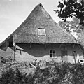
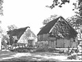
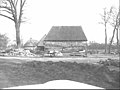
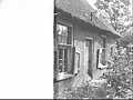
farmhouse in Coevorden, Netherlands  | |||||
| Upload media | |||||
| Instance of | |||||
|---|---|---|---|---|---|
| Location | Aalden, Coevorden, Drenthe, Netherlands | ||||
| Located on street |
| ||||
| Heritage designation |
| ||||
 | |||||
|
This is a category about rijksmonument number 41521
|
| Address |
|
Media in category "Oud Aalden 8, Aalden"
The following 107 files are in this category, out of 107 total.
-
 Achter- en zijgevel nr. F 324-19 - Aalden - 20439533 - RCE.jpg 1,200 × 900; 178 KB
-
 Achter- en zijgevel nr. F 324-20 - Aalden - 20439511 - RCE.jpg 1,200 × 900; 171 KB
-
 Achtergevel - Aalden - 20439524 - RCE.jpg 1,200 × 900; 156 KB
-
 Achtergevel - Aalden - 20439525 - RCE.jpg 1,200 × 900; 101 KB
-
 Achtergevel - Aalden - 20439526 - RCE.jpg 1,200 × 900; 161 KB
-
 Achtergevel nr. F 324-02 - Aalden - 20439452 - RCE.jpg 1,200 × 900; 118 KB
-

-
 Baander detail grendel - Aalden - 20439531 - RCE.jpg 1,200 × 900; 142 KB
-
 Bedstedewand nr. F 321-36 - Aalden - 20439435 - RCE.jpg 1,200 × 900; 105 KB
-
 Boerderij en schuren nr. F 324-16 - Aalden - 20439508 - RCE.jpg 1,200 × 900; 103 KB
-
 Boerderij en schuren nr. F 324-17 - Aalden - 20439509 - RCE.jpg 1,200 × 900; 118 KB
-
 Boerderij en wagenschuur nr. 58469 - Aalden - 20439463 - RCE.jpg 1,200 × 900; 122 KB
-
 Boerderij met bijgebouwen - Aalden - 20439523 - RCE.jpg 1,200 × 900; 173 KB
-
 Boerderij met bijgebouwen nr. F 324-10 - Aalden - 20439458 - RCE.jpg 1,200 × 900; 157 KB
-
 Boerderij met bijgebouwen nr. F 324-11 - Aalden - 20439459 - RCE.jpg 1,200 × 900; 162 KB
-
 Boerderij met bijgebouwen nr. F 7-19 - Aalden - 20439469 - RCE.jpg 1,200 × 900; 171 KB
-
 Boerderij met schuur - Aalden - 20439522 - RCE.jpg 613 × 887; 76 KB
-
 Boerderij, bijgebouwen en erf nr. F 7-21 - Aalden - 20439470 - RCE.jpg 1,200 × 900; 184 KB
-
 Deel achtergevel - Aalden - 20439527 - RCE.jpg 1,200 × 900; 188 KB
-
 Deel achtergevel nr. F 324-04 - Aalden - 20439454 - RCE.jpg 1,200 × 900; 79 KB
-
 Deel achtergevel nr. F 324-05 - Aalden - 20439455 - RCE.jpg 1,200 × 900; 71 KB
-
 Deel met pomp - Aalden - 20439498 - RCE.jpg 1,200 × 900; 100 KB
-
 Deel voorgevel - Aalden - 20439483 - RCE.jpg 1,200 × 900; 180 KB
-
 Deel voorgevel - Aalden - 20439485 - RCE.jpg 1,200 × 900; 156 KB
-
 Deel voorgevel nr. F 323-09 - Aalden - 20439449 - RCE.jpg 1,200 × 900; 102 KB
-
 Deel voorgevel nr. F 323-10 - Aalden - 20439450 - RCE.jpg 1,200 × 900; 104 KB
-
 Deel zijgevel - Aalden - 20439493 - RCE.jpg 1,200 × 900; 125 KB
-
 Deel zijgevel - Aalden - 20439499 - RCE.jpg 1,200 × 900; 171 KB
-
 Deel zijgevel nr. F 324-36 - Aalden - 20439516 - RCE.jpg 1,200 × 900; 101 KB
-
 Deel zijgevel nr. F 324-38 - Aalden - 20439518 - RCE.jpg 1,200 × 900; 190 KB
-
 Deeldeur naar spoelkeuken - Aalden - 20439497 - RCE.jpg 1,200 × 900; 97 KB
-
 Deeldeuren achtergevel - Aalden - 20439528 - RCE.jpg 1,200 × 900; 81 KB
-
 Deeldeuren achtergevel - Aalden - 20439529 - RCE.jpg 1,200 × 900; 68 KB
-
 Deeldeuren achtergevel nr. F 324-03 - Aalden - 20439453 - RCE.jpg 1,200 × 900; 79 KB
-
 Deeldeuren achtergevel nr. Oud Aalden 2 - Aalden - 20439467 - RCE.jpg 955 × 888; 120 KB
-
 Detail baander achtergevel - Aalden - 20439530 - RCE.jpg 1,200 × 900; 80 KB
-
 Detail voorgevel - Aalden - 20439481 - RCE.jpg 1,200 × 900; 89 KB
-
 Detail voorgevel - Aalden - 20439482 - RCE.jpg 1,200 × 900; 151 KB
-
 Detail voorgevel nr. F 323-01 - Aalden - 20439443 - RCE.jpg 1,200 × 900; 103 KB
-
 Detail voorgevel nr. F 323-06 - Aalden - 20439460 - RCE.jpg 1,200 × 900; 110 KB
-
 Detail voorgevel nr. F 323-07 - Aalden - 20439447 - RCE.jpg 1,200 × 900; 112 KB
-
 Detail zijgevel met emmerrek nr. F 324-40 - Aalden - 20439520 - RCE.jpg 1,200 × 900; 189 KB
-
 Detail zijgevel nr. F 324-32 - Aalden - 20439512 - RCE.jpg 1,200 × 900; 202 KB
-
 Detail zijgevel nr. F 324-39 - Aalden - 20439534 - RCE.jpg 1,200 × 900; 194 KB
-
 Deur en raam zijgevel - Aalden - 20439519 - RCE.jpg 1,200 × 900; 117 KB
-
 Deur voorgevel nr. F 323-02 - Aalden - 20439444 - RCE.jpg 1,200 × 900; 93 KB
-
 Deur zijgevel - Aalden - 20439491 - RCE.jpg 1,200 × 900; 104 KB
-
 Deur zijgevel - Aalden - 20439532 - RCE.jpg 1,200 × 900; 90 KB
-
 Deur zijgevel nr. F 324-33 - Aalden - 20439513 - RCE.jpg 1,200 × 900; 174 KB
-
 Deur zijgevel nr. F 324-35 - Aalden - 20439515 - RCE.jpg 1,200 × 900; 173 KB
-
 Hoek voor- en zijgevel - Aalden - 20439487 - RCE.jpg 1,200 × 900; 96 KB
-
 Houten hek nr. F 324-13 - Aalden - 20439446 - RCE.jpg 1,200 × 900; 127 KB
-
 Interieur bedr.ged. - Aalden - 20439496 - RCE.jpg 1,200 × 900; 134 KB
-
 Interieur nr. F 321-26 - Aalden - 20439471 - RCE.jpg 1,200 × 900; 123 KB
-
 Interieur nr. F 321-28 - Aalden - 20439472 - RCE.jpg 1,200 × 900; 103 KB
-
 Interieur nr. F 321-29 - Aalden - 20439473 - RCE.jpg 1,200 × 900; 146 KB
-
 Interieur nr. F 321-30 - Aalden - 20439474 - RCE.jpg 1,200 × 900; 123 KB
-
 Interieur nr. F 321-31 - Aalden - 20439475 - RCE.jpg 1,200 × 900; 130 KB
-
 Interieur nr. F 321-34 - Aalden - 20439465 - RCE.jpg 1,200 × 900; 74 KB
-
 Interieur nr. F 321-35 - Aalden - 20439464 - RCE.jpg 1,200 × 900; 73 KB
-
 Interieur woonged. nr. F 321-32 - Aalden - 20439476 - RCE.jpg 1,200 × 900; 125 KB
-
 Interieur woonged. nr. F 321-33 - Aalden - 20439448 - RCE.jpg 1,200 × 900; 147 KB
-
 Interieur woonkeuken nr. F 321-01 - Aalden - 20439440 - RCE.jpg 1,200 × 900; 108 KB
-
 Interieur woonkeuken nr. F 321-02 - Aalden - 20439441 - RCE.jpg 1,200 × 900; 75 KB
-
 Interieur woonkeuken nr. F 321-03 - Aalden - 20439442 - RCE.jpg 1,200 × 900; 131 KB
-
 Interieur woonkeuken nr. F 321-43 - Aalden - 20439439 - RCE.jpg 1,200 × 900; 132 KB
-
 Kop- en zijgevel - Aalden - 20439494 - RCE.jpg 1,200 × 900; 175 KB
-
 Kopgevel - Aalden - 20439495 - RCE.jpg 1,200 × 900; 91 KB
-
 Kopgevel nr. F 324-18 - Aalden - 20439510 - RCE.jpg 1,200 × 900; 125 KB
-
 Oud Aalden 8 met bijschuur.jpg 4,608 × 3,456; 3.19 MB
-
 Oud Aalden 8.jpg 4,608 × 3,456; 3.63 MB
-
 Overstek voorgevel - Aalden - 20439488 - RCE.jpg 1,200 × 900; 93 KB
-
 Overstek voorgevel - Aalden - 20439489 - RCE.jpg 1,200 × 900; 73 KB
-
 Overstek voorgevel nr. F 323-08 - Aalden - 20439434 - RCE.jpg 1,200 × 900; 81 KB
-
 Overzicht erf nr. F 324-08 - Aalden - 20439456 - RCE.jpg 1,200 × 900; 136 KB
-

-
 Raam en deur zijgevel - Aalden - 20439500 - RCE.jpg 1,200 × 900; 103 KB
-
 Raam en deur zijgevel nr. F 324-41 - Aalden - 20439506 - RCE.jpg 1,200 × 900; 188 KB
-
 Raam met luiken zijgevel nr. F 324-34 - Aalden - 20439514 - RCE.jpg 1,200 × 900; 181 KB
-
 Raam voorgevel nr. F 323-03 - Aalden - 20439445 - RCE.jpg 1,200 × 900; 100 KB
-
 Raam zijgevel - Aalden - 20439479 - RCE.jpg 1,200 × 900; 114 KB
-
 Ramen met luiken zijgevel - Aalden - 20439492 - RCE.jpg 1,200 × 953; 68 KB
-
 Ramen met luiken zijgevel nr. F 324-37 - Aalden - 20439517 - RCE.jpg 1,200 × 900; 181 KB
-
 Rieten dak - Aalden - 20439501 - RCE.jpg 1,200 × 900; 118 KB
-
 Rieten dak voorgevel - Aalden - 20439484 - RCE.jpg 1,200 × 900; 102 KB
-
-

-
 Schouw met fornuis en kachel nr. F 321-38 - Aalden - 20439436 - RCE.jpg 1,200 × 900; 85 KB
-
 Schouw met fornuis en kachel nr. F 321-39 - Aalden - 20439437 - RCE.jpg 1,200 × 900; 82 KB
-
 Schouw met fornuis nr. F 321-40 - Aalden - 20439438 - RCE.jpg 1,200 × 900; 89 KB
-
 Voor- en zijgevel nr. F 324-14 - Aalden - 20439477 - RCE.jpg 1,200 × 900; 138 KB
-
 Voorgevel nr. F 323-11 - Aalden - 20439451 - RCE.jpg 1,200 × 900; 134 KB
-
 Voorgevel nr. F 324-12 - Aalden - 20439490 - RCE.jpg 1,200 × 900; 188 KB
-
 Voorgevel van rietgedekte boerderij - Aalden - 20003256 - RCE.jpg 1,197 × 1,200; 422 KB
-
 Voorzolderluik - Aalden - 20439486 - RCE.jpg 1,200 × 900; 126 KB
-
 Zij- en achtergevel nr. F 324-15 - Aalden - 20439507 - RCE.jpg 1,200 × 900; 131 KB
-
 Zij- en achtergevel nr. Oud Aalden 1 - Aalden - 20439461 - RCE.jpg 1,200 × 900; 128 KB
-
 Zij- en kopgevel nr. 3-18 - Aalden - 20439462 - RCE.jpg 1,200 × 900; 150 KB
-
 Zij- en kopgevel nr. Oud Aalden 4 - Aalden - 20439466 - RCE.jpg 1,200 × 900; 140 KB
-
 Zij- en voorgevel - Aalden - 20439480 - RCE.jpg 1,200 × 900; 166 KB
-
 Zijgevel - Aalden - 20439478 - RCE.jpg 1,200 × 900; 156 KB
-
 Zijgevel - Aalden - 20439505 - RCE.jpg 1,200 × 900; 143 KB
-
 Zijgevel nr. F 2-15 - Aalden - 20439468 - RCE.jpg 1,200 × 900; 143 KB
-
 Zijgevel nr. F 324-09 - Aalden - 20439457 - RCE.jpg 1,200 × 900; 169 KB
-
 Zijgevel nr. F 324-21 - Aalden - 20439535 - RCE.jpg 1,200 × 900; 118 KB
-
 Zijgevel van rietgedekte boerderij - Aalden - 20003257 - RCE.jpg 1,200 × 1,198; 495 KB
-
 Zijgevel woonged. - Aalden - 20439521 - RCE.jpg 1,200 × 900; 122 KB


