Category:Oudegracht 239, Utrecht
Jump to navigation
Jump to search
| Object location | | View all coordinates using: OpenStreetMap |
|---|
 | |||||
| Upload media | |||||
| Instance of |
| ||||
|---|---|---|---|---|---|
| Location | Utrecht, Netherlands | ||||
| Street address |
| ||||
| Located on street | |||||
| Heritage designation |
| ||||
 | |||||
|
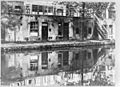
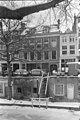
This is a category about rijksmonument number 36540
|
| Address |
|
Media in category "Oudegracht 239, Utrecht"
The following 4 files are in this category, out of 4 total.
-
 Achtergevels ? - Utrecht - 20236766 - RCE.jpg 1,200 × 872; 271 KB
-
 Oudegracht 239.JPG 2,592 × 3,456; 4.35 MB
-
 Voorgevel - Utrecht - 20236765 - RCE.jpg 803 × 1,200; 213 KB
-
 Voorgevel - Utrecht - 20236768 - RCE.jpg 804 × 1,200; 190 KB


