Category:Oudestraat 155, Kampen
Jump to navigation
Jump to search
| Object location | | View all coordinates using: OpenStreetMap |
|---|
building in Kampen, Netherlands .JPG) | |||||
| Upload media | |||||
| Instance of | |||||
|---|---|---|---|---|---|
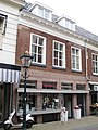
| Location | Kampen, Overijssel, Netherlands | ||||
| Heritage designation |
| ||||
 | |||||
|
This is a category about rijksmonument number 23116
|
| Address |
|
Media in category "Oudestraat 155, Kampen"
The following 2 files are in this category, out of 2 total.
-
 Kampen 9-2011 (60).JPG 1,944 × 2,592; 1.17 MB
-
 Voorgevel - Kampen - 20123356 - RCE.jpg 806 × 1,200; 218 KB
