Category:Ouvrage du Hackenberg
Jump to navigation
Jump to search
| Object location | | View all coordinates using: OpenStreetMap |
|---|
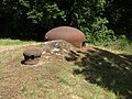
gros ouvrage of the Maginot Line  Otočná výsuvná dělostřelecká věž pro dvě houfnice ráže 135 mm v objektu B9 na levém křídle tvrze | |||||
| Upload media | |||||
| Instance of |
| ||||
|---|---|---|---|---|---|
| Part of | |||||
| Location | Veckring, Moselle, Grand Est, Metropolitan France, France | ||||
 | |||||
fr:Ouvrage du Hackenberg, un des plus gros ouvrages de la fr:Ligne_Maginot
Subcategories
This category has only the following subcategory.
W
- Weapons in Ouvrage du Hackenberg (10 F)
Media in category "Ouvrage du Hackenberg"
The following 200 files are in this category, out of 384 total.
(previous page) (next page)-
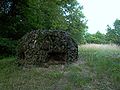 A19 hackenberg gfm 001.jpg 640 × 480; 101 KB
-
 A19 hackenberg wieza km 001.jpg 640 × 480; 81 KB
-
-

-
 Fort Hackenberg Sep10 001.jpg 900 × 602; 370 KB
-
 Fort Hackenberg Sep10 002.jpg 900 × 602; 264 KB
-
 Fort Hackenberg Sep10 003.jpg 900 × 602; 358 KB
-
 Fort Hackenberg Sep10 005.jpg 602 × 900; 330 KB
-
 Fort Hackenberg Sep10 006.jpg 900 × 602; 302 KB
-
 Fort Hackenberg Sep10 007.jpg 603 × 901; 303 KB
-
 Fort Hackenberg Sep10 010.jpg 900 × 602; 328 KB
-
 Fort Hackenberg Sep10 011.jpg 900 × 602; 330 KB
-
 Fort Hackenberg.jpg 1,600 × 1,200; 367 KB
-
 French soldiers on Maginot Line.jpg 500 × 314; 43 KB
-
 Gros Ouvrage du Hackenberg (9621794965).jpg 2,736 × 3,648; 5.97 MB
-
 Gros Ouvrage du Hackenberg (9621797727).jpg 2,736 × 3,648; 5.42 MB
-
 Gros Ouvrage du Hackenberg (9621804881).jpg 2,736 × 3,648; 5.3 MB
-
 Gros Ouvrage du Hackenberg (9621807337).jpg 2,736 × 3,648; 5.25 MB
-
 Gros Ouvrage du Hackenberg (9621809009).jpg 2,736 × 3,648; 6.91 MB
-
 Gros Ouvrage du Hackenberg (9621814513).jpg 3,648 × 2,736; 6.28 MB
-
 Gros Ouvrage du Hackenberg (9621817821).jpg 3,648 × 2,736; 7.13 MB
-
 Gros Ouvrage du Hackenberg (9621828269).jpg 3,648 × 2,736; 6.13 MB
-
 Gros Ouvrage du Hackenberg (9621830125).jpg 2,816 × 2,112; 1.06 MB
-
 Gros Ouvrage du Hackenberg (9621833101).jpg 3,648 × 2,736; 5.86 MB
-
 Gros Ouvrage du Hackenberg (9621840541).jpg 3,648 × 2,736; 6.29 MB
-
 Gros Ouvrage du Hackenberg (9621842051).jpg 3,648 × 2,736; 5.75 MB
-
 Gros Ouvrage du Hackenberg (9621845017).jpg 3,648 × 2,736; 5.9 MB
-
 Gros Ouvrage du Hackenberg (9621846437).jpg 3,648 × 2,736; 5.69 MB
-
 Gros Ouvrage du Hackenberg (9621847969).jpg 3,648 × 2,736; 6.03 MB
-
 Gros Ouvrage du Hackenberg (9621854663).jpg 3,648 × 2,736; 6.78 MB
-
 Gros Ouvrage du Hackenberg (9621856519).jpg 3,648 × 2,736; 6.39 MB
-
 Gros Ouvrage du Hackenberg (9621858173).jpg 3,648 × 2,736; 6.52 MB
-
 Gros Ouvrage du Hackenberg (9621861779).jpg 3,648 × 2,736; 6.98 MB
-
 Gros Ouvrage du Hackenberg (9621863781).jpg 3,648 × 2,736; 6.77 MB
-
 Gros Ouvrage du Hackenberg (9621867389).jpg 3,648 × 2,736; 6.32 MB
-
 Gros Ouvrage du Hackenberg (9621868921).jpg 3,648 × 2,736; 6.23 MB
-
 Gros Ouvrage du Hackenberg (9621870807).jpg 3,648 × 2,736; 7.27 MB
-
 Gros Ouvrage du Hackenberg (9621872293).jpg 3,648 × 2,736; 6.32 MB
-
 Gros Ouvrage du Hackenberg (9621874181).jpg 3,648 × 2,736; 7.27 MB
-
 Gros Ouvrage du Hackenberg (9621874405).jpg 2,816 × 2,112; 1.01 MB
-
 Gros Ouvrage du Hackenberg (9621876145).jpg 3,648 × 2,736; 7.1 MB
-
 Gros Ouvrage du Hackenberg (9621877807).jpg 3,648 × 2,736; 7.09 MB
-
 Gros Ouvrage du Hackenberg (9621879623).jpg 3,648 × 2,736; 7.06 MB
-
 Gros Ouvrage du Hackenberg (9621883361).jpg 3,648 × 2,736; 7.4 MB
-
 Gros Ouvrage du Hackenberg (9621885197).jpg 3,648 × 2,736; 7.27 MB
-
 Gros Ouvrage du Hackenberg (9621887315).jpg 3,648 × 2,736; 7.39 MB
-
 Gros Ouvrage du Hackenberg (9621889223).jpg 3,648 × 2,736; 7.06 MB
-
 Gros Ouvrage du Hackenberg (9621895261).jpg 3,648 × 2,736; 7.42 MB
-
 Gros Ouvrage du Hackenberg (9621898875).jpg 3,648 × 2,736; 7.02 MB
-
 Gros Ouvrage du Hackenberg (9621900265).jpg 3,648 × 2,736; 6.24 MB
-
 Gros Ouvrage du Hackenberg (9621903685).jpg 3,648 × 2,736; 6.32 MB
-
 Gros Ouvrage du Hackenberg (9621905083).jpg 3,648 × 2,736; 5.6 MB
-
 Gros Ouvrage du Hackenberg (9621906559).jpg 3,648 × 2,736; 5.91 MB
-
 Gros Ouvrage du Hackenberg (9621910065).jpg 2,816 × 2,112; 1.15 MB
-
 Gros Ouvrage du Hackenberg (9621911413).jpg 3,648 × 2,736; 5.65 MB
-
 Gros Ouvrage du Hackenberg (9621912895).jpg 3,648 × 2,736; 5.91 MB
-
 Gros Ouvrage du Hackenberg (9621914531).jpg 3,648 × 2,736; 5.57 MB
-
 Gros Ouvrage du Hackenberg (9621915765).jpg 3,648 × 2,736; 5.49 MB
-
 Gros Ouvrage du Hackenberg (9621917231).jpg 3,648 × 2,736; 5.61 MB
-
 Gros Ouvrage du Hackenberg (9621918763).jpg 3,648 × 2,736; 5.93 MB
-
 Gros Ouvrage du Hackenberg (9621920617).jpg 2,816 × 2,112; 1.04 MB
-
 Gros Ouvrage du Hackenberg (9621921939).jpg 3,648 × 2,736; 5.22 MB
-
 Gros Ouvrage du Hackenberg (9621930129).jpg 3,648 × 2,736; 5.65 MB
-
 Gros Ouvrage du Hackenberg (9621931739).jpg 3,648 × 2,736; 5.84 MB
-
 Gros Ouvrage du Hackenberg (9621938223).jpg 3,648 × 2,736; 6.07 MB
-
 Gros Ouvrage du Hackenberg (9621944109).jpg 3,648 × 2,736; 5.47 MB
-
 Gros Ouvrage du Hackenberg (9621945759).jpg 3,648 × 2,736; 5.95 MB
-
 Gros Ouvrage du Hackenberg (9621947243).jpg 3,648 × 2,736; 5.46 MB
-
 Gros Ouvrage du Hackenberg (9621948753).jpg 3,648 × 2,736; 5.82 MB
-
 Gros Ouvrage du Hackenberg (9621949373).jpg 2,816 × 2,112; 1.09 MB
-
 Gros Ouvrage du Hackenberg (9621951163).jpg 3,648 × 2,736; 5.74 MB
-
 Gros Ouvrage du Hackenberg (9621951657).jpg 2,816 × 2,112; 1.06 MB
-
 Gros Ouvrage du Hackenberg (9621954793).jpg 3,648 × 2,736; 5.98 MB
-
 Gros Ouvrage du Hackenberg (9621955203).jpg 2,816 × 2,112; 1.19 MB
-
 Gros Ouvrage du Hackenberg (9621957243).jpg 3,648 × 2,736; 6.03 MB
-
 Gros Ouvrage du Hackenberg (9621958747).jpg 3,648 × 2,736; 5.53 MB
-
 Gros Ouvrage du Hackenberg (9621962179).jpg 3,648 × 2,736; 6.93 MB
-
 Gros Ouvrage du Hackenberg (9621969279).jpg 3,648 × 2,736; 7.25 MB
-
 Gros Ouvrage du Hackenberg (9621972237).jpg 3,648 × 2,736; 6.06 MB
-
 Gros Ouvrage du Hackenberg (9625030790).jpg 2,736 × 3,648; 5.85 MB
-
 Gros Ouvrage du Hackenberg (9625033690).jpg 2,736 × 3,648; 5.5 MB
-
 Gros Ouvrage du Hackenberg (9625036460).jpg 2,736 × 3,648; 5.62 MB
-
 Gros Ouvrage du Hackenberg (9625037662).jpg 2,736 × 3,648; 5.05 MB
-
 Gros Ouvrage du Hackenberg (9625040710).jpg 2,736 × 3,648; 5.36 MB
-
 Gros Ouvrage du Hackenberg (9625043312).jpg 2,736 × 3,648; 5.05 MB
-
 Gros Ouvrage du Hackenberg (9625047520).jpg 2,736 × 3,648; 4.56 MB
-
 Gros Ouvrage du Hackenberg (9625048980).jpg 2,736 × 3,648; 5.59 MB
-
 Gros Ouvrage du Hackenberg (9625050630).jpg 3,648 × 2,736; 7.19 MB
-
 Gros Ouvrage du Hackenberg (9625053766).jpg 3,648 × 2,736; 6.27 MB
-
 Gros Ouvrage du Hackenberg (9625057148).jpg 3,648 × 2,736; 7.03 MB
-
 Gros Ouvrage du Hackenberg (9625058500).jpg 3,648 × 2,736; 5.77 MB
-
 Gros Ouvrage du Hackenberg (9625059928).jpg 3,648 × 2,736; 5.78 MB
-
 Gros Ouvrage du Hackenberg (9625061310).jpg 3,648 × 2,736; 5.68 MB
-
 Gros Ouvrage du Hackenberg (9625062982).jpg 3,648 × 2,736; 6.9 MB
-
 Gros Ouvrage du Hackenberg (9625064584).jpg 3,648 × 2,736; 6.23 MB
-
 Gros Ouvrage du Hackenberg (9625067792).jpg 3,648 × 2,736; 5.96 MB
-
 Gros Ouvrage du Hackenberg (9625069348).jpg 3,648 × 2,736; 5.53 MB
-
 Gros Ouvrage du Hackenberg (9625072402).jpg 3,648 × 2,736; 6.55 MB
-
 Gros Ouvrage du Hackenberg (9625073808).jpg 3,648 × 2,736; 5.89 MB
-
 Gros Ouvrage du Hackenberg (9625075204).jpg 3,648 × 2,736; 5.92 MB
-
 Gros Ouvrage du Hackenberg (9625076558).jpg 3,648 × 2,736; 5.81 MB
-
 Gros Ouvrage du Hackenberg (9625080794).jpg 3,648 × 2,736; 5.53 MB
-
 Gros Ouvrage du Hackenberg (9625086844).jpg 3,648 × 2,736; 6.23 MB
-
 Gros Ouvrage du Hackenberg (9625088642).jpg 3,648 × 2,736; 7.19 MB
-
 Gros Ouvrage du Hackenberg (9625090262).jpg 3,648 × 2,736; 6.41 MB
-
 Gros Ouvrage du Hackenberg (9625103002).jpg 3,648 × 2,736; 6.86 MB
-
 Gros Ouvrage du Hackenberg (9625118962).jpg 3,648 × 2,736; 7.05 MB
-
 Gros Ouvrage du Hackenberg (9625128618).jpg 3,648 × 2,736; 6.72 MB
-
 Gros Ouvrage du Hackenberg (9625130572).jpg 3,648 × 2,736; 7.21 MB
-
 Gros Ouvrage du Hackenberg (9625134260).jpg 3,648 × 2,736; 6.21 MB
-
 Gros Ouvrage du Hackenberg (9625138116).jpg 2,816 × 2,112; 1.17 MB
-
 Gros Ouvrage du Hackenberg (9625139556).jpg 3,648 × 2,736; 5.54 MB
-
 Gros Ouvrage du Hackenberg (9625145636).jpg 3,648 × 2,736; 5.88 MB
-
 Gros Ouvrage du Hackenberg (9625147084).jpg 3,648 × 2,736; 5.88 MB
-
 Gros Ouvrage du Hackenberg (9625157812).jpg 3,648 × 2,736; 5.89 MB
-
 Gros Ouvrage du Hackenberg (9625166016).jpg 3,648 × 2,736; 5.58 MB
-
 Gros Ouvrage du Hackenberg (9625170812).jpg 3,648 × 2,736; 5.76 MB
-
 Gros Ouvrage du Hackenberg (9625172588).jpg 3,648 × 2,736; 6.26 MB
-
 Gros Ouvrage du Hackenberg (9625174268).jpg 3,648 × 2,736; 6.13 MB
-
 Gros Ouvrage du Hackenberg (9625177394).jpg 3,648 × 2,736; 5.97 MB
-
 Gros Ouvrage du Hackenberg (9625178732).jpg 3,648 × 2,736; 5.79 MB
-
 Gros Ouvrage du Hackenberg (9625180136).jpg 3,648 × 2,736; 5.44 MB
-
 Gros Ouvrage du Hackenberg (9625186238).jpg 2,816 × 2,112; 1.31 MB
-
 Gros Ouvrage du Hackenberg (9625186810).jpg 2,816 × 2,112; 1.08 MB
-
 Gros Ouvrage du Hackenberg (9625188422).jpg 2,816 × 2,112; 1.11 MB
-
 Gros Ouvrage du Hackenberg (9625190274).jpg 3,648 × 2,736; 5.63 MB
-
 Gros Ouvrage du Hackenberg (9625192406).jpg 2,816 × 2,112; 1.34 MB
-
 Gros Ouvrage du Hackenberg (9625197102).jpg 3,648 × 2,736; 7.08 MB
-
 Gros Ouvrage du Hackenberg (9625200758).jpg 3,648 × 2,736; 7.2 MB
-
 Gros Ouvrage du Hackenberg (9625202418).jpg 3,648 × 2,736; 7.35 MB
-
 Gros Ouvrage du Hackenberg (9625204104).jpg 3,648 × 2,736; 6.88 MB
-
 Gros Ouvrage du Hackenberg (9625207418).jpg 3,648 × 2,736; 6.3 MB
-
 Gros Ouvrage du Hackenberg (9625210740).jpg 3,648 × 2,736; 7.22 MB
-
 Gros Ouvrage du Hackenberg (9625212560).jpg 3,648 × 2,736; 6.65 MB
-
 Gros Ouvrage du Hackenberg (9625214310).jpg 3,648 × 2,736; 7.14 MB
-
 Hackenberg - blason.JPG 2,448 × 3,264; 1.46 MB
-
 Hackenberg - entrée A19.JPG 3,264 × 2,448; 1.71 MB
-
 Hackenberg - Small bunkers on access road (20956319903).jpg 3,648 × 2,736; 6.68 MB
-
 Hackenberg - Small bunkers on access road (21389407740).jpg 3,648 × 2,736; 6.35 MB
-
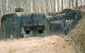 Hackenberg B22.jpg 1,016 × 631; 664 KB
-
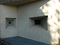
 Hackenberg B9.jpg 1,008 × 674; 669 KB
-
 Hackenberg Bloc 10 (20954232673).jpg 3,648 × 2,736; 6.48 MB
-
 Hackenberg Bloc 10 (21387319080).jpg 3,648 × 2,736; 6.32 MB
-
 Hackenberg Bloc 10 (21387326090).jpg 3,648 × 2,736; 6.37 MB
-
 Hackenberg Bloc 10 (21387336240).jpg 3,648 × 2,736; 6.52 MB
-
 Hackenberg Bloc 10 (21387512088).jpg 3,648 × 2,736; 7.27 MB
-
 Hackenberg Bloc 10 (21387521038).jpg 3,648 × 2,736; 6.3 MB
-
 Hackenberg Bloc 10 (21387538368).jpg 3,648 × 2,736; 6.33 MB
-
 Hackenberg Bloc 10 (21549171236).jpg 3,648 × 2,736; 5.72 MB
-
 Hackenberg Bloc 10 (21549187726).jpg 3,648 × 2,736; 6.41 MB
-
 Hackenberg Bloc 10 (21549200306).jpg 3,648 × 2,736; 6.11 MB
-
 Hackenberg Bloc 10 (21564089362).jpg 3,648 × 2,736; 5.77 MB
-
 Hackenberg Bloc 10 (21575400505).jpg 3,648 × 2,736; 6.65 MB
-
 Hackenberg Bloc 10 (21575418985).jpg 3,648 × 2,736; 7.01 MB
-
 Hackenberg Bloc 11 (20953448453).jpg 3,648 × 2,736; 6.3 MB
-
 Hackenberg Bloc 11 (20953457873).jpg 3,648 × 2,736; 5.6 MB
-
 Hackenberg Bloc 11 (20953462043).jpg 3,648 × 2,736; 7.29 MB
-
 Hackenberg Bloc 11 (21386733968).jpg 3,648 × 2,736; 6.21 MB
-
 Hackenberg Bloc 11 (21548384976).jpg 3,648 × 2,736; 6.45 MB
-
 Hackenberg Bloc 11 (21548388466).jpg 3,648 × 2,736; 6.42 MB
-
 Hackenberg Bloc 11 (21574602675).jpg 3,648 × 2,736; 7.37 MB
-
 Hackenberg Bloc 11 (21574606225).jpg 3,648 × 2,736; 6.71 MB
-
 Hackenberg Bloc 11 (21583402681).jpg 3,648 × 2,736; 6.53 MB
-
 Hackenberg Bloc 12 (20951999354).jpg 3,648 × 2,736; 6.52 MB
-
 Hackenberg Bloc 12 (20952005984).jpg 3,648 × 2,736; 6.5 MB
-
 Hackenberg Bloc 12 (20953630913).jpg 3,648 × 2,736; 5.78 MB
-
 Hackenberg Bloc 12 (21386917558).jpg 3,648 × 2,736; 4.45 MB
-
 Hackenberg Bloc 12 (21548570136).jpg 3,648 × 2,736; 6.96 MB
-
 Hackenberg Bloc 12 (21548572176).jpg 3,648 × 2,736; 7.34 MB
-
 Hackenberg Bloc 12 (21548577546).jpg 3,648 × 2,736; 6.8 MB
-
 Hackenberg Bloc 12 (21548583046).jpg 3,648 × 2,736; 7.07 MB
-
 Hackenberg Bloc 12 (21548584536).jpg 3,648 × 2,736; 5.05 MB
-
 Hackenberg Bloc 12 (21563492432).jpg 3,648 × 2,736; 5.67 MB
-
 Hackenberg Bloc 12 (21574794005).jpg 3,648 × 2,736; 5.09 MB
-
 Hackenberg Bloc 12 (21583574301).jpg 3,648 × 2,736; 7.04 MB
-
 Hackenberg Bloc 12 (21583596791).jpg 3,648 × 2,736; 6.82 MB
-
 Hackenberg Bloc 2 (20955384723).jpg 3,648 × 2,736; 6.73 MB
-
 Hackenberg Bloc 2 (20955401473).jpg 3,648 × 2,736; 6.28 MB
-
 Hackenberg Bloc 2 (21388482880).jpg 3,648 × 2,736; 6.93 MB
-
 Hackenberg Bloc 2 (21388677148).jpg 3,648 × 2,736; 6.45 MB
-
 Hackenberg Bloc 2 (21388679328).jpg 3,648 × 2,736; 7.16 MB
-
 Hackenberg Bloc 2 (21389609979).jpg 3,648 × 2,736; 6.85 MB
-
 Hackenberg Bloc 2 (21550336776).jpg 3,648 × 2,736; 7.18 MB
-
 Hackenberg Bloc 2 (21565257762).jpg 3,648 × 2,736; 6.49 MB
-
 Hackenberg Bloc 2 (21576544545).jpg 3,648 × 2,736; 6.33 MB
-
 Hackenberg Bloc 2 (21576546455).jpg 3,648 × 2,736; 7.08 MB
-
 Hackenberg Bloc 2 (21585360061).jpg 3,648 × 2,736; 6.25 MB
-
 Hackenberg Bloc 2 (21585362231).jpg 3,648 × 2,736; 6.75 MB
-
 Hackenberg Bloc 21 (20953857464).jpg 2,736 × 3,648; 6.96 MB
-
 Hackenberg Bloc 21 (20953859884).jpg 3,648 × 2,736; 7.29 MB
-
 Hackenberg Bloc 21 (20953867674).jpg 3,648 × 2,736; 6.45 MB
-
 Hackenberg Bloc 21 (20955496673).jpg 3,648 × 2,736; 7.42 MB
-
 Hackenberg Bloc 21 (20955510753).jpg 3,648 × 2,736; 7.02 MB
-
 Hackenberg Bloc 21 (21388583000).jpg 3,648 × 2,736; 6.43 MB
-
 Hackenberg Bloc 21 (21389700399).jpg 3,648 × 2,736; 7.31 MB
-
 Hackenberg Bloc 21 (21550448516).jpg 2,736 × 3,648; 6.79 MB
-
 Hackenberg Bloc 21 (21565337302).jpg 3,648 × 2,736; 6.47 MB
-
 Hackenberg Bloc 21 (21565341392).jpg 3,648 × 2,736; 6.47 MB
-
 Hackenberg Bloc 21 (21565361062).jpg 2,736 × 3,648; 6.37 MB
-
 Hackenberg Bloc 21 (21576647175).jpg 3,648 × 2,736; 6.61 MB


.jpg)
.jpg)
.jpg)
.jpg)
.jpg)
.jpg)
.jpg)
.jpg)
.jpg)
.jpg)
.jpg)
.jpg)
.jpg)
.jpg)
.jpg)
.jpg)
.jpg)
.jpg)
.jpg)
.jpg)
.jpg)
.jpg)
.jpg)
.jpg)
.jpg)
.jpg)
.jpg)
.jpg)
.jpg)
.jpg)
.jpg)
.jpg)
.jpg)
.jpg)
.jpg)
.jpg)
.jpg)
.jpg)
.jpg)
.jpg)
.jpg)
.jpg)
.jpg)
.jpg)
.jpg)
.jpg)
.jpg)
.jpg)
.jpg)
.jpg)
.jpg)
.jpg)
.jpg)
.jpg)
.jpg)
.jpg)
.jpg)
.jpg)
.jpg)
.jpg)
.jpg)
.jpg)
.jpg)
.jpg)
.jpg)
.jpg)
.jpg)
.jpg)
.jpg)
.jpg)
.jpg)
.jpg)
.jpg)
.jpg)
.jpg)
.jpg)
.jpg)
.jpg)
.jpg)
.jpg)
.jpg)
.jpg)
.jpg)
.jpg)
.jpg)
.jpg)
.jpg)
.jpg)
.jpg)
.jpg)
.jpg)
.jpg)
.jpg)
.jpg)
.jpg)
.jpg)
.jpg)
.jpg)
.jpg)
.jpg)
.jpg)
.jpg)
.jpg)
.jpg)
.jpg)
.jpg)
.jpg)
.jpg)
.jpg)
.jpg)
.jpg)
.jpg)
.jpg)
.jpg)
.jpg)
.jpg)
.jpg)
.jpg)
.jpg)
.jpg)
.jpg)


.jpg)
.jpg)


.jpg)
.jpg)
.jpg)
.jpg)
.jpg)
.jpg)
.jpg)
.jpg)
.jpg)
.jpg)
.jpg)
.jpg)
.jpg)
.jpg)
.jpg)
.jpg)
.jpg)
.jpg)
.jpg)
.jpg)
.jpg)
.jpg)
.jpg)
.jpg)
.jpg)
.jpg)
.jpg)
.jpg)
.jpg)
.jpg)
.jpg)
.jpg)
.jpg)
.jpg)
.jpg)
.jpg)
.jpg)
.jpg)
.jpg)
.jpg)
.jpg)
.jpg)
.jpg)
.jpg)
.jpg)
.jpg)
.jpg)
.jpg)
.jpg)
.jpg)
.jpg)
.jpg)
.jpg)
.jpg)
.jpg)
.jpg)
.jpg)
.jpg)
.jpg)