Category:Oxton, Scottish Borders
Jump to navigation
Jump to search
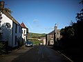
English: Oxton is a village in the Scottish Borders, Scotland. It is south of the Dalkeith and Edinburgh. It currently growing but contains only one shop.

village in Scottish Borders, Scotland, UK  | |||||
| Upload media | |||||
| Instance of | |||||
|---|---|---|---|---|---|
| Location |
| ||||
 | |||||
Media in category "Oxton, Scottish Borders"
The following 109 files are in this category, out of 109 total.
-
 A winged soul at Channelkirk Churchyard - geograph.org.uk - 894728.jpg 640 × 480; 128 KB
-
 Boghall - geograph.org.uk - 240800.jpg 640 × 480; 84 KB
-
 Borrow pit - geograph.org.uk - 285667.jpg 640 × 480; 106 KB
-

-
 Carfraemill Hotel - geograph.org.uk - 817282.jpg 640 × 480; 60 KB
-
 Cattle, Carfrae - geograph.org.uk - 1458222.jpg 640 × 359; 73 KB
-
 Farm track, Threeburnford - geograph.org.uk - 1722882.jpg 640 × 480; 124 KB
-
 Glanders Cleugh - geograph.org.uk - 273084.jpg 480 × 640; 76 KB
-
-
 Kelphope Burn - geograph.org.uk - 1229304.jpg 640 × 359; 64 KB
-
 Kelphope Burn - geograph.org.uk - 1628199.jpg 640 × 480; 87 KB
-
 Kelphope Burn in Lauderdale - geograph.org.uk - 1041488.jpg 640 × 480; 121 KB
-
 Lauderdale farmland - geograph.org.uk - 1188398.jpg 640 × 427; 121 KB
-
 LeaderWater Oxton.jpg 1,024 × 768; 288 KB
-

-
 Negative and divisive. - geograph.org.uk - 515386.jpg 480 × 640; 127 KB
-
 New Channelkirk - geograph.org.uk - 175718.jpg 640 × 480; 72 KB
-
 New hedge, Kelphope - geograph.org.uk - 515398.jpg 640 × 480; 92 KB
-
 Nomada leucophthalma (male) - Flickr - S. Rae (1).jpg 980 × 824; 389 KB
-
 Nomada leucophthalma (male) - Flickr - S. Rae (2).jpg 764 × 656; 188 KB
-
 Nomada leucophthalma (male) - Flickr - S. Rae (3).jpg 951 × 855; 311 KB
-
 Nomada leucophthalma (male) - Flickr - S. Rae.jpg 916 × 822; 397 KB
-
 Nomada sp. - Flickr - S. Rae (5).jpg 927 × 736; 254 KB
-
 Old Quarry building Airhouse Quarry - geograph.org.uk - 760179.jpg 640 × 480; 156 KB
-
 On Headshaw Hill - geograph.org.uk - 1467397.jpg 640 × 480; 102 KB
-
 Oxton Mains.jpg 1,024 × 768; 277 KB
-
 Oxton.jpg 640 × 480; 320 KB
-
 Oxton3.jpg 768 × 1,024; 368 KB
-
 Oxton5.jpg 768 × 1,024; 426 KB
-
 Phratoria vitellinae (Brassy Willow Beetle) - Flickr - S. Rae.jpg 1,264 × 1,116; 538 KB
-
 Pipizella - Flickr - S. Rae (1).jpg 948 × 740; 377 KB
-
 Pipizella - Flickr - S. Rae (2).jpg 1,356 × 1,024; 488 KB
-
 Pipizella - Flickr - S. Rae.jpg 1,328 × 964; 496 KB
-
 Pipizella sp. (female) - Flickr - S. Rae.jpg 1,124 × 820; 337 KB
-
 Platycheirus discimanus (female) - Flickr - S. Rae.jpg 1,240 × 1,006; 289 KB
-
 Pond on the Kelphope Burn - geograph.org.uk - 1035801.jpg 640 × 480; 123 KB
-
 Round bales, Lauderdale - geograph.org.uk - 242517.jpg 640 × 480; 105 KB
-
 Sarcophagidae - Flesh Fly (small species) - Flickr - S. Rae.jpg 1,632 × 1,204; 875 KB
-
 Sargus iridatus-cuprarius - Flickr - S. Rae.jpg 808 × 646; 189 KB
-
 Saturnia pavonia (Small emperor) - Flickr - S. Rae.jpg 2,264 × 1,984; 1.41 MB
-
 Saturnia pavonia (Small emperor) - underside - Flickr - S. Rae.jpg 2,212 × 1,968; 1.33 MB
-
 Snow gates, A68 - geograph.org.uk - 209962.jpg 640 × 480; 65 KB
-
 Snow plough on the Kelphope road - geograph.org.uk - 1628211.jpg 640 × 359; 54 KB
-
-
 The edge of a ploughed field - geograph.org.uk - 1188380.jpg 640 × 427; 162 KB
-
 Upstream Leader Burn - geograph.org.uk - 1743185.jpg 640 × 480; 111 KB
-

-

-
-
 Back to Lauder - geograph.org.uk - 807466.jpg 640 × 480; 61 KB
-
 Between Soonhope and Kelphope - geograph.org.uk - 515335.jpg 640 × 480; 67 KB
-
 Bridge over Harry Burn - geograph.org.uk - 719441.jpg 640 × 360; 89 KB
-
 Bridge over the Hillhouse Burn - geograph.org.uk - 1458602.jpg 640 × 480; 134 KB
-
 Burn on Collie Law - geograph.org.uk - 1449290.jpg 640 × 359; 77 KB
-
 Burnt area, Hogs Law - geograph.org.uk - 285688.jpg 640 × 467; 78 KB
-
 Cleekhimin Burn - geograph.org.uk - 519289.jpg 640 × 480; 109 KB
-
 Dod Cleugh - geograph.org.uk - 515377.jpg 640 × 480; 93 KB
-
 Earthwork, Peat Law - geograph.org.uk - 285323.jpg 640 × 480; 78 KB
-
 Enclosure, Soonhope - geograph.org.uk - 515354.jpg 640 × 480; 104 KB
-
 Feeding stations - geograph.org.uk - 356156.jpg 640 × 480; 105 KB
-
 Ferny Cleugh - geograph.org.uk - 286730.jpg 640 × 480; 75 KB
-
 Field, Dod Cleugh - geograph.org.uk - 515391.jpg 640 × 480; 81 KB
-
 Foxes Cleugh - geograph.org.uk - 286737.jpg 480 × 640; 101 KB
-
 Gate above Longcroft - geograph.org.uk - 285238.jpg 640 × 480; 73 KB
-
 Hill fort and Thorny Cleugh - geograph.org.uk - 286710.jpg 640 × 480; 55 KB
-
 Hog Hill - geograph.org.uk - 515324.jpg 640 × 480; 90 KB
-
 Hog Hill - geograph.org.uk - 515341.jpg 640 × 480; 100 KB
-
 Hogs Burn - geograph.org.uk - 285684.jpg 639 × 460; 89 KB
-
 Hogs Law - geograph.org.uk - 285745.jpg 640 × 480; 71 KB
-
 Hotel at Carfraemill - geograph.org.uk - 70132.jpg 640 × 480; 60 KB
-
 Kelphope - geograph.org.uk - 515322.jpg 640 × 480; 83 KB
-
 Kelphope Burn - geograph.org.uk - 515312.jpg 640 × 480; 105 KB
-
 Lauder Camping and Caravanning Club site - geograph.org.uk - 658544.jpg 2,088 × 1,408; 949 KB
-
 Lauderdale - geograph.org.uk - 450837.jpg 640 × 480; 82 KB
-
 Longcroft - geograph.org.uk - 285190.jpg 640 × 480; 86 KB
-
 Lylestone Hill - geograph.org.uk - 519275.jpg 640 × 480; 98 KB
-
 Lylestone Hill - geograph.org.uk - 519281.jpg 640 × 480; 90 KB
-
 Marsh ground - geograph.org.uk - 356170.jpg 640 × 480; 104 KB
-
 Moorland in retreat - geograph.org.uk - 285245.jpg 640 × 480; 73 KB
-
 Newbigging Walls - geograph.org.uk - 291150.jpg 640 × 486; 82 KB
-
 Pastoral Farmland below Collie Law - geograph.org.uk - 392713.jpg 640 × 428; 58 KB
-
 Pastureland, Kelphope - geograph.org.uk - 515316.jpg 640 × 480; 96 KB
-
 Peat Law - geograph.org.uk - 285319.jpg 640 × 480; 104 KB
-
 Peat Law - geograph.org.uk - 285336.jpg 639 × 438; 95 KB
-
 Peat Law from Hogs Law - geograph.org.uk - 285677.jpg 640 × 480; 86 KB
-
 Pilmuir - geograph.org.uk - 450876.jpg 640 × 448; 53 KB
-
 Ploughed field, Lauderdale - geograph.org.uk - 335031.jpg 640 × 480; 134 KB
-
 Pylons, Blackburn - geograph.org.uk - 450841.jpg 640 × 480; 98 KB
-
 Rabbity reentrant - geograph.org.uk - 285223.jpg 480 × 640; 115 KB
-
 Riddel Law - geograph.org.uk - 515352.jpg 480 × 640; 102 KB
-
 Riddell Law - geograph.org.uk - 515360.jpg 480 × 640; 114 KB
-
 Roundabout at Carfraemill - geograph.org.uk - 351998.jpg 640 × 480; 77 KB
-

-
 Settlement - geograph.org.uk - 515336.jpg 640 × 480; 70 KB
-
 Sheep and thistle - geograph.org.uk - 515320.jpg 640 × 480; 94 KB
-
 Sheep, Blackburn - geograph.org.uk - 450833.jpg 640 × 480; 83 KB
-
 Soonhope - geograph.org.uk - 515344.jpg 640 × 480; 81 KB
-
 Soonhope - geograph.org.uk - 515346.jpg 640 × 480; 80 KB
-
 Soonhope - geograph.org.uk - 515349.jpg 640 × 480; 100 KB
-
 Soonhope - geograph.org.uk - 515350.jpg 640 × 480; 91 KB
-
 Soonhope - geograph.org.uk - 515356.jpg 640 × 480; 96 KB
-
 The "Newbigging Worm" - geograph.org.uk - 291147.jpg 640 × 480; 101 KB
-
 The Coldstream Road - geograph.org.uk - 352006.jpg 640 × 480; 83 KB
-
 The Mid Burn - geograph.org.uk - 335029.jpg 640 × 480; 144 KB
-
 The Wimple Burn - geograph.org.uk - 356214.jpg 640 × 485; 106 KB
-
 Whalplaw Burn - geograph.org.uk - 285219.jpg 480 × 640; 71 KB
-
 Whalplaw Burn - geograph.org.uk - 285230.jpg 640 × 480; 61 KB
-
 Whalplaw Burn - geograph.org.uk - 286721.jpg 640 × 480; 120 KB
-
 Whalplaw Burn - geograph.org.uk - 286740.jpg 640 × 480; 88 KB


_-_Flickr_-_S._Rae_(1).jpg)
_-_Flickr_-_S._Rae_(2).jpg)
_-_Flickr_-_S._Rae_(3).jpg)
_-_Flickr_-_S._Rae.jpg)
.jpg)


_-_Flickr_-_S._Rae.jpg)
.jpg)
.jpg)

_-_Flickr_-_S._Rae.jpg)
_-_Flickr_-_S._Rae.jpg)


_-_Flickr_-_S._Rae.jpg)

_-_Flickr_-_S._Rae.jpg)
_-_underside_-_Flickr_-_S._Rae.jpg)


_(14568971110).jpg)


