Category:Oxton Road, Birkenhead
Jump to navigation
Jump to search
| Object location | | View all coordinates using: OpenStreetMap |
|---|
Oxton Road runs from Charing Cross to the junction of Ball's Road and Woodchurch Road, Birkenhead.
Subcategories
This category has only the following subcategory.
O
Media in category "Oxton Road, Birkenhead"
The following 20 files are in this category, out of 20 total.
-
 Benkid77 Oxton Road, Birkenhead 090809.JPG 3,648 × 2,736; 3.58 MB
-
 Benkid77 Oxton Road, Birkenhead 2 090809.JPG 3,648 × 2,736; 3.56 MB
-
 Post box at Oak Bank, Birkenhead.jpg 3,191 × 5,191; 20.5 MB
-
 Post box at Old Charing Cross Post Office.jpg 2,915 × 5,176; 18.96 MB
-
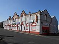
 Fothergill's ghost sign on Oxton Road.jpg 5,184 × 3,456; 5.12 MB
-
 Genting Casino, Birkenhead (1).JPG 4,320 × 3,240; 2.9 MB
-
 Genting Casino, Birkenhead (2).JPG 4,320 × 3,240; 2.97 MB
-
 Marriott Motorcycles, Birkenhead (1).JPG 4,608 × 3,456; 3.41 MB
-
 Marriott Motorcycles, Birkenhead (2).JPG 4,608 × 3,456; 3.41 MB
-
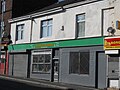 Marriott's shop, Birkenhead.JPG 4,608 × 3,456; 3.68 MB
-
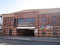
 The Richmond, Oxton Road.jpg 4,052 × 3,224; 5.99 MB
-
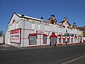
 Shops on Oxton Road, Birkenhead (1).JPG 4,320 × 3,240; 3.1 MB
-
 Shops on Oxton Road, Birkenhead (2).JPG 4,320 × 3,240; 3.26 MB
-
 Shops on Oxton Road, Birkenhead (3).JPG 4,608 × 3,456; 3.49 MB
-
 Shops on Oxton Road, Birkenhead (4).JPG 4,608 × 3,456; 3.47 MB
-
 Shops, Oxton Road, Birkenhead - DSCF0055.JPG 4,000 × 3,000; 2.97 MB
-
 Shops, Oxton Road, Birkenhead - DSCF0056.JPG 4,000 × 3,000; 2.88 MB
-
 Shops, Oxton Road, Birkenhead - DSCF0157.JPG 4,000 × 3,000; 2.89 MB
-
 The Fish Bowl, Birkenhead.JPG 4,608 × 3,456; 3.53 MB
-
 Windsor Castle, Oxton Road.jpg 4,864 × 3,167; 6.85 MB


.JPG)
.JPG)
.JPG)
.JPG)


.JPG)
.JPG)
.JPG)
.JPG)


