Category:Pennard
Jump to navigation
Jump to search

Cymraeg: Pentref a chymuned ar benrhyn Gŵyr, yn sir Abertawe, yw Pennard. Saif tua 7 milltir i'r de-orllewin o ganol dinas Abertawe. Y canolfannau mwyaf poblog yn y gymuned yw Southgate a Kittle; pentref bychan yw Pennard ei hun. Roedd poblogaeth y gymuned yn 2001 yn 2,648.
English: The village of Pennard is located about 7 miles south west of Swansea city centre in the Gower peninsula. Pennard falls within the Pennard ward of Swansea. It has a church, a Primary School and a golf course.
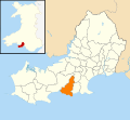
village on the Gower Peninsula, Wales  | |||||
| Upload media | |||||
| Instance of | |||||
|---|---|---|---|---|---|
| Location | Gower Peninsula, Swansea, Wales | ||||
 | |||||
Subcategories
This category has the following 7 subcategories, out of 7 total.
Media in category "Pennard"
The following 200 files are in this category, out of 250 total.
(previous page) (next page)-
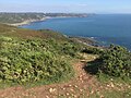
 "The links in the sky" - geograph.org.uk - 1307795.jpg 640 × 480; 78 KB
-
 17th Tee at Pennard - geograph.org.uk - 5339852.jpg 3,264 × 2,448; 1.54 MB
-
 2010 Wales Swansea Community Pennard map.svg 512 × 472; 632 KB
-
 2024 Wales Swansea Community Pennard map.svg 512 × 472; 651 KB
-
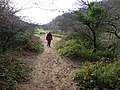
 A steep climb on the Wales Coast Path - geograph.org.uk - 6223500.jpg 4,000 × 3,000; 2.84 MB
-

-
 A4118 at Kilvrough Manor Woods - geograph.org.uk - 4136334.jpg 640 × 481; 107 KB
-
 A4118 crosses Fairwood Common east of Swansea Airport - geograph.org.uk - 3957230.jpg 3,648 × 2,736; 1.13 MB
-
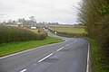
 A4118 junction with Kittle Hill Lane - geograph.org.uk - 3957196.jpg 3,448 × 2,481; 1.72 MB
-
 A4118 running straight across Fairwood Common - geograph.org.uk - 5831175.jpg 1,600 × 960; 617 KB
-
 Abandoned MG Midget^ - geograph.org.uk - 2447663.jpg 640 × 480; 126 KB
-
 Abandoned vehicles along Hael Lane - geograph.org.uk - 2447642.jpg 640 × 480; 116 KB
-

-
 B4436 east of the Barland Quarry - geograph.org.uk - 3957142.jpg 3,648 × 2,736; 2.64 MB
-
 B4436 south of The Round House - geograph.org.uk - 3957190.jpg 3,451 × 2,574; 1.33 MB
-
 B4436-A4118 junction - geograph.org.uk - 4136333.jpg 640 × 480; 117 KB
-
 Bend in road - geograph.org.uk - 6106941.jpg 2,048 × 1,536; 1.25 MB
-
 Bishopston Stream at Pwll Du - geograph.org.uk - 6222944.jpg 4,000 × 3,000; 2.89 MB
-
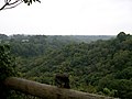 Bishopston Valley - geograph.org.uk - 2053370.jpg 1,024 × 768; 194 KB
-
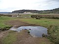
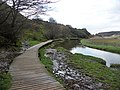 Boardwalk beside Pennard Pill - geograph.org.uk - 2211478.jpg 800 × 600; 174 KB
-
 Boardwalk with cows - geograph.org.uk - 2084905.jpg 1,600 × 1,219; 673 KB
-
 Braided channel in the Pennard Pill - geograph.org.uk - 2320031.jpg 2,048 × 1,536; 384 KB
-
 Bungalow on the outskirts of Southgate - geograph.org.uk - 6224596.jpg 4,000 × 3,000; 2.85 MB
-
 Bus shelter outside a surf shop, Kittle - geograph.org.uk - 5831181.jpg 1,600 × 1,200; 844 KB
-

-

-
 Cattle on Pwll Du Head - geograph.org.uk - 6224487.jpg 4,000 × 3,000; 2.89 MB
-
-
 Cliff erosion on Three Cliffs Bay - geograph.org.uk - 2318249.jpg 2,048 × 1,536; 727 KB
-
 Cliff slumping adjacent to the Pennard Pill floodplain - geograph.org.uk - 2320022.jpg 2,048 × 1,536; 431 KB
-
 Cliff top above Shire Combe - geograph.org.uk - 4915682.jpg 6,000 × 4,000; 4.84 MB
-
 Cliff top near West Cliff - geograph.org.uk - 4915692.jpg 6,000 × 4,000; 5.35 MB
-
 Cliffs and slopes on the Southgate Coast - geograph.org.uk - 3055899.jpg 3,648 × 2,736; 3.43 MB
-
 Cliffs east of Shire Combe - geograph.org.uk - 1190135.jpg 640 × 615; 137 KB
-
 Cliffs on the western side of Threecliff Bay - geograph.org.uk - 3056842.jpg 3,648 × 2,736; 2.25 MB
-
 Cliffs on Three Cliffs Bay, Gower - geograph.org.uk - 3594195.jpg 640 × 480; 60 KB
-
 Cliffs, Pobbles Beach - geograph.org.uk - 1493289.jpg 640 × 455; 76 KB
-
 Clifftop path near East Cliff - geograph.org.uk - 4914467.jpg 6,000 × 4,000; 4.29 MB
-
 Clifftop path near East Cliff - geograph.org.uk - 4914484.jpg 6,000 × 4,000; 3.38 MB
-
 Clubhouse at Pennard Golf Club - geograph.org.uk - 3076832.jpg 3,648 × 2,736; 1.66 MB
-
 Coast path near Pwlldu Head - geograph.org.uk - 4912829.jpg 6,000 × 4,000; 5.51 MB
-
 Coast path nearing Hunts Farm - geograph.org.uk - 4914411.jpg 6,000 × 4,000; 3.38 MB
-
 Coast path towards East Cliff - geograph.org.uk - 4912888.jpg 6,000 × 4,000; 3.61 MB
-
 Coastal cliffs from Pwll Du Head. - geograph.org.uk - 6224412.jpg 4,000 × 3,000; 2.95 MB
-
 Coastal meadow beside Pennard Pill - geograph.org.uk - 3594136.jpg 640 × 480; 100 KB
-
 Conglomerate on the coast - geograph.org.uk - 1306669.jpg 640 × 480; 142 KB
-
 Corner of Park Road and Pennard Road - geograph.org.uk - 538490.jpg 640 × 480; 51 KB
-
 Cottage in Southgate - geograph.org.uk - 5339836.jpg 3,264 × 2,448; 2.36 MB
-
 Cottages, Pwll Du Bay - geograph.org.uk - 6222927.jpg 4,000 × 3,000; 2.83 MB
-
 Cwm Bishopston Valley - geograph.org.uk - 3843137.jpg 640 × 480; 154 KB
-
 Cwm Llanilltyd Gwyr - Ilston Cwm - geograph.org.uk - 4321907.jpg 640 × 480; 124 KB
-
 Deep Slade - geograph.org.uk - 3843128.jpg 640 × 480; 68 KB
-
 Deep Slade - geograph.org.uk - 6275544.jpg 2,048 × 1,536; 1.32 MB
-
 Deep Slade near Southgate - geograph.org.uk - 3055878.jpg 3,648 × 2,736; 3.74 MB
-
 Deep Slade on a June evening - geograph.org.uk - 2447765.jpg 640 × 480; 56 KB
-
 Dry stream bed and flowing spring - geograph.org.uk - 6085768.jpg 1,536 × 2,048; 1.91 MB
-
 Eastcliff houses - geograph.org.uk - 6275542.jpg 2,048 × 1,536; 1.27 MB
-
 Eastern end of runway 10-28, Swansea Airport - geograph.org.uk - 5771483.jpg 4,592 × 3,056; 4.24 MB
-
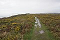
 Edge of moorland - geograph.org.uk - 1053959.jpg 640 × 480; 98 KB
-
 Entering National Trust land on Pwlldu Head - geograph.org.uk - 4912853.jpg 6,000 × 4,000; 4.91 MB
-
 Fainc Southgate Bench - geograph.org.uk - 4321871.jpg 640 × 480; 94 KB
-
 Fairwood Common - geograph.org.uk - 6179972.jpg 4,000 × 3,000; 2.38 MB
-
 Fairwood Common and the Blackhills Stream valley - geograph.org.uk - 5831164.jpg 1,600 × 1,200; 756 KB
-
 Ffarm yr Hael Farm - geograph.org.uk - 3842811.jpg 640 × 480; 73 KB
-
 Fields beside the A4118 - geograph.org.uk - 6283340.jpg 2,592 × 1,944; 1.27 MB
-
 First Cymru 41392 on route 14 at Pennard Cliffs (17749840385).jpg 2,880 × 1,623; 1.72 MB
-
 Footpath across Pwlldu Head - geograph.org.uk - 6274680.jpg 2,048 × 1,536; 1.32 MB
-
 Footpath near the Bishopston Valley - geograph.org.uk - 2447670.jpg 640 × 480; 131 KB
-
 Ford at Pwlldu - geograph.org.uk - 4912760.jpg 6,000 × 4,000; 5.89 MB
-
 Ford behind Pwlldu Bay - geograph.org.uk - 2447731.jpg 640 × 480; 75 KB
-
 Foxhole Cove from High Tor - geograph.org.uk - 6019992.jpg 1,600 × 1,060; 463 KB
-
 Garlic scented woods near Parkmill - geograph.org.uk - 2959218.jpg 640 × 480; 119 KB
-
 Gate beside the A4118 - geograph.org.uk - 1974282.jpg 2,000 × 1,328; 2.51 MB
-
 Ger - Near Swn y Coed - geograph.org.uk - 4345661.jpg 640 × 484; 88 KB
-
 Glimpse of House - geograph.org.uk - 5339844.jpg 3,264 × 2,448; 2.07 MB
-
 Gorse scrub on Fairwood Common - geograph.org.uk - 5771459.jpg 4,592 × 3,056; 4.18 MB
-
 Gower Coast - geograph.org.uk - 6274648.jpg 2,048 × 1,536; 958 KB
-
 Gower moorland - geograph.org.uk - 1042573.jpg 640 × 480; 118 KB
-
 Gower Ponies - geograph.org.uk - 381858.jpg 640 × 480; 178 KB
-
 Grassy headland at Southgate - geograph.org.uk - 6224600.jpg 4,000 × 3,000; 2.9 MB
-
 Graves End - geograph.org.uk - 3842839.jpg 640 × 480; 83 KB
-
 Graves End - geograph.org.uk - 4256508.jpg 1,000 × 750; 342 KB
-
 Guzzle Hole in Bishopston Valley - geograph.org.uk - 2685624.jpg 1,200 × 800; 251 KB
-
 Hael Lane - geograph.org.uk - 2053360.jpg 1,024 × 768; 434 KB
-
 Hael Lane to Bishopston Valley - geograph.org.uk - 2053364.jpg 1,024 × 768; 457 KB
-
 Heading west over the sand dunes to Three Cliffs Bay - geograph.org.uk - 6227994.jpg 4,000 × 3,000; 2.46 MB
-
 Heatherslade Residential Home, Southgate - geograph.org.uk - 6224603.jpg 4,000 × 3,000; 2.72 MB
-
 Hen Heol Pennard Old Road - geograph.org.uk - 4321895.jpg 640 × 480; 85 KB
-
 High Pennard Fort - geograph.org.uk - 4912867.jpg 6,000 × 4,000; 4.41 MB
-
 High Tor - geograph.org.uk - 4914494.jpg 6,000 × 4,000; 3.6 MB
-
 House undergoing renovation - geograph.org.uk - 4915645.jpg 6,000 × 4,000; 4.39 MB
-
 Houses by Pennard Road - geograph.org.uk - 5831179.jpg 1,600 × 1,200; 749 KB
-
 Housing on Hael Lane, Southgate - geograph.org.uk - 2447612.jpg 640 × 480; 79 KB
-
 Hunt's Farm, Southgate - geograph.org.uk - 6224490.jpg 4,000 × 3,000; 2.83 MB
-
 Hunts Farm east of Southgate - geograph.org.uk - 3055859.jpg 2,845 × 2,145; 1.1 MB
-
 Illston Cwm - geograph.org.uk - 2084900.jpg 1,600 × 1,136; 1.01 MB
-
 In clover - geograph.org.uk - 6274646.jpg 3,249 × 2,050; 3.26 MB
-
 In the mouth of Guzzle Hole - geograph.org.uk - 2685634.jpg 960 × 720; 147 KB
-
 Inside Mitchin Hole - geograph.org.uk - 2274529.jpg 3,264 × 2,448; 1.82 MB
-
 Kittle Hill Lane - geograph.org.uk - 5831191.jpg 1,600 × 1,200; 774 KB
-
 Kittle Road - geograph.org.uk - 1053964.jpg 640 × 480; 108 KB
-
 Lime kiln beside the A4118 - geograph.org.uk - 1974289.jpg 2,000 × 1,328; 2.63 MB
-
 Lime Kiln beside the A4118 - geograph.org.uk - 1974297.jpg 2,000 × 1,328; 2.78 MB
-
 Limestone near Pennard - geograph.org.uk - 1306702.jpg 640 × 480; 119 KB
-
 Llwybr Barland - Barland path - geograph.org.uk - 4345674.jpg 640 × 480; 131 KB
-

-
 Llwybr Pennard Path - geograph.org.uk - 4221261.jpg 640 × 480; 87 KB
-
 Llwybr Widegate Path - geograph.org.uk - 4324505.jpg 640 × 480; 138 KB
-
 Llwybr Widegate Path - geograph.org.uk - 4324507.jpg 640 × 480; 138 KB
-
 Lodge at entrance to Kilvrough Manor - geograph.org.uk - 4142487.jpg 800 × 591; 88 KB
-
 Looking towards Penmaen Burrows - geograph.org.uk - 2211491.jpg 800 × 600; 125 KB
-
 Looking towards Three Cliffs Bay - geograph.org.uk - 2211876.jpg 800 × 600; 139 KB
-

-
 Looking west towards Pobbles Bay and Three Cliffs Bay - geograph.org.uk - 6224605.jpg 4,000 × 3,000; 2.34 MB
-
 Margam Farm - geograph.org.uk - 6066717.jpg 2,048 × 1,536; 1.25 MB
-
 Mitchin Hole - geograph.org.uk - 2274522.jpg 2,448 × 3,264; 2.4 MB
-
 Northill Wood from Pennard Burrows - geograph.org.uk - 2211866.jpg 800 × 600; 202 KB
-
 Old Kittle Road - geograph.org.uk - 4918712.jpg 6,000 × 4,000; 5.3 MB
-
 On Fairwood Common - geograph.org.uk - 226469.jpg 640 × 480; 67 KB
-
 On Pobbles Beach, Gower - geograph.org.uk - 3594182.jpg 640 × 480; 42 KB
-
 On the Wales Coast Path near Pwll Du Head - geograph.org.uk - 6223517.jpg 3,899 × 2,925; 2.91 MB
-
 On the way to Pwll Du Head - geograph.org.uk - 6223509.jpg 4,000 × 3,000; 2.86 MB
-
 Ordnance Survey Cut Mark - geograph.org.uk - 4511955.jpg 480 × 640; 127 KB
-
 Ordnance Survey Cut Mark - geograph.org.uk - 4511974.jpg 480 × 640; 147 KB
-
 Ordnance Survey Cut Mark - geograph.org.uk - 4511983.jpg 480 × 640; 127 KB
-
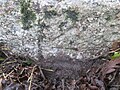 Ordnance Survey Cut Mark - geograph.org.uk - 4763902.jpg 640 × 480; 127 KB
-
 Ordnance Survey Flush Bracket (G3819) - geograph.org.uk - 4006198.jpg 480 × 640; 130 KB
-
 Over the cliff - geograph.org.uk - 6274660.jpg 4,719 × 2,575; 6.92 MB
-
 Overgrown runway at Swansea Airport - geograph.org.uk - 4140005.jpg 800 × 476; 61 KB
-

-
 Pasture land in eastern Gower - geograph.org.uk - 1042569.jpg 640 × 480; 128 KB
-
 Path on Pennard Burrows - geograph.org.uk - 4916905.jpg 6,000 × 4,000; 4.63 MB
-
 Path on the edge of Pennard Burrows - geograph.org.uk - 4917413.jpg 6,000 × 4,000; 7.75 MB
-
 Path to Three Cliffs Bay - geograph.org.uk - 2211454.jpg 800 × 600; 250 KB
-
 Path to Three Cliffs Bay - geograph.org.uk - 2211455.jpg 800 × 600; 246 KB
-
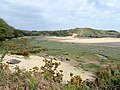
 Penmaen Pill Estuary - geograph.org.uk - 6228127.jpg 4,000 × 3,000; 2.23 MB
-
 Pennard Boardwalk - geograph.org.uk - 563589.jpg 640 × 480; 62 KB
-
 Pennard Burrows - geograph.org.uk - 1307929.jpg 640 × 480; 106 KB
-
 Pennard Burrows - geograph.org.uk - 1493302.jpg 640 × 455; 58 KB
-
 Pennard Castle - geograph.org.uk - 6228030.jpg 4,000 × 3,000; 2.63 MB
-
 Pennard golf club - geograph.org.uk - 1307611.jpg 640 × 480; 78 KB
-
 Pennard Golf Club - geograph.org.uk - 4136331.jpg 640 × 480; 53 KB
-
 Pennard Golf Club - geograph.org.uk - 5339837.jpg 2,916 × 2,173; 1.58 MB
-
 Pennard Golf Club and clubhouse - geograph.org.uk - 4917409.jpg 6,000 × 4,000; 3.46 MB
-
 Pennard Golf Course - geograph.org.uk - 869855.jpg 640 × 480; 169 KB
-
 Pennard Golf Links - geograph.org.uk - 6228025.jpg 4,000 × 3,000; 2.39 MB
-

-
 Pennard Pill - geograph.org.uk - 2211463.jpg 800 × 600; 176 KB
-
 Pennard Pill - geograph.org.uk - 2211868.jpg 800 × 600; 176 KB
-
 Pennard Pill - geograph.org.uk - 2271716.jpg 3,264 × 2,448; 2.13 MB
-
 Pennard Pill - geograph.org.uk - 5479173.jpg 3,000 × 4,000; 2.05 MB
-

-
 Pennard Pill and Three Cliffs Bay - geograph.org.uk - 4917406.jpg 6,000 × 4,000; 4.3 MB
-
 Pennard Pill heading into Three Cliffs Bay - geograph.org.uk - 3981545.jpg 1,350 × 898; 130 KB
-

-
 Pennard Pill meander - geograph.org.uk - 2211864.jpg 800 × 600; 169 KB
-
 Pennard Pill meandering through Three Cliffs Bay - geograph.org.uk - 2318268.jpg 2,048 × 1,536; 633 KB
-
 Pennard Pill with horses - geograph.org.uk - 2084918.jpg 1,600 × 1,214; 828 KB
-
 Pennard Pound - geograph.org.uk - 4917415.jpg 6,000 × 4,000; 5.15 MB
-
 Pennard Road - geograph.org.uk - 4918525.jpg 6,000 × 4,000; 4.32 MB
-
 Pennard Road eastwards through Little Highway - geograph.org.uk - 3067579.jpg 2,940 × 2,196; 1.38 MB
-
 Pennard Road looking west - geograph.org.uk - 4136330.jpg 640 × 480; 49 KB
-
 Pennard Road, west of Pennard - geograph.org.uk - 4136329.jpg 640 × 480; 55 KB
-
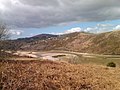
 Pennard Valley flood plain - geograph.org.uk - 6228118.jpg 4,000 × 3,000; 2.73 MB
-
 Pennard Water Tower - geograph.org.uk - 869878.jpg 640 × 480; 158 KB
-
 Pobbles at dusk - geograph.org.uk - 1306059.jpg 640 × 480; 57 KB
-
 Pobbles Bay - geograph.org.uk - 6225244.jpg 4,000 × 3,000; 2.47 MB
-
 Pobbles Bay at mid tide - geograph.org.uk - 1306013.jpg 640 × 480; 96 KB
-
 Pobbles Beach and Pennard Burrows - geograph.org.uk - 1190108.jpg 640 × 612; 113 KB
-
 Ponies on Fairwood Common - geograph.org.uk - 6179980.jpg 4,000 × 3,000; 2.33 MB
-
 Pwll Du - geograph.org.uk - 3842807.jpg 640 × 480; 135 KB
-
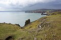
 Pwll Du Head - geograph.org.uk - 6223512.jpg 4,000 × 3,000; 2.91 MB
-
 Pwlldu Bay - geograph.org.uk - 2053374.jpg 1,024 × 768; 170 KB
-

-
 Pwlldu Head - geograph.org.uk - 6274685.jpg 3,264 × 1,577; 1.75 MB
-
 Pwlldu Head - geograph.org.uk - 6275585.jpg 3,264 × 2,448; 3.8 MB
-
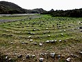 Rings of small stones - geograph.org.uk - 2211845.jpg 800 × 600; 217 KB
-
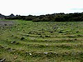 Rings of small stones - geograph.org.uk - 2211853.jpg 800 × 600; 184 KB
-
 Road to East Cliff - geograph.org.uk - 4914426.jpg 6,000 × 4,000; 6.94 MB
-
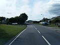
 Roundabout at junction of Southgate Road and West Cliff - geograph.org.uk - 3055884.jpg 3,648 × 2,736; 1.84 MB
-
 Runway markers, Swansea Airport - geograph.org.uk - 5771475.jpg 4,592 × 3,056; 3.75 MB
-
 Salt pans in the Pennard Valley floodplain - geograph.org.uk - 2318272.jpg 2,048 × 1,536; 783 KB
-
 Sand dunes alongside the Pennard Pill - geograph.org.uk - 2320043.jpg 2,048 × 1,536; 585 KB
-

-
 Sculpture and bench in the dunes - geograph.org.uk - 6228023.jpg 4,000 × 3,000; 2.81 MB
-
 Shifting sands at Pennard - geograph.org.uk - 1305975.jpg 640 × 480; 96 KB
-
 Ship Cottage, Pwll Du Bay - geograph.org.uk - 6222948.jpg 4,000 × 3,000; 2.98 MB
-
 Shire Combe - geograph.org.uk - 1493298.jpg 640 × 455; 75 KB
-
 Shire Combe - geograph.org.uk - 1493301.jpg 640 × 455; 97 KB
-
 Shops, Kittle - geograph.org.uk - 5831186.jpg 1,600 × 1,200; 832 KB
-
 Slope down to Pennard Burrows and Three Cliffs Bay - geograph.org.uk - 4915700.jpg 6,000 × 4,000; 4.62 MB
-
 Southgate Road sleeper - geograph.org.uk - 4136332.jpg 640 × 480; 52 KB
-
 Southgate village centre - geograph.org.uk - 6224602.jpg 4,000 × 3,000; 2.72 MB
-
 Southgate, UK - panoramio (3).jpg 2,592 × 1,944; 2.14 MB
-
 Spring emerging from hill - the Courthouse main flood rising - geograph.org.uk - 6085767.jpg 2,048 × 1,536; 1.57 MB
-
 Stepping stones - geograph.org.uk - 6147567.jpg 2,048 × 1,536; 1.16 MB
-
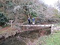
 Stepping stones across Pennard Pill - geograph.org.uk - 2211855.jpg 800 × 602; 175 KB
-
 Stepping stones crossing Pennard Pill - geograph.org.uk - 6228033.jpg 4,000 × 3,000; 2.85 MB
-
 Stepping stones Pennard Pill - geograph.org.uk - 3825092.jpg 3,473 × 2,481; 2.36 MB
-
 Sticil Lon Hael Lane Stile - geograph.org.uk - 4321883.jpg 640 × 480; 165 KB


.jpg)


_-_geograph.org.uk_-_4006198.jpg)


.jpg)


