Category:Peperstraat 102, Gouda
Jump to navigation
Jump to search
| Object location | | View all coordinates using: OpenStreetMap |
|---|
 | |||||
| Upload media | |||||
| Instance of |
| ||||
|---|---|---|---|---|---|
| Location | Gouda, South Holland, Netherlands | ||||
| Street address |
| ||||
| Located on street | |||||
| Heritage designation |
| ||||
 | |||||
|
This is a category about rijksmonument number 16914
|
| Address |
|
Media in category "Peperstraat 102, Gouda"
The following 5 files are in this category, out of 5 total.
-
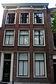
 Overzicht van de voorgevel - Gouda - 20379894 - RCE.jpg 1,200 × 1,178; 302 KB
-
 Overzicht voorgevels - Gouda - 20082732 - RCE.jpg 955 × 1,200; 256 KB
-
 Peperstraat 102, Gouda.jpg 2,048 × 3,072; 2.39 MB
-
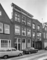
 Voorgevels - Gouda - 20082749 - RCE.jpg 804 × 1,200; 171 KB
-
 Voorgevels - Gouda - 20082750 - RCE.jpg 950 × 1,200; 231 KB


