Category:Perton
Jump to navigation
Jump to search
Cebuano: Perton maoy parokya sa Hiniusang Gingharian. Ang Perton nahimutang sa kondado sa Staffordshire ug apil sa nasod sa Inglatera, sa habagatang bahin sa nasod, ka mga kilometro kwadrado. (→Perton)
English: Perton is a large village and civil parish located in Staffordshire, England. It lies to the south of Codsall, and to the west of the city of Wolverhampton. Perton is named such as a derivative of 'Pear Town' due to the number of pear trees that were once there. (→Perton)
Español: Perton es una parroquia civil y un pueblo del distrito de South Staffordshire, en el condado de Staffordshire (Inglaterra). (→Perton)
Nederlands: Perton is een plaats en civil parish in het bestuurlijke gebied South Staffordshire, in het Engelse graafschap Staffordshire met 10.824 inwoners. (→Perton)
Polski: Perton – wieś w Anglii, w hrabstwie Staffordshire, w dystrykcie South Staffordshire. Leży 25 km na południe od miasta Stafford i 187 km na północny zachód od Londynu. W 2004 miejscowość liczyła 10 824 mieszkańców. (→Perton)
Svenska: Perton är en parish i Storbritannien. Den ligger i grevskapet Staffordshire och riksdelen England, i den södra delen av landet, kvadratkilometer. (→Perton)

a village located in South Staffordshire, United Kingdom  | |||||
| Upload media | |||||
| Instance of | |||||
|---|---|---|---|---|---|
| Location | South Staffordshire, Staffordshire, West Midlands, England | ||||
| Different from | |||||
 | |||||
Media in category "Perton"
The following 200 files are in this category, out of 275 total.
(previous page) (next page)-
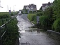 A ford on Monarch's Way - geograph.org.uk - 834297.jpg 640 × 480; 87 KB
-

-
 A small pond beside the track - geograph.org.uk - 1759315.jpg 717 × 538; 208 KB
-
 A41 - Wrottesley Park traffic lights - geograph.org.uk - 2773828.jpg 640 × 480; 67 KB
-
 A41 at County Lane crossroads - geograph.org.uk - 2774195.jpg 640 × 480; 58 KB
-
 A41 at Middle Lane junction - geograph.org.uk - 2774173.jpg 640 × 480; 64 KB
-
 A41 at Oaken - geograph.org.uk - 2774176.jpg 640 × 480; 50 KB
-
 A41 at Stafford Lane junction - geograph.org.uk - 2774171.jpg 640 × 480; 54 KB
-

-
 A41 in Kingswood - geograph.org.uk - 2774192.jpg 640 × 480; 68 KB
-

-
 A41-A461 junction, Oaken - geograph.org.uk - 2774182.jpg 640 × 480; 63 KB
-
 A454 at Furness Grange Road - geograph.org.uk - 2773274.jpg 640 × 480; 44 KB
-
 A454 enters Trescott - geograph.org.uk - 2773237.jpg 640 × 480; 42 KB
-
 A454 west of Trescott - geograph.org.uk - 2773232.jpg 640 × 480; 35 KB
-
 Airfield Buildings - geograph.org.uk - 1618674.jpg 640 × 480; 66 KB
-
 Along the Staffordshire Way near Trescott - geograph.org.uk - 2482651.jpg 1,024 × 768; 308 KB
-
 Arable land south-east of Perton, Staffordshire - geograph.org.uk - 2108018.jpg 1,024 × 528; 361 KB
-
 Back on a marked path - geograph.org.uk - 2482663.jpg 1,152 × 864; 325 KB
-

-
 Bennett's Lane Bend - geograph.org.uk - 1245735.jpg 480 × 640; 49 KB
-
 Birch Coppice - geograph.org.uk - 6076926.jpg 800 × 600; 132 KB
-
 Bird Lift - geograph.org.uk - 5959325.jpg 800 × 600; 132 KB
-

-
 Bridge 55 Winter view - geograph.org.uk - 1732889.jpg 640 × 480; 70 KB
-

-
 Bridgnorth Bus - geograph.org.uk - 4355933.jpg 800 × 600; 184 KB
-
-
 Bridgnorth Road in the Mist - geograph.org.uk - 5240027.jpg 800 × 600; 74 KB
-
-
 Bridleway east of Nurton, Staffordshire - geograph.org.uk - 2107391.jpg 480 × 640; 165 KB
-

-

-

-
 Bus at Sainsbury's, Perton - geograph.org.uk - 3896101.jpg 1,024 × 768; 142 KB
-
 Byway to the east of Perton - geograph.org.uk - 1759319.jpg 640 × 480; 180 KB
-
 Children's play area at Perton Centre - geograph.org.uk - 1805843.jpg 922 × 691; 173 KB
-
 The Church at Perton - geograph.org.uk - 127986.jpg 640 × 427; 51 KB
-
 Coppice in the Mist - geograph.org.uk - 5240045.jpg 800 × 600; 98 KB
-
 Corner Path - geograph.org.uk - 4355921.jpg 800 × 600; 97 KB
-
 Country road to the north of Pattingham - geograph.org.uk - 5162637.jpg 800 × 600; 177 KB
-
 Cranmoor Scene - geograph.org.uk - 6071885.jpg 800 × 600; 131 KB
-
 Cranmoor View - geograph.org.uk - 6073569.jpg 800 × 600; 78 KB
-
 Cranmoor Wood - geograph.org.uk - 6071892.jpg 800 × 600; 225 KB
-
 Cranmore Lodge Farm, Perton, W of Wolverhampton - geograph.org.uk - 5219878.jpg 5,184 × 2,920; 1.04 MB
-

-

-

-

-

-

-
 Crop field near Great Moor, Staffordshire - geograph.org.uk - 2108605.jpg 1,080 × 1,440; 2.05 MB
-
 Crossing the Stile - geograph.org.uk - 5959305.jpg 800 × 600; 231 KB
-
 Crossroads - Pattingham Road - geograph.org.uk - 1939985.jpg 922 × 691; 181 KB
-
 Crossroads of bridleways - geograph.org.uk - 1391839.jpg 640 × 480; 176 KB
-
 Crossroads View - geograph.org.uk - 5316411.jpg 800 × 600; 165 KB
-
 Daff View - geograph.org.uk - 4886979.jpg 800 × 600; 226 KB
-
 Disused Buildings near Cranmoor Lodge farm, Perton - geograph.org.uk - 384570.jpg 1,600 × 838; 1.11 MB
-
 Disused Buildings, near Cranmoor Lodge Farm, Perton - geograph.org.uk - 384558.jpg 1,611 × 1,080; 1.47 MB
-
 Electricity pylon in farmland - geograph.org.uk - 5162651.jpg 800 × 600; 128 KB
-
 Entrance way to Wergs Hall - geograph.org.uk - 4647413.jpg 640 × 452; 83 KB
-
 Estate Road - geograph.org.uk - 5317494.jpg 800 × 600; 202 KB
-

-

-
 Farm Track scene - geograph.org.uk - 5316422.jpg 800 × 600; 183 KB
-
 Farm View - geograph.org.uk - 5314522.jpg 800 × 600; 86 KB
-

-
 Farmland in the Smestow valley - geograph.org.uk - 2478346.jpg 1,101 × 826; 320 KB
-
 Farmland near Great Moor, Staffordshire - geograph.org.uk - 2107911.jpg 800 × 600; 325 KB
-
 Farmland near Great Moor, Staffordshire - geograph.org.uk - 2108964.jpg 640 × 418; 127 KB
-
 Farmland near Great Moor, Staffordshire - geograph.org.uk - 2108966.jpg 640 × 480; 135 KB
-
 Farmland near Great Moor, Staffordshire - geograph.org.uk - 2108967.jpg 640 × 419; 138 KB
-
 Farmland near Great Moor, Staffordshire - geograph.org.uk - 2110847.jpg 800 × 550; 265 KB
-

-

-

-

-

-
 Field Edge - geograph.org.uk - 6073573.jpg 800 × 600; 130 KB
-

-
 Field Path - geograph.org.uk - 4354857.jpg 800 × 600; 159 KB
-
 Field Path - geograph.org.uk - 4899002.jpg 800 × 600; 79 KB
-
 Field Path View - geograph.org.uk - 4354863.jpg 800 × 600; 111 KB
-
 Field Path View - geograph.org.uk - 4886899.jpg 800 × 600; 125 KB
-
 Field Track - geograph.org.uk - 4355925.jpg 800 × 600; 199 KB
-
 Field ^ woodland boundary - geograph.org.uk - 1876378.jpg 640 × 480; 100 KB
-
 Flooded field - geograph.org.uk - 5210632.jpg 1,024 × 768; 289 KB
-
 Footbridge over the Smestow Brook - geograph.org.uk - 2478345.jpg 672 × 896; 347 KB
-
 Footbridge View - geograph.org.uk - 6073597.jpg 800 × 600; 219 KB
-
 Footpath Scene - geograph.org.uk - 5317520.jpg 600 × 800; 241 KB
-
 Footpath through the Oilseed Rape - geograph.org.uk - 1876483.jpg 640 × 480; 95 KB
-
 Footpath to the Bradshaws - geograph.org.uk - 3707849.jpg 1,600 × 1,064; 460 KB
-
 Freehold Wood Path - geograph.org.uk - 4960541.jpg 800 × 600; 120 KB
-
 Frustrating isn't it - geograph.org.uk - 1876446.jpg 640 × 480; 89 KB
-
 Furnace Grange Drive - geograph.org.uk - 4960593.jpg 800 × 600; 89 KB
-
 Garden Path - geograph.org.uk - 6073602.jpg 800 × 600; 150 KB
-
 Gated farm access at Trescott - geograph.org.uk - 2474775.jpg 640 × 480; 98 KB
-
 Gated Path - geograph.org.uk - 4354871.jpg 800 × 600; 224 KB
-
 Grazing land south of Nurton - geograph.org.uk - 1986290.jpg 920 × 690; 187 KB
-
 Great Moor Road - geograph.org.uk - 1244971.jpg 640 × 480; 77 KB
-
 Hillside grazing just off the A454 - geograph.org.uk - 6177881.jpg 800 × 589; 76 KB
-
 Hollies Lane - geograph.org.uk - 1244976.jpg 640 × 480; 134 KB
-
 Hollies Lane - geograph.org.uk - 6071799.jpg 800 × 600; 119 KB
-
 Hollies Lane End - geograph.org.uk - 4886881.jpg 800 × 600; 133 KB
-
 Horses grazing near The Grange - geograph.org.uk - 1759310.jpg 881 × 660; 167 KB
-
 Houses on Bridgnorth Road (A454) - geograph.org.uk - 6177874.jpg 800 × 509; 72 KB
-
 Icy Brook - geograph.org.uk - 5240016.jpg 800 × 600; 146 KB
-
 Inland Pool, Wrottesley Park - geograph.org.uk - 1420578.jpg 640 × 480; 149 KB
-
-

-

-
 Judging the dogs in Perton - geograph.org.uk - 5539331.jpg 1,600 × 1,200; 604 KB
-
 Just about visible - geograph.org.uk - 2482653.jpg 1,126 × 845; 317 KB
-
 Kingswood Bank Farm - geograph.org.uk - 729398.jpg 640 × 480; 70 KB
-
 Kingswood Nursery and Infant Centre - geograph.org.uk - 3707845.jpg 1,600 × 1,064; 733 KB
-
 Kingswood Track - geograph.org.uk - 5314531.jpg 800 × 600; 60 KB
-
 Kingswood, footpath - geograph.org.uk - 3538293.jpg 1,024 × 768; 318 KB
-
 Kingswood, track - geograph.org.uk - 3538277.jpg 1,024 × 768; 333 KB
-
 Kingswood, track - geograph.org.uk - 3538289.jpg 1,024 × 768; 268 KB
-
 Kingswood, woodland - geograph.org.uk - 3538297.jpg 768 × 1,024; 339 KB
-
 Lower Lake Perton - geograph.org.uk - 457555.jpg 640 × 480; 169 KB
-
 Marshy pool near Perton - geograph.org.uk - 1759316.jpg 640 × 480; 111 KB
-
 Mere Oak View - geograph.org.uk - 6076946.jpg 800 × 600; 145 KB
-
 Milepost at N.G.R. SO 83929689.jpg 538 × 717; 176 KB
-
 Misty Track - geograph.org.uk - 5240032.jpg 800 × 600; 74 KB
-
 Misty Way Junction - geograph.org.uk - 5240058.jpg 800 × 600; 169 KB
-
 Molehills - geograph.org.uk - 5210631.jpg 1,024 × 768; 423 KB
-
 Monarch's Way View - geograph.org.uk - 6071841.jpg 800 × 600; 147 KB
-
 Mr Mouse Horse Sanctuary - geograph.org.uk - 304340.jpg 480 × 640; 161 KB
-

-
 No access to Perton - geograph.org.uk - 1036218.jpg 640 × 480; 154 KB
-
 No footpath to be seen - geograph.org.uk - 2482656.jpg 1,280 × 960; 318 KB
-
 North west end of School Road, Tettenhall Wood - geograph.org.uk - 3896082.jpg 1,024 × 768; 137 KB
-
 Nurton Bank - geograph.org.uk - 1244902.jpg 640 × 480; 100 KB
-
 Nurton Brook - geograph.org.uk - 4899016.jpg 800 × 600; 120 KB
-
 Nurton Path - geograph.org.uk - 6071828.jpg 800 × 600; 161 KB
-
 Nurton Reservoir - geograph.org.uk - 1410720.jpg 640 × 480; 112 KB
-
 Oak trees, Wrottesley Park - geograph.org.uk - 2075798.jpg 640 × 480; 100 KB
-

-

-
 Oilseed Rape ^ a copse - geograph.org.uk - 1876407.jpg 640 × 480; 104 KB
-

-
 On the Holyhead Road - geograph.org.uk - 2774146.jpg 640 × 480; 60 KB
-
 Open Field - geograph.org.uk - 398261.jpg 640 × 480; 91 KB
-

-
 Parkway, Perton - geograph.org.uk - 3896091.jpg 1,024 × 768; 125 KB
-
 Part of Perton shopping precinct - geograph.org.uk - 3181829.jpg 640 × 480; 108 KB
-
 Parting of the ways - geograph.org.uk - 1876416.jpg 640 × 480; 62 KB
-
 Passing Through - geograph.org.uk - 4354847.jpg 800 × 600; 161 KB
-
 Pasture and ridge east of Nurton, Staffordshire - geograph.org.uk - 2111400.jpg 1,024 × 580; 283 KB
-

-
 Path Crossroads - geograph.org.uk - 4886963.jpg 800 × 600; 222 KB
-
 Path Gate - geograph.org.uk - 5316425.jpg 800 × 600; 245 KB
-
 Path Scene - geograph.org.uk - 6076938.jpg 800 × 600; 160 KB
-
 Path View - geograph.org.uk - 6073576.jpg 800 × 579; 128 KB
-
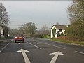
 Pattingham Road - geograph.org.uk - 1244896.jpg 640 × 480; 80 KB
-
 Pattingham Road - geograph.org.uk - 3181822.jpg 640 × 480; 114 KB
-
 Pedestrian subway under Parkway, Perton - geograph.org.uk - 3896094.jpg 1,024 × 768; 194 KB
-
 Permissive Path - geograph.org.uk - 4899010.jpg 800 × 600; 207 KB
-
 Perton Border - geograph.org.uk - 6071823.jpg 800 × 600; 162 KB
-
 Perton bus link, Tettenhall Wood - geograph.org.uk - 5637419.jpg 1,024 × 768; 255 KB
-
 Perton Court - geograph.org.uk - 391614 (cropped).jpg 375 × 375; 109 KB
-
 Perton Golf Course - geograph.org.uk - 1986275.jpg 880 × 660; 190 KB
-
 Perton Golf Course - geograph.org.uk - 729340.jpg 640 × 480; 75 KB
-
 Perton Lake - geograph.org.uk - 5539442.jpg 1,600 × 1,200; 501 KB
-
 Perton Library - geograph.org.uk - 457587.jpg 640 × 480; 124 KB
-
 Perton Mill Farm - geograph.org.uk - 458259.jpg 640 × 480; 143 KB
-
 Perton Park Golf Club - geograph.org.uk - 457576.jpg 640 × 480; 90 KB
-
 Perton Ridge View - geograph.org.uk - 4684077.jpg 800 × 600; 103 KB
-
 Perton Shopping Centre - geograph.org.uk - 458245.jpg 640 × 480; 126 KB
-
 Perton Shopping Centre - geograph.org.uk - 5539446.jpg 1,600 × 1,200; 368 KB
-
 Perton Sign - geograph.org.uk - 1610079.jpg 640 × 480; 62 KB
-
 Perton Sign - geograph.org.uk - 304350.jpg 640 × 480; 144 KB
-
 Pheasant Path - geograph.org.uk - 5959352.jpg 800 × 600; 230 KB
-
 Plank Bridge - geograph.org.uk - 5960701.jpg 800 × 600; 259 KB
-
 Pond near Wrottesley Hall, Staffordshire - geograph.org.uk - 797786.jpg 640 × 469; 160 KB
-

-
 Pool and boat house at Wrottesley Hall - geograph.org.uk - 1420579.jpg 640 × 480; 104 KB
-
 Pool in Birch Coppice - geograph.org.uk - 1410718.jpg 640 × 480; 154 KB
-
 Pool Path - geograph.org.uk - 6073578.jpg 800 × 600; 154 KB
-
 Pool Scene - geograph.org.uk - 4355344.jpg 800 × 600; 234 KB
-
 Pool View - geograph.org.uk - 4886999.jpg 800 × 600; 200 KB
-

-

-
 Private farmland track - geograph.org.uk - 5162633.jpg 800 × 600; 150 KB
-
 Pub View - geograph.org.uk - 5316383.jpg 800 × 589; 95 KB
-
 Pylon in the Mist - geograph.org.uk - 5240099.jpg 1,024 × 768; 72 KB
-
 Pylon Line - geograph.org.uk - 4355930.jpg 800 × 600; 167 KB
-
 Quiet lane near Trescott - geograph.org.uk - 1224322.jpg 600 × 450; 282 KB
-
 RAF Base Sign - geograph.org.uk - 4898990.jpg 800 × 600; 183 KB
-
 Restricted road access to Perton - geograph.org.uk - 649238.jpg 640 × 480; 246 KB
-
 Ribbon Development, Perton - geograph.org.uk - 2075095.jpg 640 × 480; 54 KB
-

-
 River Penk entering Perton - geograph.org.uk - 2172527.jpg 640 × 480; 191 KB
-
 Roundabout on Perton estate - geograph.org.uk - 1943118.jpg 947 × 710; 183 KB
-
 Run to Perton - geograph.org.uk - 6071902.jpg 800 × 600; 152 KB
-

-
 Short cut to Perton - geograph.org.uk - 3181861.jpg 640 × 480; 172 KB
-
 Sign and stile - geograph.org.uk - 1223409.jpg 600 × 450; 240 KB
-
 Silver Poplars Park Homes - geograph.org.uk - 3706838.jpg 1,600 × 1,200; 426 KB


_towards_Wolverhampton_-_geograph.org.uk_-_6177876.jpg)


_towards_Wolverhampton_-_geograph.org.uk_-_6177878.jpg)


_-_geograph.org.uk_-_6177874.jpg)


_-_geograph.org.uk_-_2076582.jpg)


_from_the_traffic_lights_-_geograph.org.uk_-_2774184.jpg)


.jpg)


