Category:Petham
Jump to navigation
Jump to search
English: Petham is a small village and civil parish in the North Downs, five miles south of Canterbury in Kent, South East England.
village in the United Kingdom  | |||||
| Upload media | |||||
| Instance of | |||||
|---|---|---|---|---|---|
| Location | Canterbury, Kent, South East England, England | ||||
| Area |
| ||||
 | |||||
Subcategories
This category has the following 6 subcategories, out of 6 total.
A
C
- Cotterell Court, Petham (2 F)
D
- Dormer Cottage, Petham (2 F)
L
- Lyon House, Petham (3 F)
O
- The Old Rectory, Petham (3 F)
Media in category "Petham"
The following 200 files are in this category, out of 354 total.
(previous page) (next page)-
 A field of crops - geograph.org.uk - 4966924.jpg 640 × 426; 73 KB
-
 A gentle chalk dry valley - geograph.org.uk - 4966882.jpg 640 × 426; 62 KB
-
 B2068 - geograph.org.uk - 4987270.jpg 640 × 426; 74 KB
-
 B2068 - geograph.org.uk - 4987272.jpg 640 × 426; 71 KB
-
 B2068 Stone Street towards Canterbury - geograph.org.uk - 5835872.jpg 1,024 × 684; 228 KB
-
 B2068 Stone Street towards Canterbury - geograph.org.uk - 5835886.jpg 1,024 × 684; 206 KB
-
 B2068 Stone Street towards Canterbury - geograph.org.uk - 5835910.jpg 1,024 × 684; 260 KB
-
 B2068, Stone Street - geograph.org.uk - 4987291.jpg 640 × 426; 67 KB
-
 B2068, Stone Street - geograph.org.uk - 4987299.jpg 640 × 426; 60 KB
-
 Bales below The Downs - geograph.org.uk - 4849755.jpg 640 × 426; 81 KB
-
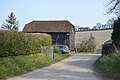
 Barn by Garlinge Green Rd - geograph.org.uk - 4966961.jpg 640 × 426; 95 KB
-
 Barn, Court Lodge - geograph.org.uk - 4975405.jpg 640 × 426; 120 KB
-
 Barn, Court Lodge - geograph.org.uk - 4975412.jpg 640 × 426; 73 KB
-
 Barn, Wootton - geograph.org.uk - 4975340.jpg 640 × 426; 86 KB
-
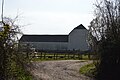
 Barn, Wootton Farm - geograph.org.uk - 4967009.jpg 640 × 426; 120 KB
-
 Barn, Wootton Farm - geograph.org.uk - 4967013.jpg 640 × 426; 75 KB
-
 Below Chartham Downs - geograph.org.uk - 4849759.jpg 640 × 426; 60 KB
-
 Below Chartham Downs - geograph.org.uk - 4849768.jpg 640 × 426; 79 KB
-
 Below Chartham Downs - geograph.org.uk - 4849836.jpg 640 × 426; 97 KB
-
 Big barn by Garlinge Green Rd - geograph.org.uk - 4966959.jpg 640 × 426; 78 KB
-
 Bridle gate on the bridleway to Petham - geograph.org.uk - 1802919.jpg 3,072 × 2,304; 2.6 MB
-
 Bridleway and footpath junction near Petham - geograph.org.uk - 1930967.jpg 3,072 × 2,304; 2.64 MB
-
 Bridleway beside Park Wood (2) - geograph.org.uk - 1805691.jpg 2,304 × 3,072; 2.37 MB
-
 Bridleway beside Park Wood - geograph.org.uk - 1805687.jpg 3,072 × 2,304; 2.14 MB
-
 Bridleway crosses Capel Road - geograph.org.uk - 1925780.jpg 3,072 × 2,304; 2.38 MB
-
 Bridleway crosses Stone Street - geograph.org.uk - 1802857.jpg 3,072 × 2,304; 2.23 MB
-

-
 Bridleway in Capel Wood - geograph.org.uk - 1925794.jpg 2,304 × 3,072; 2.3 MB
-
 Bridleway off Garlinge Green Rd - geograph.org.uk - 4966898.jpg 640 × 426; 80 KB
-
 Bridleway to Chequers Hill - geograph.org.uk - 1931042.jpg 3,072 × 2,304; 2.25 MB
-
 Bridleway to Denge Wood - geograph.org.uk - 2351963.jpg 480 × 640; 119 KB
-
 Bridleway to Duckpit Road - geograph.org.uk - 1931007.jpg 3,072 × 2,304; 2.11 MB
-
 Bridleway to Petham - geograph.org.uk - 1802941.jpg 3,072 × 2,304; 2.19 MB
-
 Broadway - geograph.org.uk - 2349227.jpg 640 × 480; 141 KB
-
 Byway to Garlinge Green - geograph.org.uk - 4958602.jpg 640 × 426; 123 KB
-
 Canterbury Fields Camp Site - geograph.org.uk - 4987289.jpg 640 × 426; 63 KB
-
 Capel Rd - geograph.org.uk - 4975334.jpg 640 × 426; 107 KB
-
 Capel Road - geograph.org.uk - 1925671.jpg 3,072 × 2,304; 2.03 MB
-
 Capel Road - geograph.org.uk - 2349737.jpg 640 × 480; 94 KB
-
 Capel Road - geograph.org.uk - 3388051.jpg 2,256 × 1,504; 3.24 MB
-
 Capel Road in Capel Wood - geograph.org.uk - 1925772.jpg 2,304 × 3,072; 2.2 MB
-
 Chalk dry valley - geograph.org.uk - 4984436.jpg 640 × 426; 40 KB
-
 Chalk farmland by Chequers Hill - geograph.org.uk - 4984475.jpg 640 × 426; 58 KB
-
 Chapel House - geograph.org.uk - 1803084.jpg 3,072 × 2,304; 2.31 MB
-
 Chartham Downs - geograph.org.uk - 4849825.jpg 640 × 426; 52 KB
-
 Chartham Downs Rd - geograph.org.uk - 4849772.jpg 640 × 426; 101 KB
-
 Chartham Downs Rd - geograph.org.uk - 4849778.jpg 640 × 426; 103 KB
-
 Chartham Downs Rd - geograph.org.uk - 4849780.jpg 640 × 426; 98 KB
-
 Chartham Downs Rd - geograph.org.uk - 4849807.jpg 640 × 426; 103 KB
-
 Chartham Downs Rd - geograph.org.uk - 4849828.jpg 640 × 426; 91 KB
-
 Chartham Downs Rd - geograph.org.uk - 4849829.jpg 640 × 426; 92 KB
-
 Chartham Downs Rd - geograph.org.uk - 4849831.jpg 640 × 426; 82 KB
-
 Chartham Downs Rd - geograph.org.uk - 4849838.jpg 640 × 426; 92 KB
-
 Chartham Downs Rd - geograph.org.uk - 4854276.jpg 640 × 426; 102 KB
-
 Chartham Downs Rd - geograph.org.uk - 4854283.jpg 640 × 426; 81 KB
-
 Chartham Downs Rd - geograph.org.uk - 4854303.jpg 640 × 426; 62 KB
-
 Chartham Downs Rd - geograph.org.uk - 4854308.jpg 640 × 426; 67 KB
-
 Chartham Downs Rd - geograph.org.uk - 4854310.jpg 640 × 426; 57 KB
-
 Chartham Downs Rd - geograph.org.uk - 4854320.jpg 640 × 426; 61 KB
-
 Chartham Downs Rd, Kenfield Rd junction - geograph.org.uk - 4849790.jpg 640 × 426; 110 KB
-
 Chartham Downs Road - geograph.org.uk - 3388004.jpg 2,256 × 1,504; 2.05 MB
-
 Checkers Mill, Petham, Kent.jpg 1,868 × 2,940; 1.55 MB
-
 Chequers Hill - geograph.org.uk - 2349232.jpg 640 × 427; 63 KB
-
 Chequers Hill - geograph.org.uk - 2349714.jpg 640 × 480; 66 KB
-
 Chequers Hill - geograph.org.uk - 4984447.jpg 640 × 426; 66 KB
-
 Chequers Hill - geograph.org.uk - 4984454.jpg 640 × 426; 65 KB
-
 Chequers Hill - geograph.org.uk - 4984467.jpg 640 × 426; 67 KB
-
 Chequers Hill - geograph.org.uk - 4984470.jpg 640 × 426; 58 KB
-
 Chequers Hill - geograph.org.uk - 4984473.jpg 640 × 426; 87 KB
-
 Chequers Hill - geograph.org.uk - 4984488.jpg 640 × 426; 114 KB
-
 Chequers Hill - geograph.org.uk - 4984489.jpg 640 × 426; 118 KB
-
 Chequers Hill - geograph.org.uk - 4987268.jpg 640 × 426; 66 KB
-
 China Court - geograph.org.uk - 4975398.jpg 640 × 426; 84 KB
-
 Church Lane - geograph.org.uk - 4975399.jpg 640 × 426; 90 KB
-
 Church Lane - geograph.org.uk - 4975408.jpg 640 × 426; 80 KB
-
 Church Lane - geograph.org.uk - 4984434.jpg 640 × 426; 83 KB
-
 Church Lane, Petham - geograph.org.uk - 4992488.jpg 2,048 × 1,536; 1.52 MB
-
 Church of All Saints - geograph.org.uk - 4984411.jpg 640 × 447; 85 KB
-
 Church of All Saints - geograph.org.uk - 4984413.jpg 640 × 426; 90 KB
-
 Church of All Saints - geograph.org.uk - 4984424.jpg 640 × 426; 117 KB
-
 Church of All Saints - geograph.org.uk - 4984441.jpg 640 × 426; 56 KB
-
 Church of All Saints - geograph.org.uk - 4984445.jpg 640 × 426; 49 KB
-
 Church of All Saints - geograph.org.uk - 4984449.jpg 640 × 426; 50 KB
-
 Churchyard, Church of All Saints - geograph.org.uk - 4984427.jpg 640 × 524; 114 KB
-
 Clearing in Denge Wood - geograph.org.uk - 2351924.jpg 640 × 480; 120 KB
-
 Clump of trees - geograph.org.uk - 4849834.jpg 640 × 426; 79 KB
-
 Clump of trees, Chartham Downs - geograph.org.uk - 4854273.jpg 640 × 426; 86 KB
-
 Coppicing track in Capel Wood - geograph.org.uk - 1925813.jpg 2,304 × 3,072; 2.19 MB
-
 Coppicing, Denge Wood - geograph.org.uk - 4958563.jpg 640 × 426; 138 KB
-
 Cottages, Garlinge Green Rd - geograph.org.uk - 4966962.jpg 640 × 426; 108 KB
-
 Cotterall Court, The Street, Petham - geograph.org.uk - 2266571.jpg 640 × 480; 86 KB
-
 Cotterell Court - geograph.org.uk - 4975390.jpg 640 × 426; 70 KB
-
 Court Lodge - geograph.org.uk - 1803015.jpg 3,072 × 2,304; 2.26 MB
-
 Court Lodge - geograph.org.uk - 4975407.jpg 640 × 426; 101 KB
-
 Court Lodge - geograph.org.uk - 4984396.jpg 640 × 426; 86 KB
-
 Court Lodge Farm - geograph.org.uk - 4984439.jpg 640 × 426; 61 KB
-
 Cricket Pavilion - geograph.org.uk - 4966894.jpg 640 × 426; 103 KB
-
 Cricket pitch - geograph.org.uk - 4966892.jpg 640 × 426; 67 KB
-
 Crop field by Chequers Hill - geograph.org.uk - 2349244.jpg 640 × 427; 89 KB
-
 Cross, Churchyard, Church of All Saints - geograph.org.uk - 4984410.jpg 426 × 640; 112 KB
-
 Cross, Churchyard, Church of All Saints - geograph.org.uk - 4984421.jpg 426 × 640; 121 KB
-
 Crossroads, Chartham Downs Rd - geograph.org.uk - 4854326.jpg 640 × 426; 68 KB
-
 Dane Chantry - geograph.org.uk - 1930902.jpg 3,072 × 2,304; 2.03 MB
-
 Dane Farm Barn - geograph.org.uk - 1930912.jpg 3,072 × 2,304; 2.26 MB
-
 Denge Wood - geograph.org.uk - 2349807.jpg 480 × 640; 156 KB
-
 Denge Wood - geograph.org.uk - 2349833.jpg 347 × 640; 159 KB
-
 Denge Wood - geograph.org.uk - 2351917.jpg 480 × 640; 154 KB
-
 Denge Wood - geograph.org.uk - 2351922.jpg 640 × 480; 148 KB
-
 Denge Wood - geograph.org.uk - 2351952.jpg 480 × 640; 148 KB
-
 Denge Wood - geograph.org.uk - 4272570.jpg 640 × 480; 193 KB
-
 Denge Wood information board - geograph.org.uk - 2351931.jpg 640 × 437; 98 KB
-
 Dense Vegetation, Stump Shave - geograph.org.uk - 3042049.jpg 640 × 430; 126 KB
-
 Downhill to Petham Village - geograph.org.uk - 2211084.jpg 1,110 × 755; 361 KB
-
 Duckpit Road enters Petham - geograph.org.uk - 5563965.jpg 640 × 428; 148 KB
-
 Duckpit Road, Petham - geograph.org.uk - 4993897.jpg 2,048 × 1,536; 1.52 MB
-
 Dutch gable - geograph.org.uk - 4967008.jpg 640 × 426; 39 KB
-
 Earley Wood - geograph.org.uk - 2349223.jpg 640 × 480; 132 KB
-
 Entrance to footpath off Garlinge Green Road - geograph.org.uk - 3388043.jpg 2,256 × 1,504; 3.23 MB
-
 Entrance, Church of All Saints - geograph.org.uk - 4984415.jpg 640 × 426; 104 KB
-
 Fallow field - geograph.org.uk - 4975337.jpg 640 × 426; 73 KB
-
 Fallow field - geograph.org.uk - 4975339.jpg 640 × 426; 74 KB
-
 Farm track to Debden Court Farm - geograph.org.uk - 1802885.jpg 3,072 × 2,304; 2.01 MB
-
 Farmland by Garlinge Green Rd - geograph.org.uk - 4966884.jpg 640 × 426; 55 KB
-
 Farmland by the B2068 - geograph.org.uk - 4987295.jpg 640 × 426; 72 KB
-
 Farmland by the B2068 - geograph.org.uk - 4987297.jpg 640 × 426; 81 KB
-
 Farmland near Petham - geograph.org.uk - 3388062.jpg 2,256 × 1,504; 2.24 MB
-
 Farmland, Chartham Downs - geograph.org.uk - 4854301.jpg 640 × 426; 57 KB
-
 Farmland, Chartham Downs - geograph.org.uk - 4854306.jpg 640 × 426; 59 KB
-
 Farmland, Chartham Downs - geograph.org.uk - 4854313.jpg 640 × 426; 80 KB
-
 Farmland, Petham - geograph.org.uk - 4984451.jpg 640 × 426; 76 KB
-
 Farmland, Swarling Manor - geograph.org.uk - 4854278.jpg 640 × 426; 87 KB
-
 Field between two woods - geograph.org.uk - 1925858.jpg 3,072 × 2,304; 1.28 MB
-
 Field boundary - geograph.org.uk - 4984453.jpg 640 × 426; 38 KB
-
 Field boundary - geograph.org.uk - 4984456.jpg 640 × 426; 61 KB
-
 Field boundary - geograph.org.uk - 4984466.jpg 640 × 426; 30 KB
-
 Field by Denge Wood - geograph.org.uk - 4958592.jpg 640 × 426; 85 KB
-
 Field east of Duckpit Road - geograph.org.uk - 5563961.jpg 640 × 480; 136 KB
-
 Field of crops - geograph.org.uk - 4966925.jpg 640 × 426; 77 KB
-
 Field on Vicarage Road, Petham - geograph.org.uk - 5028054.jpg 2,048 × 1,536; 1.16 MB
-
 Fields by Duckpit Road - geograph.org.uk - 4992490.jpg 2,002 × 1,472; 782 KB
-
 Fields by Garlinge Green Road - geograph.org.uk - 5028062.jpg 2,048 × 1,536; 1.52 MB
-
 Fields off Chartham Downs Road - geograph.org.uk - 3388000.jpg 1,024 × 683; 194 KB
-
 Fields off Chequers Hill - geograph.org.uk - 2349238.jpg 640 × 427; 61 KB
-
 Footpath across a field - geograph.org.uk - 4984443.jpg 640 × 426; 83 KB
-
 Footpath junction on Bridleway in Capel Wood - geograph.org.uk - 1925835.jpg 3,072 × 2,304; 2.72 MB
-
 Footpath off Chartham Downs Rd - geograph.org.uk - 4849802.jpg 640 × 426; 121 KB
-
 Footpath off Chequers Hill - geograph.org.uk - 4984476.jpg 640 × 426; 133 KB
-
 Footpath off Church Lane - geograph.org.uk - 4984433.jpg 640 × 426; 56 KB
-
 Footpath off Garlinge Green Rd - geograph.org.uk - 4967007.jpg 640 × 426; 128 KB
-
 Footpath through Denge Wood - geograph.org.uk - 2349820.jpg 480 × 640; 162 KB
-
 Footpath to Capel Wood - geograph.org.uk - 1925864.jpg 3,072 × 2,304; 1.87 MB
-
 Footpath towards Petham - geograph.org.uk - 1930712.jpg 3,072 × 2,304; 1.86 MB
-
 Footpath towards Waltham Road - geograph.org.uk - 1926043.jpg 2,304 × 3,072; 2.3 MB
-
 Footpath, Denge Wood - geograph.org.uk - 4958566.jpg 640 × 426; 118 KB
-
 Fortifed Dovecote - geograph.org.uk - 1805661.jpg 3,072 × 2,304; 2.46 MB
-
 Garlinge Court - geograph.org.uk - 4966874.jpg 640 × 426; 111 KB
-
 Garlinge Green - geograph.org.uk - 4958605.jpg 640 × 426; 89 KB
-
 Garlinge Green - geograph.org.uk - 4966870.jpg 640 × 426; 75 KB
-
 Garlinge Green - geograph.org.uk - 5563970.jpg 640 × 480; 191 KB
-
 Garlinge Green Rd - geograph.org.uk - 4966877.jpg 640 × 426; 100 KB
-
 Garlinge Green Rd - geograph.org.uk - 4966879.jpg 640 × 426; 96 KB
-
 Garlinge Green Rd - geograph.org.uk - 4966880.jpg 640 × 426; 101 KB
-
 Garlinge Green Rd - geograph.org.uk - 4966887.jpg 640 × 426; 106 KB
-
 Garlinge Green Rd - geograph.org.uk - 4966888.jpg 640 × 426; 76 KB
-
 Garlinge Green Rd - geograph.org.uk - 4966945.jpg 640 × 426; 127 KB
-
 Garlinge Green Rd - geograph.org.uk - 4966953.jpg 640 × 426; 109 KB
-
 Garlinge Green Rd - geograph.org.uk - 4966957.jpg 640 × 426; 106 KB
-
 Garlinge Green Rd - geograph.org.uk - 4966960.jpg 640 × 426; 104 KB
-
 Garlinge Green Rd - geograph.org.uk - 4975328.jpg 640 × 426; 92 KB
-
 Garlinge Green Rd through Walk Wood - geograph.org.uk - 4966886.jpg 640 × 426; 116 KB
-
 Garlinge Green Rd, Kenfield Rd junction - geograph.org.uk - 4966897.jpg 640 × 426; 106 KB
-
 Garlinge Green Road - geograph.org.uk - 3388030.jpg 2,256 × 1,504; 1.92 MB
-
 Garlinge Green Road - geograph.org.uk - 4992509.jpg 2,038 × 1,522; 1.55 MB
-
 Garlinge Green Road - geograph.org.uk - 5006976.jpg 2,048 × 1,536; 1.55 MB
-
 Garlinge Green Road - geograph.org.uk - 5028057.jpg 1,990 × 1,454; 1.03 MB
-
 Garlinge Green Road - geograph.org.uk - 5028059.jpg 1,944 × 1,386; 1.24 MB
-
 Garlinge Green Road - geograph.org.uk - 5028061.jpg 2,048 × 1,536; 1.5 MB
-
 Garlinge Green Road - geograph.org.uk - 5563968.jpg 640 × 480; 189 KB
-
 Gates to Earley Wood and field - geograph.org.uk - 341878.jpg 640 × 480; 145 KB
-
 Grave of Thomas Ridden - geograph.org.uk - 4984419.jpg 640 × 426; 120 KB
-
 Graves, Church of All Saints - geograph.org.uk - 4984416.jpg 640 × 426; 109 KB
-
 Hogg Lane - geograph.org.uk - 4987301.jpg 640 × 426; 95 KB
-
 Hospital (disused) - geograph.org.uk - 4849752.jpg 640 × 426; 88 KB
-
 House on Church Lane - geograph.org.uk - 4975393.jpg 640 × 426; 115 KB
-
 House on Duckpit Road - geograph.org.uk - 4992492.jpg 2,048 × 1,536; 1.01 MB
-
 House on Garlinge Green Road - geograph.org.uk - 5028055.jpg 1,988 × 1,452; 880 KB
-
 House, Church Lane - geograph.org.uk - 4975396.jpg 640 × 426; 91 KB
-
 House, Garlinge Green - geograph.org.uk - 4966871.jpg 640 × 426; 71 KB
-
 Houses off The Street - geograph.org.uk - 4975385.jpg 640 × 426; 92 KB
-
 Houses on Duckpit Road, Petham - geograph.org.uk - 4992486.jpg 2,048 × 1,536; 1.49 MB
-
 Houses on Garlinge Green Road - geograph.org.uk - 5028060.jpg 1,946 × 1,390; 771 KB
-
 Houses on Stone Street - geograph.org.uk - 4987288.jpg 640 × 426; 68 KB
-
 Houses on The Street - geograph.org.uk - 4975375.jpg 640 × 426; 78 KB
-
 Houses, Church Lane - geograph.org.uk - 4975394.jpg 640 × 426; 108 KB
-
 Iffin Lane - geograph.org.uk - 4854334.jpg 640 × 426; 85 KB
-
 Iffin Wood - geograph.org.uk - 4854323.jpg 640 × 426; 82 KB
-
 Kenfield Bungalows - geograph.org.uk - 4966891.jpg 640 × 449; 112 KB
-
 Kenfield Hall - geograph.org.uk - 4966927.jpg 640 × 447; 85 KB
-
 Kenfield House - geograph.org.uk - 1805725.jpg 3,072 × 2,304; 1.88 MB
-
 Kenfield Rd - geograph.org.uk - 4849798.jpg 640 × 426; 112 KB


_-_geograph.org.uk_-_1805691.jpg)


_-_geograph.org.uk_-_4849752.jpg)


