Category:Pfarrhof St. Stephan (Blumenweg 4, Sempach)
Jump to navigation
Jump to search
| Object location | | View all coordinates using: OpenStreetMap |
|---|
| NO WIKIDATA ID FOUND! Search for Pfarrhof St. Stephan (Blumenweg 4, Sempach) on Wikidata | |
| Upload media |
Media in category "Pfarrhof St. Stephan (Blumenweg 4, Sempach)"
This category contains only the following file.
-
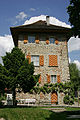 Picswiss LU-23-31.jpg 300 × 450; 55 KB
