Category:Pfarrkirche Ampass
Jump to navigation
Jump to search
| Object location | | View all coordinates using: OpenStreetMap |
|---|
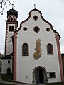
Saint John the Baptist Church and cemetery in Ampass, Austria  | |||||
| Upload media | |||||
| Instance of | |||||
|---|---|---|---|---|---|
| Location | Ampass, Innsbruck-Land District, Tyrol, Austria | ||||
| Street address |
| ||||
| Heritage designation | |||||
 | |||||
Media in category "Pfarrkirche Ampass"
The following 5 files are in this category, out of 5 total.
-
 Ampass, Pfarrkirche Hl. Johannes der Täufer.JPG 2,448 × 3,264; 2.64 MB
-
 Pfarrkirche Ampass innen.jpg 4,805 × 3,774; 14.33 MB
-
 Pfarrkirche Ampass.jpg 1,500 × 2,000; 1.22 MB
-
Pfarrkirche Ampass.webm 2 min 12 s, 1,920 × 1,080; 118.3 MB
-
 Pfarrkirche Johannes der Täufer Ampass.jpg 3,776 × 2,419; 2.43 MB


