Category:Pfarrkirche Mistelbach (Niederösterreich)
Jump to navigation
Jump to search
| Object location | | View all coordinates using: OpenStreetMap |
|---|
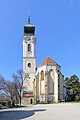
building in Mistelbach, Austria   | |||||
| Upload media | |||||
| Instance of | |||||
|---|---|---|---|---|---|
| Location | Mistelbach, Mistelbach District, Lower Austria, Austria | ||||
| Heritage designation | |||||
 | |||||
Media in category "Pfarrkirche Mistelbach (Niederösterreich)"
The following 11 files are in this category, out of 11 total.
-
 2021-09-04 Mistelbach Hauptplatz StMartin.jpg 3,554 × 5,339; 12.87 MB
-
 Mistelbach - katholische Kirche.JPG 4,581 × 3,054; 11.47 MB
-
 Mistelbach - katholische Kirche.jpg 2,399 × 3,599; 5.93 MB
-
 Mistelbach Pfarrkirche-2.jpg 1,920 × 1,280; 596 KB
-
 Mistelbach Pfarrkirche-3.jpg 1,280 × 1,920; 291 KB
-
 Mistelbach Pfarrkirche.jpg 1,920 × 1,280; 223 KB
-
 Mistelbach Pfarrkirche01.jpg 3,648 × 2,736; 3.91 MB
-
 Mistelbach Pfarrkirche02.jpg 2,736 × 3,648; 3.4 MB
-
 Mistelbach Pfarrkirche03.jpg 2,736 × 3,648; 3.55 MB
-
 Mistelbach Pfarrkirche04.jpg 2,736 × 3,648; 3.28 MB
-
 Sankt Martin Mistelbach.jpg 544 × 800; 323 KB


