Category:Pfarrkirche St. Maria (Hildisrieden)
Jump to navigation
Jump to search
| Object location | | View all coordinates using: OpenStreetMap |
|---|
|
This is a category about a cultural property of regional significance in Switzerland with KGS number 3688
|
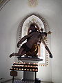
church building in Hildisrieden in the canton of Lucerne, Switzerland _P9220011_01.JPG) _P9220011_03.JPG) | |||||
| Upload media | |||||
| Instance of | |||||
|---|---|---|---|---|---|
| Part of | |||||
| Location | Hildisrieden, Sursee Constituency, Lucerne, Switzerland | ||||
| Street address |
| ||||
| Diocese | |||||
| Heritage designation | |||||
| Inception |
| ||||
 | |||||
Media in category "Pfarrkirche St. Maria (Hildisrieden)"
The following 6 files are in this category, out of 6 total.
-
 Katholische Kirche St. Maria (1904, Hardegger) P9220011 01.JPG 4,004 × 3,361; 6.78 MB
-
 Katholische Kirche St. Maria (1904, Hardegger) P9220011 02.JPG 3,456 × 4,608; 3.69 MB
-
 Katholische Kirche St. Maria (1904, Hardegger) P9220011 03.JPG 3,456 × 4,608; 3.68 MB
-
 Katholische Kirche St. Maria (1904, Hardegger) P9220011 04.JPG 3,456 × 4,608; 3.36 MB
-
 Katholische Kirche St. Maria (1904, Hardegger) P9220011 05.JPG 4,608 × 3,456; 3.04 MB
-
 Katholische Kirche St. Maria (1904, Hardegger) P9220011 06.JPG 4,608 × 3,456; 3.23 MB
_P9220011_02.JPG)
_P9220011_04.JPG)
_P9220011_05.JPG)
_P9220011_06.JPG)