Category:Pfarrscheune (Villnachernstrasse 3.5, Umiken)
Jump to navigation
Jump to search
| Object location | | View all coordinates using: OpenStreetMap |
|---|
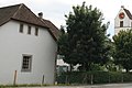
church outbuilding and part of the architectural ensemble in Umiken in the canton of Aargau, Switzerland _(Umiken_Kirche_4949,_cropped).jpg) | |||||
| Upload media | |||||
| Instance of | |||||
|---|---|---|---|---|---|
| Part of | |||||
| Location | Umiken, Brugg, Brugg District, Aargau, Switzerland | ||||
| Street address |
| ||||
| Inception |
| ||||
 | |||||
Media in category "Pfarrscheune (Villnachernstrasse 3.5, Umiken)"
This category contains only the following file.
-
 Pfarrscheune (Villnachernstrasse 3.3, Umiken) (Umiken Kirche 4949, cropped).jpg 2,774 × 1,851; 2.05 MB