Category:Philippsburg (Leer)
Jump to navigation
Jump to search
| Object location | | View all coordinates using: OpenStreetMap |
|---|
_01.JPG) | |||||
| Upload media | |||||
| Instance of | |||||
|---|---|---|---|---|---|
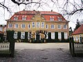
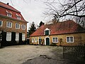
| Location | Leer, Lower Saxony, Germany | ||||
| Street address |
| ||||
| Heritage designation | |||||
| official website | |||||
 | |||||
Media in category "Philippsburg (Leer)"
The following 20 files are in this category, out of 20 total.
-
 Leer - Hohe Loga + Philippsburg 01 ies.jpg 5,616 × 3,744; 23.46 MB
-
 Leer - Hohe Loga - Philippsburg 01 ies.jpg 5,616 × 3,745; 21.06 MB
-
 Leer - Hohe Loga - Philippsburg 02 ies.jpg 5,616 × 3,744; 23.71 MB
-
 Leer - Hohe Loga - Philippsburg 03 ies.jpg 3,743 × 5,616; 19.05 MB
-
 Leer - Hohe Loga - Philippsburg 04 ies.jpg 5,616 × 3,744; 21.94 MB
-
 Leer - Hohe Loga - Philippsburg 05 ies.jpg 5,616 × 3,744; 22.18 MB
-
 Leer - Hohe Loga - Philippsburg 06 ies.jpg 5,616 × 3,744; 21.33 MB
-
 Leer - Hohe Loga - Philippsburg 07 ies.jpg 5,616 × 3,744; 25.04 MB
-
 Leer - Hohe Loga - Philippsburg 08 ies.jpg 5,616 × 3,744; 21.58 MB
-
 Leer - Hohe Loga - Philippsburg 09 ies.jpg 5,616 × 3,744; 22.11 MB
-
 Leer - Hohe Loga - Philippsburg 10 ies.jpg 5,616 × 3,745; 20.73 MB
-
 Leer - Hohe Loga - Philippsburg 11 ies.jpg 3,744 × 5,616; 21.92 MB
-
 Leer - Hohe Loga - Philippsburg 12 ies.jpg 5,616 × 3,744; 20.42 MB
-
 Leer - Hohe Loga - Philippsburg 13 ies.jpg 5,616 × 3,744; 24.58 MB
-
 Philippsburg Loga (Leer) 01.JPG 4,320 × 3,240; 3.51 MB
-
 Philippsburg Loga (Leer) 02.JPG 4,320 × 3,240; 3.77 MB
-
 Philippsburg Loga (Leer) 03.JPG 4,320 × 3,240; 3.48 MB
-
 Philippsburg Loga (Leer) 04.JPG 4,320 × 3,240; 3.17 MB
-
 Philippsburg Loga (Leer) 05.JPG 4,320 × 3,240; 3.18 MB
-
 Phillipsburg Leer Loga.jpg 5,184 × 3,456; 10.54 MB


_02.JPG)
_03.JPG)
_04.JPG)
_05.JPG)
