Category:Photos from Panoramio ID 4847496
Jump to navigation
Jump to search

Media in category "Photos from Panoramio ID 4847496"
The following 41 files are in this category, out of 41 total.
-
 360 panoramic of the clearing - panoramio.jpg 12,288 × 1,336; 3.54 MB
-
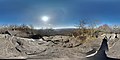
 A ledge at Mount Yonah - panoramio.jpg 7,168 × 3,584; 6.63 MB
-
 A water source on the trail - panoramio.jpg 2,688 × 1,520; 2.04 MB
-
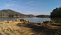 Beach at Red Top - panoramio.jpg 2,688 × 1,520; 1.76 MB
-
 Blood mountain on the east side - panoramio.jpg 6,264 × 4,148; 8.62 MB
-
 Blood Mountain Photosphere - panoramio.jpg 7,168 × 3,584; 7.36 MB
-
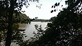 Chattahoochee river from Gold Branch - panoramio (1).jpg 2,688 × 1,520; 1.51 MB
-
 Chattahoochee river from Gold Branch - panoramio (2).jpg 2,688 × 1,520; 1.66 MB
-
 Chattahoochee river from Gold Branch - panoramio.jpg 2,688 × 1,520; 1.89 MB
-
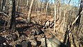 Freeman Trail Terrain - panoramio.jpg 2,688 × 1,520; 2.26 MB
-
 From Mount Yonah at sunrise - panoramio.jpg 2,688 × 1,520; 818 KB
-
 From Mount Yonah at sunset - panoramio.jpg 2,688 × 1,520; 1.41 MB
-
 Gold Branch Photosphere - panoramio.jpg 6,144 × 3,072; 8.74 MB
-
 Lake from Red Top Mountain Picnic - panoramio.jpg 2,688 × 1,520; 1.57 MB
-
 Mount Yonah at sunset - panoramio.jpg 6,292 × 4,128; 4.51 MB
-
 Mount Yonah clearing mid way up the trail - panoramio.jpg 2,688 × 1,520; 2.15 MB
-
 Mount Yonah from the parking lot - panoramio.jpg 2,688 × 1,520; 1.97 MB
-
 Mount Yonah sunrise photosphere - panoramio.jpg 7,168 × 3,584; 4.67 MB
-
 Mount Yonah Trail looking up - panoramio.jpg 2,688 × 1,520; 2.52 MB
-
 Mount Yonah Trail view from first clearing - panoramio.jpg 5,912 × 4,202; 5.8 MB
-
 Mount Yonah Trail, ankles beware - panoramio.jpg 2,688 × 1,520; 1.95 MB
-
 Near the top of Blood Mountain - panoramio.jpg 6,252 × 4,088; 7.3 MB
-
 On the trail in the fog - panoramio.jpg 2,688 × 1,520; 1.31 MB
-
 On the trail in the rain - panoramio.jpg 2,688 × 1,520; 1.64 MB
-
 Pine Mountain Above Fatman Squeeze - panoramio.jpg 2,688 × 1,520; 2.1 MB
-
 Pine Mountain Mossy Rocks - panoramio.jpg 2,688 × 1,520; 2.2 MB
-
 Pine Mountain Path - panoramio.jpg 2,688 × 1,520; 1.96 MB
-
 Pine Mountain West Loop - panoramio.jpg 2,688 × 1,520; 1.86 MB
-
 Red Top Mountain Playground and Picnic - panoramio (1).jpg 2,688 × 1,520; 1.96 MB
-
 Red Top Mountain Playground and Picnic - panoramio.jpg 2,688 × 1,520; 2.08 MB
-
 Ruined car - panoramio.jpg 2,688 × 1,520; 1.62 MB
-
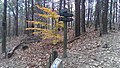
 Signpost for Freeman-AT west intersection. - panoramio.jpg 2,688 × 1,520; 2.25 MB
-
 Slaughter Mountain - panoramio (2).jpg 2,688 × 1,520; 2.84 MB
-
 Small place to rest on Blood Mountain - panoramio.jpg 6,234 × 4,168; 8.49 MB
-
 Start of the Redtop Iron Trail - panoramio.jpg 2,688 × 1,520; 1.81 MB
-
 Sunset on Lake Allatoona - panoramio.jpg 2,688 × 1,520; 1.23 MB
-
 The bald at the top of Mount Yonah - panoramio.jpg 2,688 × 1,520; 1.43 MB
-
 The path towards the Woods Hole shelter - panoramio.jpg 2,688 × 1,520; 2.32 MB
-
 The view from Freeman-AT east intersection - panoramio.jpg 2,688 × 1,520; 2.59 MB
-
 View from the trail - panoramio.jpg 2,688 × 1,520; 1.01 MB
-
 White County, GA, USA - panoramio.jpg 2,688 × 1,520; 1.45 MB


.jpg)
.jpg)


.jpg)


.jpg)


