Category:Pierres tombales près de l'église protestante (Beblenheim)
Jump to navigation
Jump to search
| Object location | | View all coordinates using: OpenStreetMap |
|---|
|
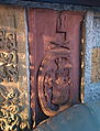
This building is classé au titre des monuments historiques de la France. It is indexed in the base Mérimée, a database of architectural heritage maintained by the French Ministry of Culture, under the reference PA00085335
|
 | |||||
| Upload media | |||||
| Instance of | |||||
|---|---|---|---|---|---|
| Location | Beblenheim, canton of Kaysersberg | ||||
| Street address |
| ||||
| Heritage designation |
| ||||
 | |||||
Media in category "Pierres tombales près de l'église protestante (Beblenheim)"
The following 5 files are in this category, out of 5 total.
-
 Beblenheim-0009.jpg 3,406 × 2,271; 4.37 MB
-
 Beblenheim-0015.jpg 4,798 × 3,199; 5.78 MB
-
 Beblenheim-0016.jpg 2,448 × 3,213; 3.1 MB
-
 Beblenheim-0019.jpg 2,646 × 3,473; 3.35 MB
-
 Beblenheim-0022.jpg 4,274 × 2,848; 6.54 MB


Categories:
- Monuments historiques in Beblenheim
- Baroque reliefs in Beblenheim
- Sandstone reliefs in Beblenheim
- Reliefs of coats of arms in Haut-Rhin
- Monuments historiques in France (graves)
- Wall mounted church monuments in Arrondissement Colmar-Ribeauvillé
- Objets monuments historiques in Bas-Rhin (ledger stones)
- Objets monuments historiques in Bas-Rhin (stone carving)