Category:Plaskerk (Raalte)
Jump to navigation
Jump to search
| Object location | | View all coordinates using: OpenStreetMap |
|---|
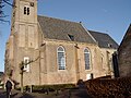
church building in Raalte, Netherlands  | |||||
| Upload media | |||||
| Instance of | |||||
|---|---|---|---|---|---|
| Location | Raalte, Overijssel, Netherlands | ||||
| Street address |
| ||||
| Located on street |
| ||||
| Heritage designation |
| ||||
| Significant event |
| ||||
| Religion or worldview | |||||
 | |||||
Nederlands: Plaskerk
|
This is a category about rijksmonument number 32268
|
| Address |
|
Subcategories
This category has only the following subcategory.
P
Media in category "Plaskerk (Raalte)"
The following 78 files are in this category, out of 78 total.
-
 Exterieur OVERZICHT BEELDHOUWWERK - Raalte - 20282983 - RCE.jpg 954 × 1,200; 256 KB
-
 Exterieur OVERZICHT NOORDGEVEL - Raalte - 20282982 - RCE.jpg 1,200 × 951; 298 KB
-

-

-
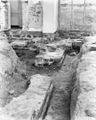
 Fundering koor voormalige kerk - Raalte - 20184079 - RCE.jpg 1,200 × 963; 272 KB
-
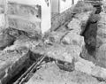
 Fundering koormuur naar het oosten - Raalte - 20184075 - RCE.jpg 957 × 1,200; 293 KB
-
 Fundering koorsluiting naar het zuid-oosten - Raalte - 20184077 - RCE.jpg 961 × 1,200; 315 KB
-
 Fundering koorsluiting naar het zuiden - Raalte - 20184078 - RCE.jpg 1,200 × 957; 283 KB
-
 Fundering middenschip naar het zuiden - Raalte - 20184081 - RCE.jpg 1,200 × 949; 299 KB
-
 Fundering middenschip naar het zuiden - Raalte - 20184082 - RCE.jpg 960 × 1,200; 288 KB
-
 Fundering naar het noorden - Raalte - 20184074 - RCE.jpg 954 × 1,200; 274 KB
-
 Fundering sacristie, noord muur van het Koor - Raalte - 20184085 - RCE.jpg 955 × 1,200; 424 KB
-
 Fundering schipmuur naar het noord-westen - Raalte - 20184070 - RCE.jpg 970 × 1,200; 281 KB
-
 Fundering schipmuur naar het oosten - Raalte - 20184072 - RCE.jpg 953 × 1,200; 269 KB
-
 Fundering schipmuur noord-zijde - Raalte - 20184073 - RCE.jpg 1,200 × 954; 281 KB
-
 Fundering triomfboog gezien naar het noorden - Raalte - 20184063 - RCE.jpg 790 × 1,200; 243 KB
-
 Fundering triomfboog gezien naar het zuiden - Raalte - 20184064 - RCE.jpg 802 × 1,200; 254 KB
-
 Fundering triomfboog naar het zuid-westen - Raalte - 20184080 - RCE.jpg 959 × 1,200; 295 KB
-
 Fundering voormalige noord-oost wand - Raalte - 20184076 - RCE.jpg 1,200 × 1,016; 321 KB
-
 Fundering voormalige west muur - Raalte - 20184069 - RCE.jpg 1,200 × 955; 276 KB
-

-
 Fundering west muur schip - Raalte - 20184068 - RCE.jpg 1,200 × 955; 343 KB
-
 Funderingen - Raalte - 20184088 - RCE.jpg 1,200 × 763; 230 KB
-
 Funderingen - Raalte - 20184089 - RCE.jpg 746 × 1,200; 229 KB
-
 Funderingen in middenschip naar het zuiden - Raalte - 20184136 - RCE.jpg 960 × 1,200; 253 KB
-
 Grafsteen - Raalte - 20184050 - RCE.jpg 774 × 1,200; 287 KB
-
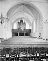 Interieur naar het oosten - Raalte - 20184040 - RCE.jpg 948 × 1,200; 191 KB
-
 Interieur naar het oosten - Raalte - 20184046 - RCE.jpg 1,200 × 962; 148 KB
-
 Interieur naar het oosten - Raalte - 20184142 - RCE.jpg 1,200 × 959; 185 KB
-
 Interieur naar het westen - Raalte - 20184039 - RCE.jpg 955 × 1,200; 157 KB
-
 Interieur van het koor - Raalte - 20184045 - RCE.jpg 1,200 × 954; 159 KB
-
 Kapconstructie - Raalte - 20184043 - RCE.jpg 1,200 × 937; 248 KB
-
 Kerk naar het zuid-westen - Raalte - 20184037 - RCE.jpg 1,200 × 953; 257 KB
-
 Kerk vanuit het oosten - Raalte - 20184035 - RCE.jpg 888 × 1,200; 192 KB
-
 Lezenaar - Raalte - 20184042 - RCE.jpg 1,200 × 952; 264 KB
-
 Lezenaar - Raalte - 20184048 - RCE.jpg 969 × 1,200; 206 KB
-
 Noord-oost zijde exterieur, fundering - Raalte - 20184083 - RCE.jpg 1,200 × 955; 402 KB
-
 Noord-oost zijde exterieur, fundering - Raalte - 20184084 - RCE.jpg 1,200 × 950; 383 KB
-
 Noordgevel - Raalte - 20184137 - RCE.jpg 1,200 × 955; 329 KB
-
 Ontgraven koorsluiting - Raalte - 20184086 - RCE.jpg 1,200 × 788; 203 KB
-
 Ontgraven koorsluiting - Raalte - 20184087 - RCE.jpg 1,200 × 788; 187 KB
-
 Ontpleistering koor - Raalte - 20184049 - RCE.jpg 786 × 1,200; 255 KB
-
 Ontpleistering koor en schip - Raalte - 20184054 - RCE.jpg 796 × 1,200; 276 KB
-
 Ontpleistering koor en schip - Raalte - 20184055 - RCE.jpg 796 × 1,200; 252 KB
-
 Ontpleistering koor en schip - Raalte - 20184056 - RCE.jpg 1,200 × 797; 270 KB
-
 Ontpleistering koor en schip - Raalte - 20184057 - RCE.jpg 794 × 1,200; 250 KB
-
 Oostgevel - Raalte - 20184141 - RCE.jpg 1,200 × 951; 240 KB
-
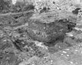
 Opgraving sacristie - Raalte - 20184051 - RCE.jpg 1,200 × 786; 323 KB
-
 Opgraving sacristie - Raalte - 20184052 - RCE.jpg 793 × 1,200; 296 KB
-
 Opgraving sacristie - Raalte - 20184053 - RCE.jpg 1,200 × 798; 287 KB
-
 Overzicht zuidzijde - Raalte - 20184138 - RCE.jpg 1,200 × 957; 258 KB
-
 Preekstoel - Raalte - 20184041 - RCE.jpg 953 × 1,200; 177 KB
-
 Preekstoel - Raalte - 20184047 - RCE.jpg 1,200 × 958; 182 KB
-
 Preekstoel - Raalte - 20184143 - RCE.jpg 955 × 1,200; 183 KB
-
 Raalte - Plaskerk-003.JPG 2,048 × 1,536; 1.39 MB
-
 Raalte - Plaskerk-011.JPG 2,048 × 1,536; 1.42 MB
-
 Raalte - Plaskerk-018.JPG 1,536 × 2,048; 1.37 MB
-
 Raalte - Plaskerk-021.JPG 2,560 × 1,920; 2.3 MB
-
 Raalte - Plaskerk-023.JPG 1,920 × 2,560; 2.29 MB
-
 Raalte - Plaskerk-027.JPG 2,560 × 1,920; 2.12 MB
-
 Raalte - Plaskerk-028.JPG 2,560 × 1,920; 2.22 MB
-
 Raalte - Plaskerk-030.JPG 2,560 × 1,920; 2.15 MB
-
 Raalte - Plaskerk.JPG 2,048 × 1,536; 1.42 MB
-
 Raalte prot plaskerk 25-11-2008 13-59-12.JPG 1,920 × 2,560; 2.17 MB
-
 Raalte prot plaskerk 25-11-2008 13-59-28.JPG 2,560 × 1,920; 2.12 MB
-
 Sacramentshuisje in het koor - Raalte - 20184044 - RCE.jpg 961 × 1,200; 210 KB
-

-
 Tegelvloer noord-west zijde - Raalte - 20184071 - RCE.jpg 1,200 × 960; 317 KB
-
 Tegelvloertje - Raalte - 20184090 - RCE.jpg 761 × 1,200; 255 KB
-
 Tegelvloertje - Raalte - 20184091 - RCE.jpg 759 × 1,200; 218 KB
-
 Toren - Raalte - 20184034 - RCE.jpg 868 × 1,200; 191 KB
-
 Toren naar het noord-oosten - Raalte - 20184036 - RCE.jpg 961 × 1,200; 273 KB
-
 Toren naar het zuid-oosten - Raalte - 20184038 - RCE.jpg 956 × 1,200; 243 KB
-
 Torenhaan - Raalte - 20184059 - RCE.jpg 1,200 × 794; 287 KB
-
 Vrijgelegde ingang noord-zijde schip - Raalte - 20184066 - RCE.jpg 799 × 1,200; 239 KB
-
 Vrijgelegde ingang zuid-zijde schip - Raalte - 20184065 - RCE.jpg 793 × 1,200; 225 KB
-
 Zuidgevel - Raalte - 20184140 - RCE.jpg 961 × 1,200; 284 KB
-
 Zuidgevel koor - Raalte - 20184139 - RCE.jpg 1,200 × 951; 322 KB


_-_Raalte_-_20184060_-_RCE.jpg)


