Category:Plateliai in topographic maps
Jump to navigation
Jump to search
Media in category "Plateliai in topographic maps"
The following 5 files are in this category, out of 5 total.
-
 Ltopo VII-11.jpg 10,083 × 10,270; 17.41 MB
-
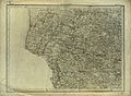 Shubert map - R10L01.jpg 7,953 × 5,833; 17.07 MB
-
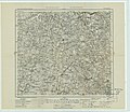 KdwR J17 1915.jpeg 10,272 × 8,893; 9.35 MB
-
 R100 o-34-140.jpg 2,000 × 2,600; 1.38 MB
-
 Šventorkalnis and Pilie sala, Plateliai, Lithuania.png 1,239 × 844; 182 KB


