Category:Playden
Jump to navigation
Jump to search
villageand civil parish in East Sussex, United Kingdom .JPG) | |||||
| Upload media | |||||
| Instance of | |||||
|---|---|---|---|---|---|
| Location | Rother, East Sussex, South East England, England | ||||
| Area |
| ||||
 | |||||
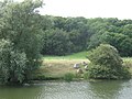
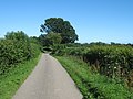
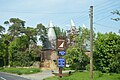
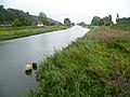
English: Playden is a village and civil parish in the Rother District of East Sussex, England. The village is located one mile (1.6 km) north-west of Rye. It is mentioned in the Domesday Book; it is a largely rural parish, having no village centre, and the hamlet of Houghton Green is included in the parish. Playden's main occupation was fishing: the fish were salted in a one-time settlement known as Saltcote, after the fact that it had a fish salting industry based there. Saltcote Street is now all that remains of that industry.
Subcategories
This category has the following 2 subcategories, out of 2 total.
O
- Oasts in Playden (19 F)
P
Media in category "Playden"
The following 200 files are in this category, out of 328 total.
(previous page) (next page)-
 A small stream joins the River Rother - geograph.org.uk - 1754368.jpg 562 × 640; 102 KB
-
 A wet day at Houghton Green - geograph.org.uk - 4142020.jpg 4,000 × 3,000; 4.17 MB
-
 A wet day on Walland Marsh - geograph.org.uk - 4142044.jpg 4,000 × 3,000; 4.06 MB
-
 A268 passes the Peace and Plenty - geograph.org.uk - 2987497.jpg 3,090 × 2,454; 1.07 MB
-
 A268, northbound - geograph.org.uk - 3758987.jpg 640 × 430; 78 KB
-
 An old floodwall - geograph.org.uk - 3103982.jpg 640 × 430; 45 KB
-
 Approaching Boonshill Bridge - geograph.org.uk - 3477371.jpg 3,776 × 2,520; 4.18 MB
-
 B2082, Iden - geograph.org.uk - 6084767.jpg 1,024 × 684; 230 KB
-
 Barn, The Gables - geograph.org.uk - 1754169.jpg 640 × 430; 148 KB
-
 Barns, North Farm - geograph.org.uk - 5223982.jpg 640 × 426; 42 KB
-
 Barrier Field - geograph.org.uk - 6197503.jpg 640 × 480; 59 KB
-
 Bend in the River Rother - geograph.org.uk - 1754833.jpg 640 × 370; 64 KB
-
 Blackthorn Oast, Houghton Lane - geograph.org.uk - 6190898.jpg 640 × 480; 76 KB
-
 Blossom, Five Watering Sewer - geograph.org.uk - 5202773.jpg 640 × 426; 51 KB
-
 Bluebell Field - geograph.org.uk - 6189786.jpg 640 × 480; 78 KB
-
 Boonshill Bridge - geograph.org.uk - 3098035.jpg 640 × 430; 57 KB
-
 Boonshill Bridge - geograph.org.uk - 3098040.jpg 640 × 415; 48 KB
-
 Boonshill Bridge - geograph.org.uk - 3455268.jpg 4,320 × 3,240; 3.74 MB
-
 Boonshill Bridge - geograph.org.uk - 6190948.jpg 640 × 480; 80 KB
-
 Boonshill Field - geograph.org.uk - 6190929.jpg 640 × 480; 86 KB
-
 Boonshill Petty Sewer - geograph.org.uk - 6190947.jpg 480 × 640; 79 KB
-
 Boonshill, Houghton Green, East Sussex - geograph.org.uk - 2311837.jpg 1,600 × 742; 174 KB
-
 Brick Barn Field - geograph.org.uk - 6190888.jpg 640 × 480; 66 KB
-
 Bridleway to Brook's Bridge - geograph.org.uk - 3103999.jpg 640 × 422; 67 KB
-
 Brook's Bridge - geograph.org.uk - 6117799.jpg 640 × 480; 84 KB
-
 Building at Scots Float Lock - geograph.org.uk - 3106042.jpg 640 × 373; 55 KB
-
 Buoys in the River Rother - geograph.org.uk - 2482792.jpg 3,072 × 2,304; 1.9 MB
-
 Burntoak Barn Field - geograph.org.uk - 6190916.jpg 640 × 480; 65 KB
-
 Butt Field - geograph.org.uk - 6192055.jpg 640 × 480; 69 KB
-
 Cedar Shingle house - geograph.org.uk - 2482733.jpg 3,072 × 2,304; 2.52 MB
-
 Cliff Farm - geograph.org.uk - 1753132.jpg 640 × 430; 109 KB
-
 Cliff Farm - geograph.org.uk - 3098047.jpg 640 × 430; 54 KB
-
 Cliff Farm - geograph.org.uk - 6190940.jpg 640 × 480; 86 KB
-
 Cliff Field - geograph.org.uk - 6190941.jpg 640 × 480; 62 KB
-
 Cliffe Wood - geograph.org.uk - 1753378.jpg 640 × 430; 74 KB
-
 Cliffe Wood - geograph.org.uk - 1753417.jpg 640 × 430; 118 KB
-
 Cliffe Wood - geograph.org.uk - 1753461.jpg 640 × 430; 118 KB
-
 Coastal Coaches bus GX05 AOP at Playden (2).jpg 2,592 × 1,944; 1.65 MB
-
 Coastal Coaches bus GX05 AOP at Playden.jpg 2,592 × 1,944; 1.64 MB
-
 Confluence, River Rother - geograph.org.uk - 3999004.jpg 2,814 × 2,010; 1 MB
-
 Corner Field-Thistly Field - geograph.org.uk - 6190902.jpg 640 × 480; 69 KB
-
 Depot, Military Rd - geograph.org.uk - 1754177.jpg 640 × 430; 141 KB
-
 Depot, Military Rd - geograph.org.uk - 1754180.jpg 640 × 430; 85 KB
-
 Drainage channel by the River Rother - geograph.org.uk - 1753474.jpg 640 × 430; 168 KB
-
 Drainage ditch - geograph.org.uk - 1753395.jpg 640 × 442; 78 KB
-
 Drainage ditch - geograph.org.uk - 3098051.jpg 640 × 396; 52 KB
-
 Drainage ditch - geograph.org.uk - 3103974.jpg 640 × 430; 56 KB
-
 Drainage ditch - geograph.org.uk - 3103983.jpg 640 × 430; 108 KB
-
 Eight Acres - geograph.org.uk - 6190859.jpg 640 × 480; 63 KB
-
 Eight Acres - geograph.org.uk - 6197480.jpg 640 × 480; 54 KB
-

-
 Extensive wheat - geograph.org.uk - 3098042.jpg 640 × 430; 67 KB
-
 Farm track, Boonshill - geograph.org.uk - 3098037.jpg 640 × 430; 51 KB
-
 Farmhouse, Cliff Farm - geograph.org.uk - 1753312.jpg 640 × 430; 109 KB
-

-
 Farmland by Union Channel - geograph.org.uk - 3106106.jpg 640 × 430; 52 KB
-
 Fatting Lodge Field - geograph.org.uk - 6197487.jpg 640 × 480; 78 KB
-
 Fence by a drainage ditch - geograph.org.uk - 1753500.jpg 640 × 589; 91 KB
-
 Fields near Houghton Green - geograph.org.uk - 2359794.jpg 1,600 × 1,061; 550 KB
-
 Fifteen Acres - geograph.org.uk - 6190933.jpg 640 × 480; 86 KB
-
 Five Watering Sewer - geograph.org.uk - 5202772.jpg 640 × 426; 47 KB
-
 Five Watering Sewer Sluice - geograph.org.uk - 2532073.jpg 800 × 533; 74 KB
-
 Flat farmland - geograph.org.uk - 3103976.jpg 640 × 407; 42 KB
-
 Flat floodplain - geograph.org.uk - 3108274.jpg 640 × 430; 60 KB
-
 Flat floodplain - geograph.org.uk - 3108285.jpg 640 × 430; 66 KB
-

-
 Following the River Rother - geograph.org.uk - 3454854.jpg 4,320 × 3,240; 4.16 MB
-
 Footbridge in Houghton Wood - geograph.org.uk - 2482758.jpg 3,072 × 2,304; 2.93 MB
-
 Footbridge near Scots Float - geograph.org.uk - 2482781.jpg 3,072 × 2,304; 2.42 MB
-
 Footpath near Houghton Wood - geograph.org.uk - 2482764.jpg 3,072 × 2,304; 2.48 MB
-
 Footpath to Five Watering Sewer - geograph.org.uk - 2495441.jpg 3,072 × 2,304; 1.93 MB
-
 Footpath to Houghton Wood (2) - geograph.org.uk - 2482755.jpg 3,072 × 2,304; 3.3 MB
-
 Footpath to Houghton Wood - geograph.org.uk - 2482747.jpg 3,072 × 2,304; 2.59 MB
-
 Footpath to Saltbarn Farm - geograph.org.uk - 6197485.jpg 480 × 640; 113 KB
-
 Footway Field - geograph.org.uk - 6190886.jpg 640 × 480; 96 KB
-
 Footway Field-Corner Field - geograph.org.uk - 6190875.jpg 640 × 480; 69 KB
-
 Former Sea Cliffs - geograph.org.uk - 1539186.jpg 640 × 480; 116 KB
-

-
 Gate on Saxon Shore Way - geograph.org.uk - 2495454.jpg 3,072 × 2,304; 2.18 MB
-
 Gate on Saxon Shore Way beside the River Rother - geograph.org.uk - 2482809.jpg 3,072 × 2,304; 2.09 MB
-
 Goodfellows, Rye - geograph.org.uk - 2493247.jpg 3,072 × 2,304; 2.5 MB
-
 Great Banks - geograph.org.uk - 6192039.jpg 640 × 480; 93 KB
-
 Haoughton Green Lane at its junction with the A268 - geograph.org.uk - 4921942.jpg 4,000 × 3,000; 3.57 MB
-
 Harvested Field - geograph.org.uk - 4329625.jpg 640 × 427; 84 KB
-
 Hay bales near Boonshill Bridge - geograph.org.uk - 4148204.jpg 4,000 × 3,000; 4.26 MB
-
 Houghton Green - geograph.org.uk - 4002035.jpg 640 × 480; 168 KB
-
 Houghton Lane - geograph.org.uk - 6197471.jpg 480 × 640; 74 KB
-
 House at Scoats Float - geograph.org.uk - 3103996.jpg 640 × 430; 66 KB
-
 House at Scoats Float - geograph.org.uk - 3104002.jpg 640 × 430; 92 KB
-
 House Field - geograph.org.uk - 6192016.jpg 602 × 640; 99 KB
-
 House Field - geograph.org.uk - 6197482.jpg 640 × 480; 100 KB
-
 House Field-Cow Field - geograph.org.uk - 6190942.jpg 640 × 480; 98 KB
-
 House on Military Rd - geograph.org.uk - 1754250.jpg 640 × 430; 131 KB
-
 House on Military Rd - geograph.org.uk - 3103988.jpg 640 × 430; 79 KB
-
 Houses on Military Rd, Playden (2) - geograph.org.uk - 1754925.jpg 640 × 430; 135 KB
-
 Houses on Military Rd, Playden - geograph.org.uk - 1754922.jpg 640 × 430; 121 KB
-
 Humphries Cross, Iden Road - geograph.org.uk - 6190849.jpg 640 × 480; 66 KB
-
 Inner Hooks - geograph.org.uk - 6197497.jpg 640 × 566; 100 KB
-
 Inner Salts - geograph.org.uk - 6117787.jpg 640 × 480; 56 KB
-
 Inside St Michael, Playden (a) - geograph.org.uk - 6210563.jpg 480 × 640; 56 KB
-
 Inside St Michael, Playden (b) - geograph.org.uk - 6210565.jpg 480 × 640; 57 KB
-
 Inside St Michael, Playden (c) - geograph.org.uk - 6210566.jpg 480 × 640; 62 KB
-
 Inside St Michael, Playden (d) - geograph.org.uk - 6210567.jpg 640 × 480; 62 KB
-
 Inside St Michael, Playden (e) - geograph.org.uk - 6210568.jpg 480 × 640; 59 KB
-
 Inside St Michael, Playden (f) - geograph.org.uk - 6210570.jpg 480 × 640; 63 KB
-
 Inside St Michael, Playden (g) - geograph.org.uk - 6210572.jpg 480 × 640; 60 KB
-
 Inside St Michael, Playden (h) - geograph.org.uk - 6210573.jpg 640 × 480; 88 KB
-
 Island - geograph.org.uk - 6117793.jpg 640 × 480; 62 KB
-
 Kiln Field - geograph.org.uk - 6197488.jpg 640 × 480; 78 KB
-
 Lane Field - geograph.org.uk - 6192044.jpg 640 × 480; 80 KB
-
 Large wheat field - geograph.org.uk - 3098064.jpg 640 × 430; 49 KB
-
 Little Banks - geograph.org.uk - 6192010.jpg 640 × 480; 66 KB
-
 Lock Keeper's Cottage, Scots Float - geograph.org.uk - 1754231.jpg 640 × 430; 89 KB
-
 Lock Keepers Cottage - geograph.org.uk - 6117792.jpg 480 × 640; 80 KB
-
 Lockkeepers Cottage, Scoats Float - geograph.org.uk - 3103994.jpg 640 × 430; 98 KB
-
 Lodge Piece - geograph.org.uk - 6117796.jpg 640 × 480; 46 KB
-
 Long Reach - geograph.org.uk - 6197495.jpg 640 × 480; 68 KB
-

-

-
 Many paths along the same route - geograph.org.uk - 1754452.jpg 430 × 640; 74 KB
-
 Marsh by River Rother - geograph.org.uk - 3108281.jpg 640 × 430; 86 KB
-
 Marshes, River Rother - geograph.org.uk - 3108277.jpg 640 × 430; 70 KB
-
 Military Canal looking to Iden Lock - geograph.org.uk - 54500.jpg 640 × 447; 267 KB
-
 Military Road - geograph.org.uk - 6190953.jpg 640 × 531; 52 KB
-
 Military Road - geograph.org.uk - 6192011.jpg 640 × 623; 95 KB
-
 Mill Field - geograph.org.uk - 6192080.jpg 640 × 480; 58 KB
-
 New England Lane, Playden - geograph.org.uk - 6192072.jpg 640 × 480; 59 KB
-

-
 Northern edge of Cliffe Wood - geograph.org.uk - 1753366.jpg 640 × 430; 118 KB
-
 Oak Field - geograph.org.uk - 6190912.jpg 640 × 480; 91 KB
-
 Oat Barn Garden - geograph.org.uk - 6197475.jpg 640 × 480; 64 KB
-
 Oilseed rape - geograph.org.uk - 3104001.jpg 640 × 430; 80 KB
-
 Oilseed rape - geograph.org.uk - 3106055.jpg 640 × 430; 92 KB
-
 Oilseed rape - geograph.org.uk - 3106071.jpg 640 × 430; 70 KB
-
 Oilseed rape - geograph.org.uk - 3106079.jpg 640 × 430; 99 KB
-

-

-

-
 Old Turk, Houghton Lane - geograph.org.uk - 6197473.jpg 640 × 480; 75 KB
-
 Orchard Field - geograph.org.uk - 6190920.jpg 640 × 480; 67 KB
-
 Ordnance Survey Cut Mark with Bolt - geograph.org.uk - 4921966.jpg 4,000 × 3,000; 4.05 MB
-
 Outer Hooks - geograph.org.uk - 6197498.jpg 640 × 480; 101 KB
-
 Path to River Rother - geograph.org.uk - 2495446.jpg 3,072 × 2,304; 2.01 MB
-

-
 Pimples beside the River Rother - geograph.org.uk - 2495465.jpg 3,072 × 2,304; 2.68 MB
-
 Pinkertons - geograph.org.uk - 6117801.jpg 640 × 554; 54 KB
-
 Planted Piece-Yellow Bank - geograph.org.uk - 6192047.jpg 640 × 480; 57 KB
-
 Platden Oast - geograph.org.uk - 6031518.jpg 1,024 × 681; 177 KB
-

-
 Playden Lane - geograph.org.uk - 2482737.jpg 3,072 × 2,304; 2.17 MB
-
 Playden Lane - geograph.org.uk - 4142004.jpg 4,000 × 3,000; 4 MB
-
 Playden Lane, Iden - geograph.org.uk - 6190866.jpg 640 × 480; 82 KB
-
 Playden Oast Inn - geograph.org.uk - 5918731.jpg 1,024 × 768; 246 KB
-
 Playden Oasts - geograph.org.uk - 5192819.jpg 640 × 426; 93 KB
-
 Playden Oasts - geograph.org.uk - 5381413.jpg 640 × 426; 87 KB
-
 Playden Oasts Hotel - geograph.org.uk - 4260734.jpg 640 × 430; 109 KB
-
 Playden, Military Road - geograph.org.uk - 2637894.jpg 3,648 × 2,736; 973 KB
-
 Playden, Military Road - geograph.org.uk - 2637907.jpg 3,648 × 2,736; 1.12 MB
-
 Playden, Military Road - geograph.org.uk - 2637928.jpg 3,648 × 2,736; 1.54 MB
-
 Playden, Military Road - geograph.org.uk - 2639018.jpg 3,648 × 2,736; 1.27 MB
-
 Playden, UK - panoramio (1).jpg 1,280 × 960; 333 KB
-
 Playden, UK - panoramio.jpg 1,280 × 960; 415 KB
-
 Point Hill, Playden - geograph.org.uk - 1754807.jpg 640 × 430; 73 KB
-

-
 Pound Field - geograph.org.uk - 6190946.jpg 640 × 480; 89 KB
-
 Public house sign - geograph.org.uk - 3355345.jpg 640 × 480; 178 KB
-
 Randolphs, Randolph Lane, Iden - geograph.org.uk - 6190855.jpg 640 × 498; 113 KB
-
 Reed beds on the River Rother. - geograph.org.uk - 1754371.jpg 640 × 430; 118 KB
-

-
 Reeds along the River Rother - geograph.org.uk - 1754364.jpg 640 × 430; 129 KB
-
 Reeds, Scots Float Lock - geograph.org.uk - 3106059.jpg 640 × 430; 90 KB
-
 Reflective Sheep, Bosney Farm - geograph.org.uk - 300508.jpg 640 × 401; 58 KB
-
 Remains of Burntoak - geograph.org.uk - 6190909.jpg 640 × 480; 76 KB
-
 River Rother - geograph.org.uk - 1753323.jpg 640 × 430; 127 KB
-
 River Rother - geograph.org.uk - 1753402.jpg 640 × 460; 89 KB
-
 River Rother - geograph.org.uk - 1753448.jpg 640 × 430; 135 KB
-
 River Rother - geograph.org.uk - 1754390.jpg 640 × 430; 116 KB
-
 River Rother - geograph.org.uk - 1754396.jpg 640 × 412; 72 KB
-
 River Rother - geograph.org.uk - 300540.jpg 640 × 479; 67 KB
-
 River Rother - geograph.org.uk - 3103990.jpg 640 × 430; 83 KB
-
 River Rother - geograph.org.uk - 3106077.jpg 640 × 430; 69 KB
-
 River Rother - geograph.org.uk - 3106085.jpg 640 × 430; 56 KB
-
 River Rother - geograph.org.uk - 3106109.jpg 640 × 430; 50 KB
-
 River Rother - geograph.org.uk - 3106110.jpg 640 × 430; 56 KB
-
 River Rother - geograph.org.uk - 3108261.jpg 640 × 430; 77 KB
-
 River Rother - geograph.org.uk - 3108268.jpg 640 × 430; 62 KB
-
 River Rother - geograph.org.uk - 3108273.jpg 640 × 430; 61 KB
-
 River Rother - geograph.org.uk - 3454864.jpg 4,320 × 3,240; 2.8 MB
-
 River Rother - geograph.org.uk - 6117776.jpg 640 × 480; 51 KB
-
 River Rother - geograph.org.uk - 6117790.jpg 480 × 640; 53 KB
-
 River Rother - geograph.org.uk - 6190952.jpg 640 × 480; 54 KB
-
 River Rother - geograph.org.uk - 6192002.jpg 640 × 558; 46 KB
-
 River Rother at low tide - geograph.org.uk - 2482842.jpg 3,072 × 2,304; 1.68 MB
-
 River Rother at Scots Float - geograph.org.uk - 3455260.jpg 4,320 × 3,240; 3.78 MB
-
 River Rother at Scots Float - geograph.org.uk - 4142054.jpg 4,000 × 3,000; 4.15 MB
-
 River Rother from Boonshill Bridge - geograph.org.uk - 2441861.jpg 2,256 × 1,496; 745 KB
-
 River Rother from Boonshill Bridge - geograph.org.uk - 3455281.jpg 4,320 × 3,240; 2.7 MB
-
 River Rother near Scots Float - geograph.org.uk - 2482789.jpg 3,072 × 2,304; 1.56 MB
-
 River Rother with Lock in distance, off Military Road - geograph.org.uk - 2441846.jpg 1,600 × 1,061; 413 KB
-
 River Rother, Playden, East Sussex, UK - panoramio (1).jpg 1,279 × 960; 277 KB


.jpg)


_-_geograph.org.uk_-_2482755.jpg)


_-_geograph.org.uk_-_1754925.jpg)


_-_geograph.org.uk_-_6210563.jpg)
_-_geograph.org.uk_-_6210565.jpg)
_-_geograph.org.uk_-_6210566.jpg)
_-_geograph.org.uk_-_6210567.jpg)
_-_geograph.org.uk_-_6210568.jpg)
_-_geograph.org.uk_-_6210570.jpg)
_-_geograph.org.uk_-_6210572.jpg)
_-_geograph.org.uk_-_6210573.jpg)


.jpg)


.jpg)