Category:Plungar
Jump to navigation
Jump to search
Plungar is a village in the Melton district of Leicestershire, England, and makes up part of the civil parish of Redmile.

village in Leicestershire, UK  | |||||
| Upload media | |||||
| Instance of |
| ||||
|---|---|---|---|---|---|
| Location | Redmile, Melton, Leicestershire, East Midlands, England | ||||
 | |||||
Subcategories
This category has the following 3 subcategories, out of 3 total.
Media in category "Plungar"
The following 36 files are in this category, out of 36 total.
-
 1879 Melton-Bingham Line - geograph.org.uk - 954316.jpg 640 × 409; 82 KB
-
 Approaching Plungar Turn - geograph.org.uk - 982634.jpg 640 × 422; 71 KB
-
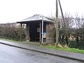 Bus-shelter, Plungar - geograph.org.uk - 675876.jpg 640 × 480; 79 KB
-
 Derelict railway track - geograph.org.uk - 675887.jpg 480 × 640; 58 KB
-
-
 Farm track along Harby Lane - geograph.org.uk - 962968.jpg 544 × 640; 134 KB
-
 Farmland near Plungar - geograph.org.uk - 162338.jpg 640 × 427; 163 KB
-
 Farmland near Plungar - geograph.org.uk - 162342.jpg 640 × 480; 122 KB
-
 Farmland near Plungar - geograph.org.uk - 66651.jpg 640 × 480; 132 KB
-
 Farmland north of Plungar - geograph.org.uk - 963269.jpg 640 × 468; 81 KB
-
 Field and trees near Plungar - geograph.org.uk - 982665.jpg 640 × 485; 83 KB
-
 Former council houses at Plungar - geograph.org.uk - 2791916.jpg 1,024 × 768; 137 KB
-
 Former farmhouse, Church Lane, Plungar - geograph.org.uk - 2794264.jpg 1,024 × 768; 130 KB
-
 Former Methodist Chapel, Plungar - geograph.org.uk - 2791924.jpg 1,024 × 768; 186 KB
-
 Frog Lane, Plungar - geograph.org.uk - 2794259.jpg 1,024 × 768; 189 KB
-
 Granby Lane near Plungar - geograph.org.uk - 963073.jpg 640 × 434; 74 KB
-

-
 Harby Lane near Plungar - geograph.org.uk - 962988.jpg 640 × 523; 75 KB
-

-
 In Plungar Wood - geograph.org.uk - 156760.jpg 640 × 427; 212 KB
-
 Northeast along Long Lane - geograph.org.uk - 982778.jpg 640 × 509; 85 KB
-
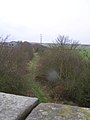
 Old railway bridge, near Plungar - geograph.org.uk - 66642.jpg 640 × 480; 140 KB
-

-
 Plungar in Leicestershire - geograph.org.uk - 963008.jpg 640 × 405; 78 KB
-
 Plungar Wood - geograph.org.uk - 157169.jpg 427 × 640; 225 KB
-
 Plungar, Leicestershire - geograph.org.uk - 64085.jpg 640 × 480; 90 KB
-
 Public Footpath near Plungar - geograph.org.uk - 66628.jpg 640 × 480; 168 KB
-
 The Village Hall, Plungar - geograph.org.uk - 2793355.jpg 1,024 × 768; 186 KB
-
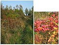
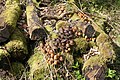 Toadstools in Plungar Wood - geograph.org.uk - 157168.jpg 640 × 427; 213 KB
-
 Vale Farm, near Plungar, Leicestershire - geograph.org.uk - 64022.jpg 640 × 480; 116 KB
-
 Farmland near Plungar, Leicestershire - geograph.org.uk - 64032.jpg 640 × 480; 98 KB
-
 Granby Lane - geograph.org.uk - 675881.jpg 640 × 480; 57 KB
-
 Notts-Leics County Boundary near Plungar - geograph.org.uk - 64029.jpg 640 × 480; 146 KB
-
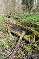
 The Rundle Beck, near Plungar - geograph.org.uk - 66646.jpg 480 × 640; 165 KB
-

-


